- UK Information
- UK Guidebooks and Maps
- UK Books for counties
- Isle of Mull books and maps
Isle of Mull books and maps
Here is a list of books for Isle of Mull that you may find useful.Isle of Mull books: Maps
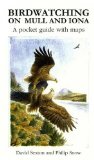
Birdwatching on Mull and Iona: A Pocket Guide with Maps
Price: £4.95
Publication: 6 Dec 2010


Price: £4.95
Publication: 6 Dec 2010
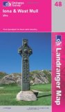
Iona and West Mull, Ulva (Landranger Maps) (OS Landranger Map)
Perfect for day trips and short breaks, the OS Landranger Map series covers Great Britain with 204 detailed maps. Each map provides all the information you need to get to know your local area and includes places of interest, tourist information, picnic areas and camp sites, plus Rights of Way information for England and Wales.
Price: £5.24
Publication: 15 Oct 2007
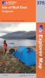
Isle of Mull East (OS Explorer Map Series)
OS Explorer Map is the Ordnance Survey's most detailed map and is recommended for anyone enjoying outdoor activities like walking, horse riding and off-road cycling. Providing complete GB coverage the series details essential information such as youth hostels, pubs and visitor information as well as rights of way, permissive paths and bridleways.
Price: £5.75
Publication: 22 Jan 2007
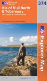
Isle of Mull North and Tobermory (OS Explorer Map Series)
OS Explorer Map is the Ordnance Survey's most detailed map and is recommended for anyone enjoying outdoor activities like walking, horse riding and off-road cycling. Providing complete GB coverage the series details essential information such as youth hostels, pubs and visitor information as well as rights of way, permissive paths and bridleways.
Price: £5.75
Publication: 22 Jan 2007
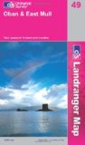
Oban and East Mull (OS Landranger Map Series)
Perfect for day trips and short breaks, the OS Landranger Map series covers Great Britain with 204 detailed maps. Each map provides all the information you need to get to know your local area and includes places of interest, tourist information, picnic areas and camp sites, plus Rights of Way information for England and Wales.
Price: £5.24
Publication: 20 Aug 2007
Isle of Mull books: Travel Guides
Isle of Mull Map (Colin Baxter Maps)
Price: £3.95
Publication: April 15, 2003 [Folded Map] [Map]
Price: £3.95
Publication: April 15, 2003 [Folded Map] [Map]
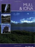
Mull and Iona (Pevensey Island Guide)
The essential guide for the discerning tourist and island devotee, "Mull & Iona" describes everything the visitor needs to know about the islands' heritage, landscape, climate, flora and fauna. It contains fascinating information about all the key places of interest, from the magnificent Torosay Castle, to nearby Iona and Saint Columba. It is illustrated with over 100 superb colour photographs showing every aspect of the island and its people.
Price: £6.39
Publication: 28 Mar 2008
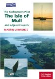
Yachtsman's Pilot to the Isle of Mull
Isle of Mull covers the coasts and islands from Crinan to fort William and Ardnamurchan as well as Mull, Coll and Tiree. The last of Martin Lawrence's pilots to the west coast of Scotland to be revised and reissued in full colour, the sailing directions and plans have been fully updated and are now illustrated with new colour photographs from sea level and the air.
Price: £26.41
Publication: 1 Aug 2008
Isle of Mull books: Walking and Tours
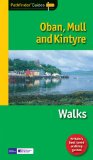
Pathfinder Oban, Mull & Kintyre (Pathfinder Guide)
The rock of Dunadd, a few miles north of Lochgilphead, marks the place where the Scots established their headquarters after landing from Ireland around 500AD, and it can rightfully claim to be the birthplace of Scotland. It is also at the heart of present-day Argyll, which roughly corresponds to the area covered by this guide. There are a range of routes across different terrains, including a walk around the Isle of Iona, with its wealth of ancient monuments, superb beaches and an ascent up Ben More, the highest peak on Mull.
Price: £8.39
Publication: 1 Sep 2009 [Paperback]

Walks Isle of Mull, Coll and Tiree (Hallewell Pocket Walking Guides)
Part of a popular series of A6 pocket walking guides which describe routes which are suitable for walkers of all abilities and to suit all tastes. Route descriptions are accompanied by 2-colour sketch maps. The guides are illustrated with line illustrations, and will provide walkers with a good introduction to what each area covered has to offer. Walks Isle of Mull, Coll & Tiree including Iona & Ulva includes walks on the Inner Hebridean island of Mull and the nearby islands. Mull is typified by spectacular coastal scenery and fine hill climbs, while the other islands are lower and gentler in character. The 29 walks featured range from 1 mile to 10.5 miles (1.6-17km). Routes on Mull include: Ben More, Carsaig Arches and two walks from Tobermory. There is also a circuit of Ulva, two fine walks on Iona plus routes on the rugged island of Coll and the wide sand beaches of Tiree. Last rewalked 2007.
Price: £2.95
Publication: 18 May 2007 [Illustrated] [Paperback]
The Isle of Mull
books listed on this page are for your information and to help you find the books you need quickly. We do not endorse any particular books and are not responsible for the advice and information in the books listed.
The price of books, where indicated, was correct at the time the book was added to this page. Prices may have changed on the booksellers web site.