- UK Information
- UK Guidebooks and Maps
- UK Books for regions
- Peak District books and maps
Peak District books and maps
Here is a list of books for Peak District that you may find useful.- Peak District books:Maps
- Peak District books:Travel Guides
- Peak District books:History & Heritage
- Peak District books:Walking and Tours
- Peak District books:General Interest
Peak District books: Maps
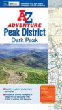
Peak District (Dark Peak) Adv. Atlas (A-Z Adventure Atlas)
he A-Z Adventure series features the accuracy and quality of OS Explorer mapping in a convenient book, complete with index. The A-Z Adventure series is an innovative concept that utilises Ordnance Survey Explorer mapping in a book, therefore eliminating the need to fold and re-fold a large sheet map to the desired area. OS Explorer is Ordnance Survey's most detailed mapping at a scale of 1:25 000, showing public rights of way, open access land, national parks, tourist Information, car parks, public houses and camping and caravan sites. Unlike the original OS sheets, this A-Z Adventure Atlas includes a comprehensive index to towns, villages, hamlets and locations, natural features, nature reserves, car parks and youth hostels, making it easy to find the required location quickly. Each index entry has a page reference and a six figure National Grid Reference. At a book size of 240mm x 134mm it is the same size as a standard OS Explorer map when closed. This A-Z Adventure Atlas of the Peak District Dark Peak features 50 pages of continuous Ordnance Survey mapping covering: Peak District National Park (northern part) Kinder Scout Hope Valley Hathersage Castleton Snake Pass Derwent Valley This A-Z Adventure Atlas has the accuracy and quality of OS Explorer mapping indexed within a book, making it the perfect companion for walkers, off-road cyclists, horse riders and anyone wishing to explore the great outdoors. Also available: A-Z Adventure Atlas of the Peak District, White Peak
Price: £6.99
Publication: 9 July 2012
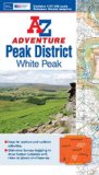
Peak District (White Peak) Adv. Atlas (A-Z Adventure Atlas)
Price: £6.99
Publication: 2 July 2012
Price: £6.99
Publication: 2 July 2012
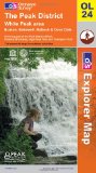
The Peak District (OS Explorer Map): White Peak area. Buxton, Bakewell, Matlock & Dove Dale. Showing part of the Peak National Park, Pennine Bridleway, High Peak Trail and Tissington Trail
"OS Explorer Map" is the Ordnance Survey's most detailed folding map and is recommended for anyone enjoying outdoor activities including walking, horse riding and off-road cycling. Providing complete GB coverage, the "OS Explorer" map series details information essential in the great outdoors, including youth hostels, pubs and visitor information. Rights of way fences, permissive paths and bridleways are clearly shown, ensuring you have the best information to get the most out of your time in the countryside.
Price: £5.75
Publication: 5 Oct 2009
Peak District books: Travel Guides
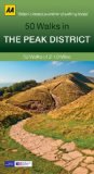
50 Walks in Peak District (AA 50 Walks Series)
Walking is one of Britain's favourite leisure activities, and this fantastic walking guide to the Peak District features a variety of mapped walks to suit all abilities. The book features all the practical detail you need, accompanied by fascinating background reading on the history and wildlife of the area, as well as other local points of interest. All walks are annotated with local points of interest and places to stop for refreshments and every walk is given a summary of distance, time, gradient, level of difficulty, type of surface and access, landscape, dog friendliness, parking and public toilets.
Price: £8.99
Publication: 30 April 2013
Peak District books: History & Heritage
The Peak District: Landscapes Through Time (Landscapes of Britain)
The book explores the Peak's prehistoric sacred landscapes; we learn how the builders of the great henge at Arbor Low may have viewed the world. It also covers the dramatic impact on the land over the centuries of farmers, miners and quarrymen. As well as new interpretative maps (of, for instance, Chatsworth Park), this edition also includes an updated gazetteer of sites and a comprehensive bibliography. It is an indispensable guide to the area's archaeology.
Price: £17.00
Publication: June 22, 2004
Peak District books: Walking and Tours
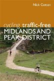
Cycling Traffic-Free: Midlands and Peak District
Cycling remains one of the most popular leisure activities in Britain today, and continuing numbers of people are taking up the sport whether for leisure enjoyment for all the family, or for health and environmental reasons. The Midlands has a high density of towns and cities and because of the congested and dangerous roads there is a growing need for a useful guide to safe, traffic-free cycling around the area. Cyclists living in the area want quick, easy access to a range of enjoyable new cycling routes where they can quickly escape from their usual crowded environment and explore quiet routes in attractive natural or man-made surroundings. In recent years, there have been many initiatives to develop traffic-free routes through national or local government schemes and organisations such as Sustrans, but it is often impracticable for leisure cyclists to keep right up to date with the latest information on the many thousands of miles of paths and lanes where it is possible, and legal, for cyclists to pursue their hobby away from traffic. All the more welcome then is this brand new title from experienced author and cyclist Nick Cotton who brings together 30 of the best routes in the Midlands and the Peak District. As well as offering practical general advice for the cyclist, the author gives clear instructions for each route, a useful diagrammatic map, suggestions on where best to park and/or start the trip, distance, gradients and hills, places of interest and suggested refreshment stops along the way or close to the route. This volume covers a large area of central England, with the majority of the rides concentrated in the counties of Cheshire, Derbyshire, Nottinghamshire, Staffordshire, Leicestershire and Northamptonshire. There are also descriptions of rides in and around the cities of Birmingham, Leicester, Nottingham, Derby, Stoke and Sheffield. Several sections of the Trans Pennine Trail are featured.
Price: £7.19
Publication: 1 July 2010
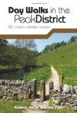
Day Walks in the Peak District: 20 Classic Circular Routes
"Day Walks in the Peak District" - 20 classic circular routes is the full second edition of Vertebrate Publishing's original guide to hill walking in the Peak District National Park. The original "Day Walks in the Peak District" (ISBN10: 0-9548131-3-8; ISBN13: 978-0-9548131-3-0) proved to be a popular guide amongst walkers. Updates to this new edition include: Ordnance Survey 1:25,000 scale maps, all new photography, and updated routes to reflect recent changes (such as the opening of the Monsal Trail through Chee Dale). This book features 20 circular walks, between 8.25 and 12 miles (13km and 19.5km) in length, suitable for hill walkers of all abilities. The routes are split into three areas - The High Moors, Hills Tors & Edges and Limestone Country - and feature walks around some of the most wild and beautiful places in the National Park, including; Alport Castles, Back Tor & Derwent Edge, the Kinder Edges, Chatsworth, Stange Moor, The Roaches, Chee Dale, Lathkill Dale, Chrome Hill, Cressbrook Dale, Wolfscote Dale and Dove Dale. Researched and written by local hill walkers, each route features: clear and easy-to-use Ordnance Survey maps, easy-to-follow directions, details of distance, navigation information, refreshment stops and local knowledge. The book is illustrated with stunning location photography, and also features a detailed Appendix.
Price: £10.99
Publication: 3 Sep 2012
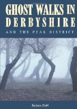
Ghost Walks in Derbyshire and the Peak District
In this book you may meet phantom coaches, headless horsemen, ghostly dogs which haunt crossroads and foretell death, the eerie sounds of a 500-year-old murder, haunted mines, pubs and houses, and even a funeral procession of 12 headless men! It is a collection of 30 circular walks in Derbyshire and the Peak District, each ranging for two to ten miles in length. Each walk has at least one ghostly story attached - and some have several chilling tales which will bring a shiver to even the most warmly-clad rambler. The walks cover a wide range of Derbyshire scenery, from gentle meadowlands to the dramatic beauty of limestone country. There is information about parking, toilets and refreshment stops and good maps. Barbara Wadd has been walks' co-ordinator of a local social club for many years.
Price: £12.22
Publication: 12 Dec 2012
Mountain Bike Guide: Quality Routes in the Peak District and Derbyshire
Illustrated mountain bike guide for beginners and experienced riders. 24 circular routes in an area of outstanding natural beauty - all types of routes from short and gentle to long and challenging over high hills. Easy to follow directions and sketch maps.
Price: £8.50
Publication: April 1, 2004 [Paperback]
Pathfinder Peak District: Walks: The best short, medium and long country walks in the Peak District National Park (Pathfinder Guide)
Pathfinder Peak District covering Eyam, the Chatsworth Estate and the Monk's Dale Nature Reserve.
This selection offers interest, regional variety and balance of routes in the Peak District providing the best walks in the area. From an easy stroll through Robin Hood's Stride to the much more challenging walks in Thornhill this volume contains something for everyone. Covering walks through the whole of the Peak District both popular and little know scenic routes including Crowden, Eyam and Win Hill.
-See walk locations by Looking Inside
Inside:
-28 great walks in the Peak District from 2 to 10 miles
-Clear, large scale Ordnance Survey route maps
-GPS reference for all Peak District waypoints
-Where to park, good pubs and places of interest en route
-All routes have been fully researched and written by expert outdoor writers
-Beautiful photography of scenes from the walks
Pathfinder Guides are Britain's best loved walking guides. Made with durable covers, they are the perfect companion for countryside walks throughout Britain. Each title features circular walks with easy-to-follow route descriptions, large-scale Ordnance Survey route maps and GPS waypoints. With over 70 titles in the series, they offer essential information for walkers throughout the country.
Price: £8.39
Publication: 1 Nov 2009
Peak District (Collins Rambler's Guides:)
Produced in association with the Rambler's Association and Harvey's Maps, this brand new series covers some of the most popular walking areas in Britain and Ireland, combining detailed route descriptions with information on the local history and wildlife. The Peak District boasts an unrivalled network of around 1,400 miles of public rights-of-way, and over 80 square miles of open access on the northern moors. This guide allows the reader to explore the infinite variety of walking opportunities, which range from gentle riverside strolls, to tough moorland treks. *The introduction gives information about the topography, geology and history of the area, and describes the flora and fauna inhabiting it. *The main section of the book comprises 30 walks. Each walk has a key illustrating principal features, such as level of difficulty and type of terrain, a route profile indicating altitude and distances, and a fact file summarising useful information such as start and finish points, duration, safety advice and points of interest. *Illustrated with colour maps from leading authority, Harveys, each walk is then described in detail with clear, easy-to-follow instructions. As well as route descriptions, the text gives the history of the main landmarks along the way plus information on the natural history of the area, and is accompanied by stunning colour photographs.
Price: £8.94
Publication: 29 April 2010
Peak District: Short Walks
This new-style edition of Pathfinder: Short Walks Peak District is fully updated and features 20 fantastic family walks ranging in length from 2 to 6 miles. Each walk is beautifully photographed and comes with a clear, large-scale Ordnance Survey route map. Set within the beauty of Britain's first National Park, Pathfinder: Short Walks Peak District expertly guides the reader along 20 short walks through the diverse and contrasting terrain of the Peak District. All the walks in Pathfinder: Short Walks Peak District have been devised with families in mind and are as suitable for newcomers to countryside walking as they are to seasoned ramblers.
Price: £5.75
Publication: 15 Jan 2011
Ramblers Short Walks in the Peak District (Collins Ramblers)
A brand new range of practical little walk guides endorsed by the Ramblers. All the walks are 5 miles or under in length and can easily be completed in less that 3 hours. 20 walks are included and use clear maps to show the route plus easy to follow walk descriptions.
The Peak District, with its two very different landscapes: the gentle limestone White Peak with its intimate wooded dales and steep-sided gorges; and the wilder more dramatic gritstone Dark Peak with its wild moorland, offer some superb walking areas. This guide, produced in co-operation with the Ramblers and featuring Ordnance Survey mapping, is the perfect way to get out and enjoy the stunning scenery.
This compact little guide contains walks, all of which are 5 miles or under, which are ideal for an afternoon stroll.
Price: £4.49
Publication: 27 May 2010
Peak District books: General Interest
Peak District from Above
An aerial view of the rugged region at the heart of England with its stately homes, wild uplands and stunning natural features. Photographs include: Chatsworth House, Riber Castle, Matlock and Matlock Baths, Ladybower Reservoir, Chesterfield, River Wye, Monsal Viaduct, Bakewell, Haddon Hall, Buxton, Ashford-in-the-Water, Curbar Edge and more.
Price: £2.99
Publication: May 1, 2002 [Paperback]
The Peak District books listed on this page are for your information and to help you find the books you need quickly. We do not endorse any particular books and are not responsible for the advice and information in the books listed.
The price of books, where indicated, was correct at the time the book was added to this page. Prices may have changed on the booksellers web site.