- UK Information
- UK Guidebooks and Maps
- UK Books for regions
- Yorkshire Dales books and maps
Yorkshire Dales books and maps
Here is a list of books for Yorkshire Dales that you may find useful.- Yorkshire Dales books:Travel Guides
- Yorkshire Dales books:History & Heritage
- Yorkshire Dales books:Art & Culture
- Yorkshire Dales books:Walking and Tours
Yorkshire Dales books: Travel Guides
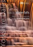
Walks to Waterfalls: Walks to the Best Waterfalls in the Yorkshire Dales (Yorkshire Dales: Top 10 Walks)
This attractive and cleverly structured guide gives walkers ten of the finest walks to waterfalls in the Yorkshire Dales National Park in a popular pocketable format. With clear information, an overview and introduction for each walk, expertly written numbered directions, large scale Ordnance Survey maps, superb, eye-grabbing panoramic photographs, and interpretation of points of interest along the way, these guides set a new standard in clarity and ease-of-use. Featured walks include: Aysgarth & Cauldron Falls, Janet's Foss & Goredale Scar, Catrigg Force, Kidson & Currack Forces, The Strid & Posforth Gill, Mill & Whitfield Gills, Ingleton Waterfalls, Linton Falls & Ghaistrill's Strid, Uldale Force and Hardraw Force.
Price: £3.74
Publication: 20 Dec 2012
Yorkshire Dales books: History & Heritage
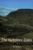
The Yorkshire Dales: Landscape and Geology (Landscape & Geology)
This book is the first in an exciting new series that tells the story of some of Britain's most beautiful landscapes. Written with the general reader - the walker, the lover of the countryside - firmly in mind, this opens the door onto a fascinating story of ancient oceans, forests, shallow seas and ice. Over millions of years, the stunning limestone landscape has been laid down at the bottom of tropical seas, deformed by movements in the earth's crust and shaped giant glaciers and, in our own time, the simple effects of rivers and rain water.
Price: £11.55
Publication: 18 Mar 2008
Yorkshire Dales books: Art & Culture
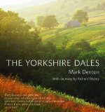
The Yorkshire Dales
Mark Denton captures the drama and beauty of one of England's most treasured landscapes. From broad, open dales to bleak uplands and isolated high hills, Mark Denton's panoramic camera reveals the ever-changing light on both renowned and unheralded places. An essay by Richard Mabey describes his first acquaintance with the Dales, and his growing understanding and appreciation of this unique landscape.
This is the concluding volume in Mark Denton's Yorkshire Trilogy, following Yorkshire Coast and Yorkshire Moors and Wolds. Mark Denton is one of Britain's most acclaimed young landscape photographers, described by Joe Cornish as 'one of the few photographers to have mastered the large panoramic camera, and he uses it to capture landscape in all its drama, depth and colour ... the result is a unique body of work.'
Price: £13.99
Publication: 1 May 2013
Yorkshire Dales books: Walking and Tours
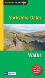
Pathfinder Yorkshire Dales (Pathfinder Guides)
This selection offers interest, regional variety and balance of routes in the Yorkshire Dales providing the best walks in the area. From an easy stroll through Ingleton Waterfalls to the much more challenging walks in Gunnerside, this volume contains something for everyone. Covering walks through the whole of the Yorkshire Dales both popular and little know scenic routes including Wharfedale, Wendleydale, and Burnsall.
Price: £8.39
Publication: 1 Dec 2011
Pub Walks in the Yorkshire Dales
Price: £5.95
Publication: March 1996
Price: £5.95
Publication: March 1996
Ramblers Short Walks in the Yorkshire Dales (Collins Ramblers)
A brand new range of practical little walk guides endorsed by the Ramblers. All the walks are 5 miles or under in length and can easily be completed in less that 3 hours. 20 walks are included and use clear maps to show the route plus easy to follow walk descriptions.
The beautiful Yorkshire Dales include impressive limestone formations, beautiful waterfalls and shadowy peaks. Picturesque dales such as Swaledale, Wharfedale and Dentdale meander through the area, where abbey ruins, ancient farmhouses and villages wait to be discovered. This guide, produced in co-operation with the Ramblers and featuring Ordnance Survey mapping, is the perfect way to get out and enjoy the stunning scenery.
Price: £4.49
Publication: 27 May 2010
Yorkshire Dales (Collins Rambler's Guides:)
Produced in association with the Ramblers, this walking guide covers the popular Yorkshire Dales area and combines detailed route descriptions with information on the local history and wildlife.
The magnificent Yorkshire Dales include impressive limestone formations, beautiful waterfalls and shadowy peaks. Picturesque dales such as Swaledale, Wharfedale and Dentdale meander through the area, where abbey ruins, ancient farmhouses and villages wait to be discovered.
The introduction gives information about the topography, geology and history of the area, and describes the flora and fauna inhabiting it.
�The main section of the book comprises 30 walks, suitable for all abilities, from young children to experienced walkers. Each walk has a key illustrating principal features, such as level of difficulty and type of terrain, as well as a fact file summarising useful information, such as start and finish points, duration, safety advice and points of interest.
�Illustrated with colour maps from the Ordnance Survey each walk is then described in detail with clear, easy-to-follow instructions. As well as route descriptions, the text gives the history of the main landmarks along the way and information about the natural history of the area, and is accompanied by stunning colour photographs.
NEW FOR 2010
� Overview map on inside front cover showing start points of the walks.
� Walks are colour coded to indicated level of difficulty: green for the simpler walks, then amber for moderate walks, then red for the more challenging walks aimed at more experienced walkers.
� Front cover flap contains the key to symbols used in the text and on the route maps. Ideal as a book mark during use.
Price: £8.39
Publication: 29 April 2010
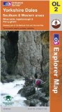
Yorkshire Dales - Southern and Western Areas (OS Explorer Map Active)
OS Explorer Map is the Ordnance Survey's most detailed map and is recommended for anyone enjoying outdoor activities such as walking, horse riding and off-road cycling. The series provides complete GB coverage and can now be used in all weathers thanks to OS Explorer Map - Active, a tough, versatile version of the OS Explorer Map.
Price: £9.65
Publication: 2 Feb 2009

Yorkshire Dales Mountain Biking: The South Dales
This is a compact guide to the southern half of the Yorkshire Dales National Park, an area which offers a superb network of bridleways, usable year-round, and awesome scenery rising above 700m. Mountain biking heaven on excellent trails weaving through a landscape of limestone plateaux, open moorland and clumps of broad leaf woodland. This work features 23 routes of varying difficulty and length, 'top ten' climbs, descents and cruises and visitor information. The routes were compiled and written by a highly experienced (and local) guidebook writer, plotted on Harvey Map's cycling-specific maps and illustrated with colour photography from Andy Heading.
Price: £10.85
Publication: 15 May 2006
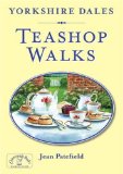
Yorkshire Dales Teashop Walks
Features twenty circular routes based on good local teashops including walks in Swaledale, Wensleydale, Nidderdale, Wharfedale and the Western Dales.
Price: £6.95
Publication: 15 May 1997
Features twenty circular routes based on good local teashops including walks in Swaledale, Wensleydale, Nidderdale, Wharfedale and the Western Dales.
Price: £6.95
Publication: 15 May 1997

Yorkshire Dales: A Dog Walker's Guide
Take your dog walking through the wonderful Yorkshire Dales without worry with this new book. The circular routes, which vary in length, will let you and your dog explore the Yorkshire Dales knowing you have all the information to hand on distance, terrain, number of stiles and in an emergency the nearest veterinary surgery.
Price: £7.99
Publication: 7 July 2011
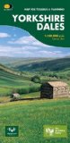
Yorkshire Dales: Map for Touring and Planning (Routemap)
This map provides a colourful overview of the Dales - famous Swaledale, Wensleydale, Wharfedale & Nidderdale. Colour shading makes it easy to pick out the hills & dales. Driveable roads are shown & steep hills marked. There is an introduction to each area, street plans of towns & lots of information on places to visit.
Price: £3.71
Publication: 30 Jun 2007
Yorkshire Dales: Southern and Western Areas (OS Explorer Map)
OS Explorer Map is the Ordnance Survey's most detailed map and is recommended for anyone enjoying outdoor activities like walking, horse riding and off-road cycling. Providing complete GB coverage the series details essential information such as youth hostels, pubs and visitor information as well as rights of way, permissive paths and bridleways.
Price: £5.75
Publication: 2 Feb 2009
The Yorkshire Dales books listed on this page are for your information and to help you find the books you need quickly. We do not endorse any particular books and are not responsible for the advice and information in the books listed.
The price of books, where indicated, was correct at the time the book was added to this page. Prices may have changed on the booksellers web site.