- UK Information
- UK Guidebooks and Maps
- Gravesend books and maps
Gravesend books and maps
Here is a list of books for Gravesend that you may find useful.If you plan to travel to Gravesend you may be interested in some guide books and travel books that will help you plan your stay in Gravesend and to find your way around. Click on any book for more information or to buy.
Gravesend books: Maps
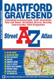
Dartford & Gravesend Street Atlas (A-Z Street Atlas)
This street atlas of Dartford, Gravesend, Bexleyheath, Erith, Crayford, Northfleet, Sidcup and Swanley features 30 pages of coloured mapping that extends to:
Thamesmead South
Greenhithe
Swanscombe
Tilbury
Shorne
Singlewell
Meopham Station
New Ash Green
West Kingsdown (part)
Farningham
Crockenhill
Hextable
Ruxley
Blackfen
Welling
Postcode districts, one-way streets, safety camera locations with their maximum speed and the Greater London Low Emission Zone boundary are featured on the mapping.
The index section lists streets, selected flats, walkways and places of interest, junction, place and area names, National Rail stations, hospitals and hospices covered by this atlas.
Price: £4.72
Publication: 5 April 2011
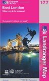
East London, Billericay & Gravesend (OS Landranger Map)
Perfect for day trips and short breaks, the OS Landranger Map series covers Great Britain with 204 detailed maps. Each map provides all the information you need to get to know your local area and includes places of interest, tourist information, picnic areas and camp sites, plus Rights of Way information for England and Wales.
Price: £5.24
Publication: 15 May 2012
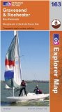
Gravesend and Rochester (OS Explorer Map)
OS Explorer Map is the Ordnance Survey's most detailed map and is recommended for anyone enjoying outdoor activities like walking, horse riding and off-road cycling. Providing complete GB coverage the series details essential information such as youth hostels, pubs and visitor information as well as rights of way, permissive paths and bridleways.
Price: £5.99
Publication: 12 Jan 2009
Gravesend books: Travel Guides
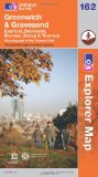
Greenwich and Gravesend (OS Explorer Map): East End, Docklands, Bromley, Sidcup & Thurrock. Showing part of the Thames Path
OS Explorer Map is the Ordnance Survey's most detailed map and is recommended for anyone enjoying outdoor activities like walking, horse riding and off-road cycling. Providing complete GB coverage the series details essential information such as youth hostels, pubs and visitor information as well as rights of way, permissive paths and bridleways.
Price: £5.99
Publication: 11 Jun 2012
The Gravesend books listed on this page are for your information and to help you find the books you need quickly. We do not endorse any particular books and are not responsible for the advice and information in the books listed.
The price of books, where indicated, was correct at the time the book was added to this page. Prices may have changed on the booksellers web site.