- UK Information
- UK Guidebooks and Maps
- Bradford books and maps
Bradford books and maps
Here is a list of books for Bradford that you may find useful.If you plan to travel to Bradford you may be interested in some guide books and travel books that will help you plan your stay in Bradford and to find your way around. Click on any book for more information or to buy.
Bradford books: Maps

Bradford and Huddersfield (Explorer Maps)
OS Explorer Map is the Ordnance Survey's most detailed map and is recommended for anyone enjoying outdoor activities like walking, horse riding and off-road cycling. Providing complete GB coverage the series details essential information such as youth hostels, pubs and visitor information as well as rights of way, permissive paths and bridleways.
Price: £5.99
Publication: February 13, 2006
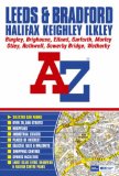
Leeds & Bradford Street Atlas (Paperback) (Street Maps & Atlases)
This Leeds and Bradford coloured street atlas includes coverage of:
Halifax, Keighley, Ilkley, Bingley, Brighouse, Elland, Garforth, Morley, Otley, Rothwell, Sowerby Bridge and Wetherby.
The 161 pages of continuous street mapping extend to:
Addingham (part), Middleton, Burley-in-Wharfedale, Newall, Pool, Bramhope, Adel, Alwoodley, Slaid Hill, Scarcroft, East Keswick, Collingham, Deighton Gates, Boston Spa, Clifford, Thorner (part), Scholes, Barwick-in-Elmet, East Garforth, Micklefield, Ledsham, Kippax, Allerton Bywater, Royds Green, Ouzlewell Green, Outwood, Chidswell (part), Birstall (part), Hunsworth, Wyke, Scholes, Bradley (part), Greetland, Sowerby, Wainstalls, Illingworth, Ogden, Denholme Clough, Oxenhope, Haworth, Oakworth, Laycock and Silsden.
Also included are large scale town centre plans of Leeds, Bradford and Halifax.
Postcode districts, one-way streets and safety camera locations with their maximum speed limit are featured on the street mapping.
The index section of the atlas lists streets, selected flats, walkways and places of interest, place, area and station names. There is a separate list of hospitals and hospices covered by this atlas.
On the outside back cover is a Leeds and Bradford Rail Connections map.
Price: £5.39
Publication: 7 July 2009
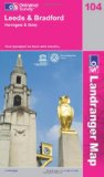
Leeds and Bradford, Harrogate and Ilkley (OS Landranger Map)
Perfect for day trips and short breaks, the OS Landranger Map series covers Great Britain with 204 detailed maps. Each map provides all the information you need to get to know your local area and includes places of interest, tourist information, picnic areas and camp sites, plus Rights of Way information for England and Wales.
Price: £5.24
Publication: 22 Jun 2009
Bradford books: Travel Guides
West Yorkshire: Leeds, Bradford, Halifax, Huddersfield, Wakefield
This spiral bound atlas of West Yorkshire includes Leeds, Bradford, Halifax, Huddersfield, Wakefield, Dewsbury and Castleford. The 172 pages of coloured street mapping extends to:
Bolton Abbey, Addingham, Ilkley, Otley, North Rigton, Wetherby, Walton, Micklefield, Fairburn, Brotherton, Knottingley, Womersley, Skellow, South Elmsall, Royston, Darton, Clayton West, Denby Dale, Holmfirth, Marsden, Todmorden, Haworth, Keighley, Steeton and Silsden.
There are large scale city and town centre maps of Leeds, Bradford, Halifax, Huddersfield and Wakefield.
Postcode districts, one-way streets and safety camera locations with their maximum speed limit are featured on the mapping.
The index section lists streets, selected flats, walkways and places of interest, place, area and station names. There is a separate list of hospitals, hospices and NHS Walk-in Centres covered by this atlas.
Price: £7.55
Publication: 2 Feb 2010
The Bradford books listed on this page are for your information and to help you find the books you need quickly. We do not endorse any particular books and are not responsible for the advice and information in the books listed.
The price of books, where indicated, was correct at the time the book was added to this page. Prices may have changed on the booksellers web site.