- UK Information
- UK Guidebooks and Maps
- Borehamwood books and maps
Borehamwood books and maps
Here is a list of books for Borehamwood that you may find useful.If you plan to travel to Borehamwood you may be interested in some guide books and travel books that will help you plan your stay in Borehamwood and to find your way around. Click on any book for more information or to buy.
Borehamwood books: Maps
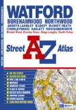
Watford Street Atlas
This atlas of Watford, Borehamwood, Bushey, Rickmansworth and Radlett features 31 pages of coloured street mapping that extends to:
Kings Langley (part)
Abbots Langley
Bricket Wood
Colney Street
M1 London Gateway Service Area
Elstree
Carpenders Park
Northwood (part)
Chorleywood
Chandler's Cross
Hunton Bridge
Also included is a large scale town centre map of Watford.
Postcode districts, one-way streets, safety camera locations with their maximum speed and the Greater London Low Emission Zone boundary are featured on the mapping.
The index section lists streets, selected flats, walkways and places of interest, junction, place and area names, National Rail and London Underground stations, hospitals and hospices covered by this atlas.
Price: £3.38
Publication: 3 Oct 2011 [Illustrated] [Paperback]
The Borehamwood books listed on this page are for your information and to help you find the books you need quickly. We do not endorse any particular books and are not responsible for the advice and information in the books listed.
The price of books, where indicated, was correct at the time the book was added to this page. Prices may have changed on the booksellers web site.