- UK Information
- UK Guidebooks and Maps
- UK Books for counties
- Surrey books and maps
Surrey books and maps
Here is a list of books for Surrey that you may find useful.Surrey books: Maps
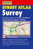
Philip's Street Atlas Surrey
This fully revised pocket-sized street atlas of Surrey gives comprehensive and detailed coverage of the county. The route planner shows all the A and B roads, and can be used when driving to get close to the destination before turning to the relevant large-scale street map.The street maps show every named road, street and lane very clearly, with major roads picked out in colour. The maps are at a standard scale of 2 2/3 inches to 1 mile, and show postcode boundaries. In addition, the town centres of Dorking, Epsom, Guildford, Kingston upon Thames, Leatherhead and Woking are shown at 5 1/3 inches to 1 mile.Other information on the maps includes car parks, railway and bus stations, post offices, schools, colleges, hospitals, police and fire stations, places of worship, leisure centres, footpaths and bridleways, camping and caravan sites, golf courses, and many other places of interest. This edition includes the latest fixed single and multiple speed-camera locations, with corresponding speed limits.The comprehensive index lists street names and postcodes, plus schools, hospitals, railway stations, shopping centres and other such features picked out in red, with other places of interest shown in blue.
Price: £5.29
Publication: 7 Jun 2010
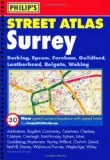
Philip's Street Atlas Surrey: Spiral Edition
This fully revised street atlas of Surrey gives comprehensive and detailed coverage of the county. The route planner shows all the A and B roads, and can be used when driving to get close to the destination before turning to the relevant large-scale street map.The street maps show every named road, street and lane very clearly, with major roads picked out in colour. The maps are at a standard scale of 3.5 inches to 1 mile, and show postcode boundaries. In addition, the town centres of Dorking, Epsom, Guildford, Kingston upon Thames, Leatherhead and Woking are shown at 7 inches to 1 mile.Other information on the maps includes car parks, railway and bus stations, post offices, schools, colleges, hospitals, police and fire stations, places of worship, leisure centres, footpaths and bridleways, camping and caravan sites, golf courses, and many other places of interest. This edition includes the latest fixed single and multiple speed-camera locations, with corresponding speed limits.The comprehensive index lists street names and postcodes, plus schools, hospitals, railway stations, shopping centres and other such features picked out in red, with other places of interest shown in blue.
Price: £8.39
Publication: 7 Jun 2010 [Spiral-Bound]
Surrey Hills Adventure Atlas (A-Z Adventure Atlas)
Price: £7.95
Publication: 17 Jun 2013 [Paperback]
Price: £7.95
Publication: 17 Jun 2013 [Paperback]
Surrey Street Atlas (A-Z Street Atlas)
Price: £13.95
Publication: 18 Aug 2013 [Spiral-Bound]
Price: £13.95
Publication: 18 Aug 2013 [Spiral-Bound]
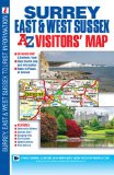
Surrey, East & West Sussex Visitors Map (A-Z Visitors Map)
This full colour foldout visitors' map of Surrey, East Sussex & West Sussex features road mapping that covers an area extending to:
The south coast from Portsmouth to Hastings
Ashford (Kent) and Faversham to the east
Reading, central London, Gravesend and Sheerness to the north
Fareham and Basingstoke to the west.
Map detail is shown at a clear 2.5 miles to 1 inch scale (1.6 kms to 1 cm) and includes the following features:
Motorways, service areas, primary routes and destinations, A & B roads, tolls, mileages, gradients 1:5 and steeper and county boundaries.
Full major road junction detail.
Selected safety camera locations with their maximum speed limits and fuel stations.
Selected places of interest, tourist information centres, caravan and camping sites and golf courses.
Areas of Outstanding Natural Beauty and the boundary to the UK's newest National Park, the South Downs National Park, are also shown.
There are 2 separate index panels adjacent to the mapping:
An index to cities, towns, villages, hamlets and locations
A comprehensive places of interest index with the corresponding map symbol shown alongside each entry for easy identification.
Price: £4.13
Publication: 4 May 2011 [Folded Map, Illustrated] [Map]
Surrey books: Travel Guides
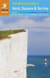
The Rough Guide to Kent, Sussex and Surrey
The brand-new, full-colour Rough Guide to Kent, Sussex & Surrey is the ultimate guide to this beautiful corner of England, with clear maps and lively accounts of both the big cultural attractions and the smaller, quirkier sights, and full coverage of vibrant Brighton and historic Canterbury.
The region is fast gaining a reputation as a foodie hotspot, and the guide offers detailed reviews of the best places to eat, from old-world tearooms to Michelin-starred restaurants. Also included is accommodation for all budgets - from country-house hotels to cozy b&b's and idyllic campsites - as well as the best places to drink, featuring the best village pubs, plus the region's celebrated wineries. Find details on a host of local festivals and events, from Lewes' raucous Bonfire Night to Hastings' popular Pirate's Day, as well as ideas on outdoor activities, from paragliding in the South Downs to canoeing Kent's waterways, with plenty of scenic walks too. Written by local experts, this is an indispensable guide to a region that's ripe for exploring.
Make the most of your time with The Rough Guide to Kent, Sussex & Surrey.
Price: £9.09
Publication: 1 May 2013 [Paperback]
Surrey books: Walking and Tours
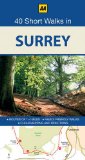
40 Short Walks Surrey (AA 40 Short Walks in)
This compact and handy guide to short walks in Surrey features walks between one and four miles long which can be covered in a morning or afternoon. There is an introduction for each walk giving background on the area, it's history, wildlife and other points of interest; plus key information panels providing a summary of distance, time, gradient and ascent, level of difficulty, type of surface and access, landscape, dog friendliness, refreshments, parking and public toilets. Each walk has a highly detailed map and clear, easy-to-follow route directions.
Price: £7.19
Publication: 30 Jun 2011
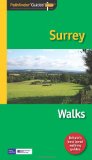
Pathfinder Surrey Walks (Pathfinder Guide)
The Pathfinder� Guide to Surrey Walks contains 28 fantastic circular walks across the county, much of which lies only a few miles away from the heart of London but which contains some of the country's most beaufiul landscapes, including the oldest untouched area of natural woodland in the UK and the rolling contours of the North Downs. Each walk in Pathfinder� Guide to Surrey Walks is accompanied by clear, large-scale Ordnance Survey route maps and GPS waypoints to help you navigate your hike with ease.
Price: £8.39
Publication: 29 Nov 2010 [Paperback]
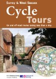
Surrey & West Sussex Cycle Tours: On and Off-road Routes Taking Less Than a Day
"Surrey and West Sussex" is one of 10 titles in the updated "Cycle Tours" series. The series has now been in continuous print for more than 15 years and with regular route revisions and updating the successful formula has gathered a large following. Each book in the series contains 20 routes all of which are either totally new or have been re-ridden and updated. There are 15 lane rides of between 23 and 36 miles taking you along low-traffic or traffic free roads, tracks and paths. These visit the handsome towns and pretty countryside of Surrey and West Sussex with suggested short cuts for shorter rides, and suggested links to other nearby rides for a full day out. The 5 off-road rides of between 11 and 16 miles explore the Hampshire Downs, the New Forest, the Isle of Wight and the South Downs. A unique feature of the "Cycle Tours" series is the superb Ordnance Survey 1:50,000 Landranger mapping showing the routes of the rides. The mapping not only gives the detail and clarity you need to follow the route with ease and safety, but allows you to plan short-cuts and detours, to look out for new places of interest, and to become truly involved in the landscape you are cycling through. Clear directions are given alongside the mapping and elevation profiles make planning the pacing of each ride an easy task. Extra information includes an introduction to the area of the route, nearest railway stations, places of interest with descriptions, guides to refreshment stops, and clear indications of distance, grade and terrain. The books are practically designed with a spiral-binding to make route-following as simple as possible.
Price: £9.09
Publication: 1 Jun 2010

Surrey (AA 50 Walks) (AA 50 Walks Series)
Walking is one of Britain's favourite leisure activities, and with "50 Walks in Surrey" you can find a variety of mapped walks to suit all abilities - from the casual walker to the experienced hiker. The book features all the practical detail you need, accompanied by fascinating background reading on the history and wildlife of the area, as well as other local points of interest. All walks are annotated with places to visit along the way: 'While You're There', featuring churches, country houses, museums, villages and towns. Each walk also has refreshment information: 'Where to Eat and Drink', including tea rooms and pubs, with extra details on their character and the food on offer. A 'What to Look For' panel features more specific details of urban and industrial heritage, flora and fauna. Every walk is given a summary of distance, time, gradient, level of difficulty, type of surface and access, landscape, dog friendliness, parking and public toilets.
Price: £6.99
Publication: 30 April 2008 [Paperback]

Surrey - A Dog Walker's Guide
On a fine day there is nothing quite so enjoyable for dog owners than getting out into the countryside with their pet for a leisurely walk. Once you get off your home patch though, it is hard to know where you can walk safely with your dog, and which pubs and cafes will welcome you both. 20 circular routes have been designed with maximum off-lead time and minimum exposure to roads.
Price: £6.45
Publication: 23 April 2012 [Paperback]
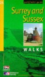
Surrey and Sussex Walks (Ordnance Survey Pathfinder Guides)
Despite the proximity of these counties to London, walkers parts of the region may find themselves treading some of the quietest footpaths in southern England. With smooth, rolling contours, they sweep across Sussex to terminate at Beachy Head and the spectacular Seven Sisters, and feature in several of the walks here. This is also a region of lonely marshlands, winding creeks and distant horizons. There are walks among these coastal lowlands around Chichester harbour, across the Pevensey Levels and over the reclaimed marshes near Rye, as well as more energetic and dramatic clifftop routes in the Seven Sisters and Hastings country parks.
Price: £8.39
Publication: 1 Oct 2008
Surrey books: Food & Drink

Adventurous Pub Walks in Surrey
This book features twenty circular walks varying in length between 7 and 12 miles, and based around good local pubs. It includes routes at Thursley, Bletchingly, Ripley, Chesham and Charlwood, and also on the Epsom Downs, along with maps and photographs.
Price: £6.36
Publication: May 30, 2004
This book features twenty circular walks varying in length between 7 and 12 miles, and based around good local pubs. It includes routes at Thursley, Bletchingly, Ripley, Chesham and Charlwood, and also on the Epsom Downs, along with maps and photographs.
Price: £6.36
Publication: May 30, 2004
Pub Walks in South Surrey
Price: £4.95
Publication: March 1, 2003 [Paperback]
Price: £4.95
Publication: March 1, 2003 [Paperback]
The Surrey
books listed on this page are for your information and to help you find the books you need quickly. We do not endorse any particular books and are not responsible for the advice and information in the books listed.
The price of books, where indicated, was correct at the time the book was added to this page. Prices may have changed on the booksellers web site.