- UK Information
- UK Guidebooks and Maps
- UK Books for counties
- Essex books and maps
Essex books and maps
Here is a list of books for Essex that you may find useful.Essex books: Maps

Essex County Atlas (A-Z Street Atlas)
Price: £12.43
Publication: 10 Feb 2013 [Spiral-Bound]


Price: £12.43
Publication: 10 Feb 2013 [Spiral-Bound]
Essex County Planning Map: No. 1A
County Wall Map of Essex at a scale of 1:100,000. The map measures approximately 900 x 840mm. Part of a new series of county wall maps published by The Map Centre Press to include each county of England. These maps use the very latest mapping information from Collins Bartholomew to produce attractive and informative wall maps. The county administrative boundary is highlighted on each map and for added emphasis the mapping outside the boundary has been faded out. These maps are ideal for any county-based businesses or organisations.
Price: £19.99
Publication: 28 April 2009 [Map]
Essex books: Walking and Tours
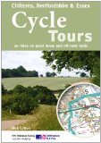
Cycle Tours Chilterns, Hertfordshire & Essex: 20 Rides on Quiet Lanes and Off-road Trails
This spiral-bound guide describes 20 wonderful bike rides in the countryside to the north and west of London. The area offers some excellent and varied cycling: from the challenges of the steep wooded escarpment of the Chilterns in the west to the gentle gradients on networks of quiet lanes in Hertfordshire and north Essex. The book contains 15 road rides (24-35 miles long) and five offroad rides on bridleways and byways (15-21 miles long). All of the rides are highlighted on Ordnance Survey Landranger 1:50,000 mapping, seen as the gold standard of mapping for cyclists. Junction-by-junction route instructions guide you from village to village through the region's beautiful rolling countryside. Each ride contains details of distance, grade of difficulty and refreshments along the way (with phone numbers of pubs and cafes so that you can check on opening hours). A height profile gives you warning of any hills to expect and schematic maps show how the ride can either be shortened or linked to adjacent rides for a longer day out. The Chilterns rise to over 800ft (245mts) at several points along the escarpment as it runs northeast from the River Thames at Goring towards Dunstable and Luton. Three of the five offroad rides use the fine stone-based tracks that weave their way through the area's famous beech woodlands which often form a great green tree cathedral overhead. Three of the road rides also explore the Chiltern woodlands, one from Princes Risborough and two around Tring. East of the Chilterns the rides make use of the network of quiet lanes that criss-cross this gently rolling, predominantly arable landscape. Small villages of thatched and half-timbered houses seem to vie with each other for the splendour of their village signs, often intricately carved and painted. The easiest ride in the book follows the Lee Navigation south from Hertford to Limehouse Basin in London: the towpath is one of the best in the whole country.
Price: £12.99
Publication: 1 Jun 2011 [Paperback]
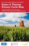
Essex & Thames Estuary Cycle Map: Including Colchester, Harlow, Chelmsford, Southend on Sea, Thurrock and 5 Individual Day Rides
One of a series of pocket sized, folded maps to the National Cycle Network which include clearly mapped on-road and traffic-free paths, easy to read contours and detailed town insets. This series is presented in 1:110,000 scale; folded 155mm X 99mm; and flat 792mm X 630mm.
Price: £3.74
Publication: 1 April 2013 [Folded Map] [Map]

Essex - A Dog Walker's Guide
On a fine day there is nothing quite so enjoyable for dogowners than getting out into the countryside with their pet for a leisurely walk. Once you get off your home patch though, it is hard to know where you are allowed to walk safely with your dog. Explore the Essex countryside without anxiety in this new colour book.
Price: £7.99
Publication: 16 Jun 2011 [Illustrated] [Paperback]
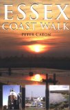
Essex Coast Walk
When Peter Caton set out to walk the Essex coast he had no idea of the beauty, wildlife and stories that he would find on the way. He takes the reader up and down the many creeks and estuaries of the longest coastline of any English county, through nature reserves, seaside resorts, unspoilt villages, sailing centres and alongside industry past and present. On the way we read of tales of witchcraft, ghosts, smuggling, bigamy and incest. We learn of the county's varied history - of battles with Vikings, invading Romans bringing elephants, a fort where the only casualty occurred during a cricket match, burning Zeppelins and Jack the Ripper. The book is illustrated with photographs and maps, and the narrative contains a wealth of information, including many little-known facts and stories. With gentle humour to match the coastline's gentle beauty, the book makes for easy reading. It tells of the solitude of some of the most remote coastal areas in England and of the huge range of wildlife to be found there. In contrast we read of the docks and industry of the Thames, but find that even here there is beauty for those willing to look. The book highlights how climate change may alter our coast and looks at new methods of coping with rising sea levels. It tells us how tiny settlements grew into large holiday resorts and how other villages have remained as unspoilt and isolated communities. The author's thought-provoking final reflections consider how the coast has changed over the centuries and what its future may be.
Price: £7.19
Publication: 30 Jun 2009 [Paperback]
Essex Year Round Walks
The routes in this book give the walker the chance to explore the glorious countryside of Essex throughout the year. Twenty circular walks which vary in length from 2 and a half to 7 miles.
Price: £7.19
Publication: 16 April 2012 [Paperback]
The routes in this book give the walker the chance to explore the glorious countryside of Essex throughout the year. Twenty circular walks which vary in length from 2 and a half to 7 miles.
Price: £7.19
Publication: 16 April 2012 [Paperback]
Essex: AA 50 Walks (50 Walks in)
Walking is one of Britain's favourite leisure activities, and this guide features a variety of mapped walks to suit all abilities. The book features all of the practical detail you need, accompanied by fascinating background reading on the history and wildlife of Essex, and cear mapping for ease of use. Every route has been colour coded according to difficulty. All walks are annotated with local points of interest and places to stop for refreshments. Every walk is given a summary of distance, time, gradient, level of difficulty, type of surface and access, landscape, dog friendliness, parking and public toilets.
Price: £8.39
Publication: 1 Sep 2013 [Paperback]
Pathfinder Essex (Pathfinder Guides)
The Essex landscape gently undulates, with the highest ground to the north and west, near the Herfordshire and Cambridgeshire borders. A variety of routes are selected across the county to give a broad flavour of the county's landscapes and heritage. On the marshes of Essex there is a genuine feeling of solitude that is hard to find anywhere else in southern England. Colchester, the oldest recorded town in Britain, is featured in one of the walks, and there are routes through Epping and Hatfield forests, which contain some of the finest surviving fragments of England's medieval forests. The Essex-Suffolk border is Constable Country, and walkers are guided through Dedham Vale, passing Flatford Mill and Willy Lott's Cottage.
Price: £8.39
Publication: 26 April 2010
Pocket Pub Walks Essex (Pocket Pub Walks)
This is a pocket-size collection of fifteen circular walks based on a local pub serving good food. It includes routes near Colchester, Rochford, Brentwood, Epping, Braintree and Chelmsford, with maps and photographs.
Price: £5.99
Publication: 31 May 2007 [Paperback]
This is a pocket-size collection of fifteen circular walks based on a local pub serving good food. It includes routes near Colchester, Rochford, Brentwood, Epping, Braintree and Chelmsford, with maps and photographs.
Price: £5.99
Publication: 31 May 2007 [Paperback]
The Essex
books listed on this page are for your information and to help you find the books you need quickly. We do not endorse any particular books and are not responsible for the advice and information in the books listed.
The price of books, where indicated, was correct at the time the book was added to this page. Prices may have changed on the booksellers web site.