- UK Information
- UK Guidebooks and Maps
- UK Books for counties
- Derbyshire books and maps
Derbyshire books and maps
Here is a list of books for Derbyshire that you may find useful.- Derbyshire books:Maps
- Derbyshire books:Travel Guides
- Derbyshire books:History & Heritage
- Derbyshire books:Walking and Tours
Derbyshire books: Maps
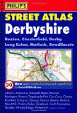
Philip's Street Atlas Derbyshire (Philip's Street Atlases)
This fully revised street atlas of Derbyshire gives comprehensive and detailed coverage of the county. The route planner shows all the A and B roads, and can be used when driving to get close to the destination before turning to the relevant large-scale street map.The street maps show every named road, street and lane very clearly, with major roads picked out in colour. The maps are at a standard scale of 3.5 inches to 1 mile, and show postcode boundaries. Other information on the maps includes car parks, railway and bus stations, post offices, schools, colleges, hospitals, police and fire stations, places of worship, leisure centres, footpaths and bridleways, camping and caravan sites, golf courses, and many other places of interest. New to this edition are fixed single and multiple speed-camera locations, with corresponding speed limits.The comprehensive index lists street names and postcodes, plus schools, hospitals, railway stations, shopping centres and other such features picked out in red, with other places of interest shown in blue.
Price: £8.39
Publication: 5 April 2010


Derbyshire books: Travel Guides
Mountain Bike Guide: Quality Routes in the Peak District and Derbyshire
Illustrated mountain bike guide for beginners and experienced riders. 24 circular routes in an area of outstanding natural beauty - all types of routes from short and gentle to long and challenging over high hills. Easy to follow directions and sketch maps.
Price: £8.50
Publication: April 1, 2004 [Paperback]


Derbyshire books: History & Heritage
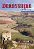
Derbyshire: A History
Derbyshire is made up of many contrasting parts. The experiences of its sheep farmers on the fringes of the northern moors were very different from those of the cheese-makers south of Ashbourne or the cereal-growers over near the Nottinghamshire border; and the lifestyle of all these farmers was completely different from that of the coal miners in the eastern pit villages, or the workers in the cotton mills of Glossop or the lace factories of Sandiacre and Long Eaton. Unlike the inhabitants of neighbouring Yorkshire and Lancashire, the people of Derbyshire never really developed a strong sense of belonging to their county. Instead, they were attached - as were people all over England - to their own neighbourhoods, or what they called their 'country', and within that to the particular places where they lived. The county's past is extremely varied and of great interest and wider significance.The river Derwent powered many of the first textile mills - the Derby silk mill of around 1720 was the world's first real factory - and is now a World Heritage Site. Cheek by jowl with this industrial might sit some of England's finest aristocratic homes and estates such as Haddon Hall and Chatsworth. The landscape is pock-marked with evidence of farming, mining, quarrying and ancient land-use. In some ways the county resembles an island, an upland area of great beauty amid a ring of industrial conglomerations, from Manchester to the wool towns of West Yorkshire, and from Stoke to Sheffield and Nottingham.This is a juxtaposition which created many routeways - roads, tracks, railways and even canals - through the Derbyshire uplands, connecting people and merchants from far and wide; and it meant that the county was never as isolated or economically disadvantaged as other English uplands such as Dartmoor or Cumbria. Derbyshire lies at the very heart of England and in many respects it can be seen to reflect almost every aspect of England's historical experience, including agriculture, mining, textiles, poverty, plague and prosperity. This book contains over 450 illustrations, mostly in full colour.
Price: £15.84
Publication: 10 Oct 2008


Derbyshire books: Walking and Tours
Derbyshire & the Peak District - A Dog Walker's Guide
20 circular routes varying in length from 2 to 5 and three quarter miles. Each walk has information on the distance and terrain, livestock likely to be encountered, number and type of stiles en route, and in an emergency, the nearest veterinary surgery.
Price: £6.36
Publication: 19 Mar 2012


20 circular routes varying in length from 2 to 5 and three quarter miles. Each walk has information on the distance and terrain, livestock likely to be encountered, number and type of stiles en route, and in an emergency, the nearest veterinary surgery.
Price: £6.36
Publication: 19 Mar 2012


Derbyshire (AA 50 Walks Series)
Walking is one of Britain's favourite leisure activities, and this guide features a variety of mapped walks to suit all abilities. The book features all the practical detail you need, accompanied by fascinating background reading on the history and wildlife of Derbyshire, as well as other local points of interest. All walks are annotated with places to visit along the way, including tea rooms and pubs, with extra details on their character and the food on offer. Every walk is given a summary of distance, time, gradient, level of difficulty, type of surface and access, landscape, dog friendliness, parking and public toilets.
Price: £7.99
Publication: 28 Feb 2009


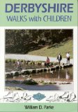
Derbyshire Walks with Children
This book describes 25 circular walks which reflect the splendid diversity of the Derbyshire countryside. There are routes across heather-covered moors in the north and rich, rolling agricultural land in the south. At other times Bill Parke leads us beside sparkling rivers and through picturesque stone villages. In all cases he has taken care to ensure that the different needs of individual family members are considered. All of the routes are less than 6 miles long, with 'Escape Routes' which allow the very young or less energetic to shorten the walk. There are comprehensive instructions and an absorbing commentary which should occupy the most enquiring young mind. Many routes include a highlight which will be of particular interest to children - among others, there's a racing car collection, an otter and owl sanctuary, the National Tramway Museum, theme parks and working mills, farms and mines.
Price: £6.47
Publication: 1 April 1997


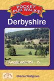
Pocket Pub Walks Derbyshire (Pocket Pub Walks)
This is a pocket-size collection of fifteen circular walks each based on a local pub serving good food. It includes routes at Whaley Bridge, Dronfield, Matlock, Ashbourne, Over Haddon and Thulston, with maps and photographs.
Price: £5.17
Publication: 17 May 2007


This is a pocket-size collection of fifteen circular walks each based on a local pub serving good food. It includes routes at Whaley Bridge, Dronfield, Matlock, Ashbourne, Over Haddon and Thulston, with maps and photographs.
Price: £5.17
Publication: 17 May 2007


The Peak District (OS Explorer Map): White Peak area. Buxton, Bakewell, Matlock & Dove Dale. Showing part of the Peak National Park, Pennine Bridleway, High Peak Trail and Tissington Trail
"OS Explorer Map" is the Ordnance Survey's most detailed folding map and is recommended for anyone enjoying outdoor activities including walking, horse riding and off-road cycling. Providing complete GB coverage, the "OS Explorer" map series details information essential in the great outdoors, including youth hostels, pubs and visitor information. Rights of way fences, permissive paths and bridleways are clearly shown, ensuring you have the best information to get the most out of your time in the countryside.
Price: £5.75
Publication: 5 Oct 2009


The Derbyshire
books listed on this page are for your information and to help you find the books you need quickly. We do not endorse any particular books and are not responsible for the advice and information in the books listed.
The price of books, where indicated, was correct at the time the book was added to this page. Prices may have changed on the booksellers web site.


