- UK Information
- UK Guidebooks and Maps
- UK Books for counties
- Cleveland books and maps
Cleveland books and maps
Here is a list of books for Cleveland that you may find useful.Cleveland books: Travel Guides

Cleveland Way and the Yorkshire Wolds Way: With the Tabular Hills Walk: With Yorkshire Wolds Way and Link (Cicerone Guide)
The Cleveland Way National Trail offers a fine walk around the North York Moors National Park, enjoying scenery that includes the open heather moorlands, gentle dales, interesting towns and villages, and dramatic cliff coastline. The Link through the Tabular Hills Walk is a Regional Trail that allows walkers to close the loop of the Cleveland Way and transform it into an enormous circular walk. The Yorkshire Wolds Way, one of the quietest of Britain's National Trails, wanders through gentle, cultivated and sparsely populated countryside. It links end-to-end with the Cleveland Way on the coast, so that walkers who wander from trail to trail can cover over 400km (250 miles) of easy and enjoyable walking in the beautiful Yorkshire countryside.
Price: £9.06
Publication: July 2005
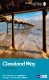
The Cleveland Way (National Trail Guides)
The Cleveland Way winds for over a hundred miles around the North York Moors National Park, from the ancient moorland town of Helmsley to finish on the seafront at Filey.
Along the way it takes in splendid coastal towns and villages like Staithes and Whitby, wild empty heather moorland, a blaze of purple in late-summer, dramatic coastline and clifftops, and stunning historic sites like Rievaulx Abbey.
Whether you're interested in the industrial history of ironstone mining, or a weekend stroller seeking a coastal walk from the seaside resort of Scarborough, this book, published in association with Natural England which waymarks the National Trails, is the only companion you need
Price: £9.09
Publication: 1 May 2012
Cleveland books: Walking and Tours
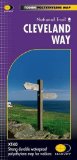
Cleveland Way (Route Maps)
Cleveland Way National Trail was the second to be established in Britain and is now over 40 years old. Many walkers consider it to be a classic route because of the variety of landscapes through which it travels. Another popular feature of the Cleveland Way is the wealth of important heritage sites and history to enjoy along the route.
Price: £11.66
Publication: 28 Aug 2010
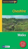
Pathfinder Cheshire (Pathfinder Guides)
Walkers coming to Cheshire and expecting an entirely flat county are in for a surprise. There are easy, undemanding walks that take you across characteristic, pastoral Cheshire landscapes, invariably passing through some of the attractive villages and by some of the county's outstanding churches and country houses. But you can also experience rough and challenging moorland hikes on the edge of the Peak District, plenty of attractive woodland walks along the sandstone ridge, or across parklands, or through the remnants of the medieval forests, a superb choice of peaceful canal walks and, on the Wirral, even coastal - or at least estuary - walking.
Price: £9.59
Publication: 28 Feb 2011 [Paperback]
The Cleveland
books listed on this page are for your information and to help you find the books you need quickly. We do not endorse any particular books and are not responsible for the advice and information in the books listed.
The price of books, where indicated, was correct at the time the book was added to this page. Prices may have changed on the booksellers web site.