- UK Information
- UK Guidebooks and Maps
- Runcorn books and maps
Runcorn books and maps
Here is a list of books for Runcorn that you may find useful.If you plan to travel to Runcorn you may be interested in some guide books and travel books that will help you plan your stay in Runcorn and to find your way around. Click on any book for more information or to buy.
Runcorn books: Maps

Liverpool, St Helens: Widnes and Runcorn (Explorer Maps)
OS Explorer Map is the Ordnance Survey's most detailed map and is recommended for anyone enjoying outdoor activities like walking, horse riding and off-road cycling. Providing complete GB coverage the series details essential information such as youth hostels, pubs and visitor information as well as rights of way, permissive paths and bridleways.
Price: £5.99
Publication: September 8, 2004
![Merseyside Street Atlas (A-Z Street Atlas) [Illustrated]](/images/books/1843486911.jpg)
Merseyside Street Atlas (A-Z Street Atlas) [Illustrated]
This spiral bound street atlas of Merseyside includes coverage of Liverpool, Birkenhead, Ellesmere Port, Runcorn, Skelmersdale, Southport, St. Helens, Warrington, and Widnes. There are 170 pages of continuous coloured street mapping extending from central Liverpool to:
Formby
Southport
Ormskirk
Orrell
Ashton-in-Makerfield
Culcheth
Lymm
Appleton Thorn
Frodsham
Helsby
Neston
Hoylake
Wallasey
Also included is a large scale city centre map of Liverpool, and a postcode map and road map of the atlas area. The street mapping features postcode districts, one-way streets and safety camera locations with their maximum speed limit.
The index section lists streets, selected flats, walkways and places of interest, place, area and station names. Also included is a separate list of the hospitals, NHS Walk-in Centres and hospices covered by this atlas.
Price: £8.36
Publication: 1 Dec 2010 [Spiral-Bound]
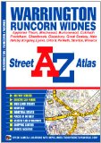
Warrington Street Atlas (A-Z Street Atlas)
This A-Z street map of Warrington, Frodsham, Runcorn and Widnes features 58 pages of coloured street mapping in an Atlas that extends to:
Burtonwood
Winwick
Culcheth
Cadishead
Warburton
Oughtrington
M6 Junction 20/ M56 Junction 9
Stretton
Preston Brook
Kingsley (inset)
Helsby
Elton
Hale (inset)
Hough Green
Whiston Lane Ends
Postcode districts, one-way streets, safety camera locations with their maximum speed are featured on the map.
The index section lists streets, selected flats, walkways and places of interest, place, area and station names, hospitals and hospices covered by this atlas.
Price: £4.12
Publication: 17 Mar 2011 [Illustrated] [Paperback]
The Runcorn books listed on this page are for your information and to help you find the books you need quickly. We do not endorse any particular books and are not responsible for the advice and information in the books listed.
The price of books, where indicated, was correct at the time the book was added to this page. Prices may have changed on the booksellers web site.