- UK Information
- UK Guidebooks and Maps
- Rochdale books and maps
Rochdale books and maps
Here is a list of books for Rochdale that you may find useful.If you plan to travel to Rochdale you may be interested in some guide books and travel books that will help you plan your stay in Rochdale and to find your way around. Click on any book for more information or to buy.
Rochdale books: Maps
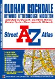
Oldham & Rochdale Street Atlas (A-Z Street Atlas)
This street atlas of Oldham and Rochdale contains 54 pages of coloured mapping with coverage that includes:
Whitworth, Littleborough, Heywood, Royton, Shaw, Middleton, Chadderton, Lees, Saddleworth, Failsworth, Mossley and Droylesden.
Large scale town centre maps of both Rochdale and Oldham.
The continuous street map coverage extends to:
Facet, Summit, Rokewood, Denshaw, Diggle, Pobgreen, Carr, Bardsley, Clayton, Harburhey, Heaton Park, Fairfield and Norden.
Postcode districts, one-way streets and safety camera locations with their maximum speed limit are featured on the street mapping.
The index section lists streets, selected flats, walkways and places of interest, place, area and station names, hospitals and hospices covered by this atlas.
Price: £5.34
Publication: 2 Aug 2010
The Rochdale books listed on this page are for your information and to help you find the books you need quickly. We do not endorse any particular books and are not responsible for the advice and information in the books listed.
The price of books, where indicated, was correct at the time the book was added to this page. Prices may have changed on the booksellers web site.