- UK Information
- UK Guidebooks and Maps
- Huntingdon books and maps
Huntingdon books and maps
Here is a list of books for Huntingdon that you may find useful.If you plan to travel to Huntingdon you may be interested in some guide books and travel books that will help you plan your stay in Huntingdon and to find your way around. Click on any book for more information or to buy.
Huntingdon books: Maps
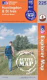
Bedford, Huntingdon, St. Neots & Biggleswade (OS Landranger Map Active)
Tough, durable and weatherproof, this title features maps that are covered in a lightweight protective plastic coating that can be written on, so that your favourite routes can be easily highlighted.
Price: £11.59
Publication: 16 April 2012


Tough, durable and weatherproof, this title features maps that are covered in a lightweight protective plastic coating that can be written on, so that your favourite routes can be easily highlighted.
Price: £11.59
Publication: 16 April 2012
Bedford, Huntingdon, St. Neots and Biggleswade (OS Landranger Map)
Perfect for day trips and short breaks, the OS Landranger Map series covers Great Britain with 204 detailed maps. Each map provides all the information you need to get to know your local area and includes places of interest, tourist information, picnic areas and camp sites, plus Rights of Way information for England and Wales.
Price: £5.24
Publication: 16 Nov 2009

Huntingdon and St.Ives, Grafham Water (Explorer Maps) (OS Explorer Map)
OS Explorer Map is the Ordnance Survey's most detailed map and is recommended for anyone enjoying outdoor activities like walking, horse riding and off-road cycling. Providing complete GB coverage the series details essential information such as youth hostels, pubs and visitor information as well as rights of way, permissive paths and bridleways.
Price: £5.99
Publication: 13 Feb 2006
Huntingdon Street Atlas (A-Z Street Atlas)
This atlas of Huntingdon, St. Ives and St. Neots contains 39 pages of coloured street mapping with continuous coverage that includes:
Alconbury, Brampton, Buckden, Eaton Socon, Fenstanton, Godmanchester, Hemingford Grey, Hilton, Great Paxton, Great Stukeley, Little Paxton, Little Stukeley, Needingworth and Offord D'Arcy.
Papworth Everard is featured separately and includes Graveley and Elsworth; Cambourne is also featured separately and includes Eltisley and Caxton.
Postcode districts, one-way streets and safety camera locations with their maximum speed limits are featured on the mapping.
The index section lists streets, selected flats, walkways and places of interest, place, area and station names, hospitals and hospices covered by this atlas.
Price: £4.50
Publication: 30 Mar 2010
Huntingdon books: Travel Guides
Philip's Street Atlas Cambridgeshire (Philip's Street Atlases)
This fully revised street atlas of Cambridgeshire gives comprehensive and detailed coverage of the county. The route planner shows all the A and B roads, and can be used when driving to get close to the destination before turning to the relevant large-scale street map.The street maps show every named road, street and lane very clearly, with major roads picked out in colour. The maps are at a scale of 3.5 inches to 1 mile, with less populated areas at a scale of 1.75 inches to 1 mile. Cambridge city centre is shown at 7 inches to 1 mile.Other information on the maps includes postcode boundaries, car parks, railway and bus stations, post offices, schools, colleges, hospitals, police and fire stations, places of worship, leisure centres, footpaths and bridleways, camping and caravan sites, golf courses, and many other places of interest. New to this edition are fixed single and multiple speed-camera locations, with corresponding speed limits.The comprehensive index lists street names and postcodes, plus schools, hospitals, railway stations, shopping centres and other such features picked out in red, with other places of interest shown in blue.
Price: £8.27
Publication: 5 Sep 2008
Huntingdon books: Walking and Tours
Huntingdon and St Ives, Grafham Water (OS Explorer Map Active)
OS Explorer Map is the Ordnance Survey's most detailed map and is recommended for anyone enjoying outdoor activities such as walking, horse riding and off-road cycling. The series provides complete GB coverage and can now be used in all weathers thanks to OS Explorer Map - Active, a tough, versatile version of the OS Explorer Map.
Price: £11.59
Publication: 13 Nov 2006
The Huntingdon books listed on this page are for your information and to help you find the books you need quickly. We do not endorse any particular books and are not responsible for the advice and information in the books listed.
The price of books, where indicated, was correct at the time the book was added to this page. Prices may have changed on the booksellers web site.