- UK Information
- UK Guidebooks and Maps
- Colwyn Bay books and maps
Colwyn Bay books and maps
Here is a list of books for Colwyn Bay that you may find useful.If you plan to travel to Colwyn Bay you may be interested in some guide books and travel books that will help you plan your stay in Colwyn Bay and to find your way around. Click on any book for more information or to buy.
Colwyn Bay books: Maps
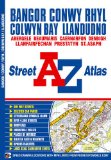
Bangor, Conwy, Rhyl, Colwyn Bay & Llandudno Street Atlas (A-Z Street Atlas)
This atlas contains 37 pages of coloured street mapping that cosists of separate coverages of:
Bangor, Beaumaris (Biwmares), Menai Bridge (Porthaethwy) and Llanfair Pwllgwyngyll.
Llanfairfechan, Penmaenmawr and Dwygyfylchi.
Conwy, Llandudno, Penrhyn Bay (Bae Penrhyn), Colwyn Bay (Bae Colwyn), Abergele, Kinmel Bay (Bae Cinmel), Rhyl (Y Rhyl), Prestatyn, Rhuddlan, Dyserth, Bodelwyddan and St. Asaph (Llan-Elwy).
Denbigh (Dinbych).
Caernarfon including a large scale town centre plan.
Postcode districts, one-way streets and safety camera locations with their maximum speed limit are featured on the street mapping.
The index section of the atlas lists streets and selected flats, walkways and places of interest, place and area names, hospitals and hospices covered by this atlas.
Price: £3.71
Publication: Paperback (5 April 2010)
Colwyn Bay books: Travel Guides
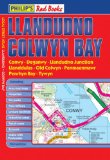
Philip's Red Books Llandudno and Colwyn Bay (Local Street Atlases)
This local street atlas of Llandudno and Colwyn Bay, and their surrounding towns and villages, gives detailed coverage of the area at a scale of 4.5 inches to 1 mile.The maps show hospitals, car parks, post offices, leisure facilities, schools, industrial areas and retail areas, while the index lists street names and postcodes. An area road map enables the user to identify through-routes more easily.Pocket sized, and wire stitched so that it opens out flat, the atlas is ideally suited for both business and leisure use, whether by locals or visitors.
Price: £4.99
Publication: 15 Aug 2008
The Colwyn Bay books listed on this page are for your information and to help you find the books you need quickly. We do not endorse any particular books and are not responsible for the advice and information in the books listed.
The price of books, where indicated, was correct at the time the book was added to this page. Prices may have changed on the booksellers web site.