- UK Information
- UK Guidebooks and Maps
- Alton books and maps
Alton books and maps
Here is a list of books for Alton that you may find useful.If you plan to travel to Alton you may be interested in some guide books and travel books that will help you plan your stay in Alton and to find your way around. Click on any book for more information or to buy.
Alton books: Maps
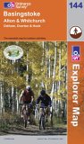
Basingstoke, Alton and Whitchurch (Explorer Maps) (OS Explorer Map)
OS Explorer Map is the Ordnance Survey's most detailed map and is recommended for anyone enjoying outdoor activities like walking, horse riding and off-road cycling. Providing complete GB coverage the series details essential information such as youth hostels, pubs and visitor information as well as rights of way, permissive paths and bridleways.
Price: £5.75
Publication: 27 Sep 2005 [Folded Map] [Paperback]
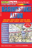
Philip's Red Books Basingstoke and Alton (Local Street Atlases)
This local street atlas of Basingstoke and Alton, and their surrounding towns and villages, gives detailed coverage of the area at a scale of 4 inches to 1 mile. It also includes an enlarged centre map for Basingstoke at 7 inches to 1 mile.The maps show hospitals, car parks, post offices, one-way streets, leisure facilities, industrial areas and retail areas, while the index lists street names and postcodes. An area road map enables the user to identify through-routes more easily.Pocket sized, and wire stitched so that it opens out flat, the atlas is ideally suited for both business and leisure use, whether by locals or visitors.
Price: £3.75
Publication: 11 Feb 2008
The Alton books listed on this page are for your information and to help you find the books you need quickly. We do not endorse any particular books and are not responsible for the advice and information in the books listed.
The price of books, where indicated, was correct at the time the book was added to this page. Prices may have changed on the booksellers web site.