- UK Information
- UK Guidebooks and Maps
- UK Books for counties
- Wiltshire books and maps
Wiltshire books and maps
Here is a list of books for Wiltshire that you may find useful.Wiltshire books: Maps
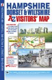
A-Z Hampshire Dorset & Wiltshire Road Map
This full colour foldout visitors' map of Hampshire, Dorset and Wiltshire features road mapping that covers an area extending to:
Chepstow, Stroud, Lechlade on Thames, Oxford, High Wycombe, Maidenhead, Bracknell, Farnham, Midhurst, Chichester, Portsmouth, Isle of Wight, Southampton, Bournemouth, Poole, Swanage, Weymouth, Isle of Portland, Lyme Regis, Ilminster, Bridgwater, Weston-Super-Mare and Newport.
Map information includes:
Motorways open with full junction detail, motorways under construction and proposed, service areas, primary routes and destinations, A and B roads, tolls, mileages, county boundaries, gradients 1:5 and steeper together with spot heights and hill shading.
Fuel station and safety camera locations with their maximum speed limits.
Selected places of interest, tourist information centres, caravan and camping sites and golf courses.
The index panel is adjacent to the map and lists towns, villages, hamlets and locations. Places of interest are listed separately.
Price: £4.40
Publication: 28 Oct 2009 [Folded Map, Illustrated] [Map]
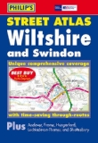
Philip's Street Atlas Wiltshire and Swindon: Pocket Edition
This pocket-sized street atlas of Wiltshire and Swindon gives comprehensive and detailed coverage of the area. The route planner shows all the A and B roads, and can be used when driving to get close to the destination before turning to the relevant large-scale street map.The street maps show every named road, street and lane very clearly, with major roads picked out in colour. The maps are at a scale of 2 2/3 inches to 1 mile, with less densely populated areas at a scale of 1 1/3 inches to 1 mile. Town maps of Andover and Frome are also included. Other information on the maps includes postcode boundaries, car parks, railway and bus stations, post offices, schools, colleges, hospitals, police and fire stations, places of worship, leisure centres, footpaths and bridleways, camping and caravan sites, golf courses, and many other places of interest.The comprehensive index lists street names and postcodes, plus schools, hospitals, railway stations, shopping centres and other such features picked out in red, with other places of interest shown in blue.
Price: £5.99
Publication: 16 May 2011 [Paperback]
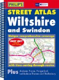
Philip's Street Atlas Wiltshire and Swindon: Spiral Edition
This full-colour street atlas of Wiltshire and Swindon gives comprehensive and detailed coverage of the area. The route planner shows all the A and B roads, and can be used when driving to get close to the destination before turning to the relevant large-scale street map.The street maps show every named road, street and lane very clearly, with major roads picked out in colour. The maps are at a scale of 3.5 inches to 1 mile, with less densely populated areas at a scale of 1.75 inches to 1 mile. Town maps of Andover and Frome are also included. Other information on the maps includes postcode boundaries, car parks, railway and bus stations, post offices, schools, colleges, hospitals, police and fire stations, places of worship, leisure centres, footpaths and bridleways, camping and caravan sites, golf courses, and many other places of interest.The comprehensive index lists street names and postcodes, plus schools, hospitals, railway stations, shopping centres and other such features picked out in red, with other places of interest shown in blue.
Price: £9.99
Publication: 13 Jun 2011 [Spiral-Bound]
Wiltshire books: Walking and Tours
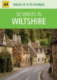
30 Walks in Wiltshire (AA 30 Walks in)
This original concept takes the most popular walks from the AA's best-selling and newly updated walks database and packages them on individual laminated cards in a durable box. The small and handy size means that the box can be stowed away in a pocket or handbag and single cards extracted at each walk start point. Clear and concise instructions plus a full-colour route map make the cards a joy to use.
Price: £5.24
Publication: 30 Jun 2010 [Cards]

Kiddiwalks in Wiltshire
Twenty short circular walks designed especially for children. They include routes at the Cotswold Water Park, Savernake Forestm the Westbury White Horsem Wardour Castle and Old Sarum.
Price: £6.73
Publication: 3 Jun 2010 [Hardcover]
Twenty short circular walks designed especially for children. They include routes at the Cotswold Water Park, Savernake Forestm the Westbury White Horsem Wardour Castle and Old Sarum.
Price: £6.73
Publication: 3 Jun 2010 [Hardcover]
Pathfinder Somerset, the Mendips & Wiltshire (Pathfinder Guides)
Both scenically and historically, Somerset and Wiltshire rank as two of the most attractive and interesting counties in Britain. Landscapes range from the breezy heights of the Mendips to the flat meadows of the Somerset Levels, and from the rolling chalk uplands of the Marlborough Downs to the mudflats and sandy expanses that fringe the Bristol Channel coast. Walkers can experience a variety of such terrains in this guide. The region boasts Europe's greatest concentration of prehistoric monuments such as those at Avebury and Stonehenge, and sites that inspired a host of romantic myths and legends, from King Arthur to Alfred the Great.
Price: £9.59
Publication: 5 July 2010

Pub Walks in Wiltshire
Features circular walks around Wiltshire, starting and finishing at a good local pub.
Price: £7.99
Publication: 20 Jun 2007 [Paperback]
Features circular walks around Wiltshire, starting and finishing at a good local pub.
Price: £7.99
Publication: 20 Jun 2007 [Paperback]
Short Walks Wiltshire: from Salisbury to the Kennett: Leisure Walks for All Ages
Wiltshire remains one of England's loveliest and least spoilt counties. With its endless tracts of open downland, gentle river valleys and picture postcard villages it is the perfect place to explore on foot. At its heart, between the historic city of Salisbury, with its magnificent cathedral and glorious watermeadows, and the meandering Kennet, one of the country's prettiest rivers, lies a complex network of winding paths and ancient tracks which convey a wonderful sense of space and distance and allow walkers to discover a multitude of attractions, including ancient burial mounds, historic standing stones and secluded country churches.
Price: £5.24
Publication: 1 May 2004 [Paperback]
The Wiltshire
books listed on this page are for your information and to help you find the books you need quickly. We do not endorse any particular books and are not responsible for the advice and information in the books listed.
The price of books, where indicated, was correct at the time the book was added to this page. Prices may have changed on the booksellers web site.