- UK Information
- UK Guidebooks and Maps
- UK Books for counties
- Staffordshire books and maps
Staffordshire books and maps
Here is a list of books for Staffordshire that you may find useful.Staffordshire books: Maps
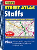
Philip's Street Atlas Staffordshire: Spiral Edition
Philip's Street Atlas Staffordshire gives comprehensive and detailed coverage of the county. The route planner shows all the A and B roads, and can be used when driving to get close to the destination before turning to the relevant large-scale street map.The street maps show every named road, street and lane very clearly, with major roads picked out in colour. The maps are at a standard scale of 3.5 inches to 1 mile. The centres of Hanley, Longton, Newcastle-under-Lyme and Stafford are shown at 7 inches to 1 mile.Other information on the maps includes postcode boundaries, car parks, railway and bus stations, post offices, schools, colleges, hospitals, police and fire stations, places of worship, leisure centres, footpaths and bridleways, camping and caravan sites, golf courses, and many other places of interest.The comprehensive index lists street names and postcodes, plus schools, hospitals, railway stations, shopping centres and other such features picked out in red, with other places of interest shown in blue.
Price: £9.99
Publication: 1 Oct 2012 [Spiral-Bound]
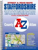
Staffordshire County Atlas (A-Z County Atlas)
This county atlas of Staffordshire has 148 pages of coloured street mapping that feature all the major towns and villages. Also included are 12 pages of road mapping covering the whole county.
The continuous street mapping around Stoke-on-Trent, Hanley and Newcastle-under-Lyme includes coverage of:
Mow Cop, Biddulph, Kidsgrove, Audley, Tunstall, Milton, Silverdale, Werrington, Keele, Longton, Balwins Gate, Wedgwood, Blythe Bridge, Barlaston and Stone.
Also included is large scale street mapping of the centres of Newcastle-under-Lyme and Stoke-on-Trent.
The continuous street mapping around Cannock, Rugeley, Lichfield and Brownhills includes:
Handsacre, Hednesford, Burntwood, Great Wyrley, Codsall, Bloxwich and Perton.
There are separate coverages each of:
Stafford, Leek, Uttoxeter, Burton-upon-Trent, Tamworth and other towns and villages within Staffordshire.
Postcode districts, one-way streets and safety camera locations with their maximum speed limit are featured on the street mapping. Safety cameras with their maximum speed limit are also featured on the road mapping.
The index section lists streets, selected flats, walkways and places of interest, junction, place, area and station names. There is a separate list of hospitals and hospices covered by this atlas.
Price: £6.44
Publication: 19 Oct 2010 [Illustrated] [Spiral-Bound]
Staffordshire books: Travel Guides
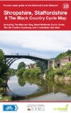
Shropshire, Staffordshire & The Black Country Cycle Map (National Cycle Network Route Maps)
Shropshire, Staffordshire & The Black Country Cycle Map including The Mercian Way, West Midlands Cycle Route, The Six Castles Cycleway and 4 individual day rides. This is in the series of pocket sized, folded maps to the National Cycle Network which include clearly mapped on-road and traffic-free paths, easy to read contours and detailed town insets. The series is published by CycleCity Guides in partnership with Sustrans. 1:110,000 scale; folded 155mm x 99mm; flat 792mm x 630mm.
Price: £3.74
Publication: 1 Sep 2013
Staffordshire books: Walking and Tours
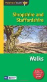
Pathfinder Shropshire & Staffordshire (Pathfinder Guides)
Britain's best loved walking guides brings you a brand new Pathfinder� Guide to Shropshire & Staffordshire Walks containing 28 fabulous walks exploring the unspoilt rural landscapes of Shropshire and Staffordshire from the Welsh borders to the fringes of the Peak District, and from the mosses and meres near the Cheshire border to Cannock Chase and the Shropshire Hills. The walks range in length from 3.5 to 9 miles and in typical Pathfinder� Guide style offer something for all tastes and abilities.
Price: £8.39
Publication: 8 May 2012 [Paperback]
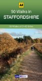
Staffordshire: AA 50 Walks (50 Walks in)
Walking is one of Britain's favourite leisure activities, and this guide features a variety of mapped walks to suit all abilities. The book features all of the practical detail you need, accompanied by fascinating background reading on the history and wildlife of Staffordshire, and cear mapping for ease of use. Every route has been colour coded according to difficulty. All walks are annotated with local points of interest and places to stop for refreshments. Every walk is given a summary of distance, time, gradient, level of difficulty, type of surface and access, landscape, dog friendliness, parking and public toilets.
Price: £9.99
Publication: 1 Sep 2013 [Paperback]
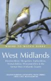
Where to Watch Birds in the West Midlands: Herefordshire, Shropshire, Staffordshire, Warwickshire, Worcestershire and the Former West Midlands County
Herefordshire, Shropshire, Staffordshire, Warwickshire, Worcestershire and the former West Midlands County are collectively known as the West Midlands. This is a region of contrasts: from the bleak moors of Peak District to the mellow hills of the Cotswolds; or from the wooded hillsides and streams of the Welsh border country to the lush valleys of the Avon. Within its rich mosaic of habitats can be found a combination of northern species such as Twite and Black Grouse and southern ones such as Nightingale; western ones like the Pied Flycatcher and the eastern Red-legged Partridge. Black Redstarts maintain a tenuous presence in the hub of Birmingham and the Marsh Warbler can still be found in Worcestershire. This third edition has been extensively revised and updated, with several new sites added and some existing site accounts considerably expanded. It is the essential tool for anyone birding in this rewarding region.
Price: £18.99
Publication: 29 Jun 2007
The Staffordshire
books listed on this page are for your information and to help you find the books you need quickly. We do not endorse any particular books and are not responsible for the advice and information in the books listed.
The price of books, where indicated, was correct at the time the book was added to this page. Prices may have changed on the booksellers web site.