- UK Information
- UK Guidebooks and Maps
- UK Books for counties
- Northumberland books and maps
Northumberland books and maps
Here is a list of books for Northumberland that you may find useful.Northumberland books: Maps
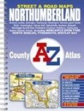
Northumberland County Atlas (A-Z Street Atlas)
This county atlas of Northumberland has 100 pages of street mapping that feature all the major towns and villages. Also included are 14 pages of road mapping covering the whole county.
The street map pages include individual maps of:
Berwick-upon-Tweed, Tweedmouth, Spittal and Scremerston; Wooler; Belford; Bamburgh; Seahouses; Beadnell; Embleton and Christon Bank; Lonhoughton; Alnwick; Alnmouth, Hipsburn and Lesbury; Shilbottle; Warkworth; Amble; Rothbury; Longframlington; Swarland; Felton and West Thirston; Acklington, Togston and North Broomhill; Hadston, South Broomhill and Red Row; Longhorsley; Widdrington Station; Ellington and Lynmouth; Bellingham; Wark; Haltwhistle; Bardon Mill and Henshaw; Haydon Bridge; Humshaugh and Allendale Town.
There are 76 pages of continuous street map coverage that extends from central Newcastle-upon-Tyne to:
Morpeth, Ashington, Newbiggin-by-the-Sea, Blyth, Seaton Sluice, Whitley Bay, Tynemouth, South Shields (part), Hebburn, Gateshead, the Metro Centre, Blaydon, Prudhoe, Painshawfield, Corbridge, Hexham, Darras Hall, Ponteland, Newcastle International Airport, Brunswick Village, Cramlington and Bedlington.
A large scale city centre map of Newcastle-upon-Tyne is included.
Postcode districts are featured on the street mapping.
The index section lists streets, selected flats, walkways and places of interest, junction, place and area names, hospitals, hospices, National Rail and Metro stations.
Price: £4.99
Publication: 14 Sep 2005 [Illustrated] [Spiral-Bound]


Philip's Navigator Road Map Northumberland: Town Plans - Berwick, Newcastle & Sunderland (Philip's Road Atlases & Maps)
A brand new sheet map featuring Philip's exceptionally large-scale and detailed Navigator[registered] mapping and covering Northumberland, Tyne and Wear, and the Scottish Borders as far as Galashiels to the north. The map is part of Philip's new series of Navigator[registered] sheet maps, each covering a county, unitary authority, or group of authorities. The map contains highly detailed coverage at 1 1/2 miles to 1 inch of the region's road network, including minor country lanes and rural tracks - and even major footpaths - and every junction, roundabout and slip-road is shown in detail. There is huge amount of other detail, including thousands of individually named farms, houses and hamlets. Airfields, stations, ferries, marinas, and an abundance of places of interest are also shown. The map has a comprehensive index and includes town plans of Berwick-upon-Tweed, Newcastle-upon-Tyne and Sunderland. The maps are designed for both professional and leisure users. For professionals, the wealth of detail makes activities such as regional planning and delivery driving far easier. For leisure, the wealth of detail greatly eases the navigation of both main roads and byways, and increases
Price: £3.99
Publication: April 5, 2004


Northumberland books: Travel Guides
Pathfinder Northumberland & the Scottish Borders (Pathfinder Guides)
This selection offers interest, regional variety and balance of routes in Northumberland the the Scottish Borders providing the best walks in the area. From an easy stroll through Doddington Moor to the much more challenging walks in Windy Gyle this volume contains something for everyone. Covering walks through the whole of Northumberland both popular and little know scenic routes including Hadrian's Wall, Thirlwall Castle and Longhoughton.
-See walk locations by Looking Inside
Inside:
-28 great walks in Northumberland from 2 to 10 miles
-Clear, large scale Ordnance Survey route maps
-GPS reference for all Northumberland waypoints
-Where to park, good pubs and places of interest en route
-All routes have been fully researched and written by expert outdoor writers
-Beautiful photography of scenes from the walks
Pathfinder® Guides are Britain's best loved walking guides. Made with durable covers, they are the perfect companion for countryside walks throughout Britain. Each title features circular walks with easy-to-follow route descriptions, large-scale Ordnance Survey route maps and GPS waypoints. With over 70 titles in the series, they offer essential information for walkers throughout the country.
Price: £8.39
Publication: 29 Nov 2010


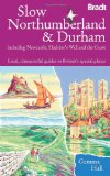
Slow Northumberland & Durham: Including Newcastle, Hadrian's Wall and the Coast (Bradt Travel Guides (Slow Guides))
Northumbria is home to the loneliest stretches of moorland and coast in the country. The region has much to offer the nature lover, walking enthusiast, history buff, gastronome and gardener: rare wildlife, Georgian architecture, the Pennine hills, Hadrian's Wall, Alnwick Gardens and Alnwick Castle, featured in the Harry Potter films. Gemma Hall shares her love of Northumberland, Durham and Tyneside, guiding visitors through historic towns, cities and villages; across the Cheviot Hills and along Northumberland's Heritage Coast; to outdoor swimming spots, high altitude flower meadows and the wooded gorges of the Durham coast.
Price: £10.34
Publication: 2 July 2012


Northumberland books: Walking and Tours
Northumberland Coast Path (National Trail Guides)
The Northumberland coastline stretches from the outskirts of Newcastle up to the Scottish border at Berwick-upon-Tweed - a popular holiday destination for its wild and sweeping landscape of endless beaches of pale sand, succession of spectacular castles like Bamburgh and Dunstanburgh, congenial resorts like Alnmouth, and unique offshore attractions like Holy Island and the Farne Islands. Now, Roland Tarr's new Trail Guide maps out the walker's route along the entire coast, starting from the centre of Newcastle and including an extension beyond Berwick to the seabird crags of St Abb's Head.
Along the way the guide covers the remarkable industrial heritage of this coastline - the coalmining town of Ashington that gave birth to both the Ashington Group of Pitmen Painters and the Charlton brothers - and its fabulous wildlife, with seals and puffins off the shore. From a handsome Tyneside city to a distinguished border town straddling the Tweed, this is a superbly bracing walking country for the ever-increasing number of tourists who discover Northumberland every year.
Price: £11.99
Publication: 2 May 2013


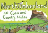
Northumberland: 40 Coast and Country Walks (Pocket Mountains)
Northumberland is England's most northern county, a magical place filled with ancient castles, golden sand beaches, rolling hills, rugged moorland and friendly little Northumberland towns and villages. This much-awaited addition to the award-nominated series of easy walking guides is an affordable and practical guide to 40 of the best family walks in the region.
Price: £5.24
Publication: 1 July 2012 [Paperback]


The Border Country: A Walker's Guide (Cicerone British Walking)
Covering the border hills, northern Northumberland and the Southern Uplands, this third edition of the guide offers a broad selection of around 50 routes, as well as outlines of a number of long-distance trails which cross the region. The Border country that lies between England and Scotland is a countryside surrounded by ridge after high ridge rythmically fading into gently folding valleys, through which the Tweed and Teviot rivers flow. The area has been the scene of thousands of years of sometimes turbulent history, from the early iron Age, through the Roman occupation, with influences down the years of both Celtic and Christian beliefs. The guide offers the hillwalker routes which will open up this broad and expansive landscape, giving a real taste of solitude and affinity with this unique area.
Price: £9.06
Publication: April 2005 [Illustrated] [Paperback]


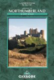
Walking in Northumberland. 36 Day Walks (Cicerone British Walking)
The book comprises 36 short walking routes generally between 4 and 26 miles, passing through, finishing in, or contained within Northumberland. Northumberland is an extensive county with wide horizons, where space and solitude are in abundance and time is measured by the seasonal cycle. Choose from wild walking, craggy ascents, forest treks and gentle riverside strolls through hills and braes that have few equals. And if that is not enough, there are endless empty miles of sandy bays, rippling dunes and rocky points each bearing pages of Northumberland history. Mountains, moorland and sandy coast provide some of the finest walking in England, and without doubt the most secluded.
Price: £9.06
Publication: 1 Jun 2004 [Illustrated] [Paperback]


The Northumberland
books listed on this page are for your information and to help you find the books you need quickly. We do not endorse any particular books and are not responsible for the advice and information in the books listed.
The price of books, where indicated, was correct at the time the book was added to this page. Prices may have changed on the booksellers web site.


