- UK Information
- UK Guidebooks and Maps
- UK Books for counties
- Shetland Islands books and maps
Shetland Islands books and maps
Here is a list of books for Shetland Islands that you may find useful.- Shetland Islands books:Maps
- Shetland Islands books:Travel Guides
- Shetland Islands books:Walking and Tours
Shetland Islands books: Maps
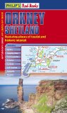
Philip's Red Books Orkney and Shetland (Philips Red Books Tourism Maps)
This double-sided leisure and tourist map of Orkney and Shetland gives detailed coverage of the islands' road network at a scale of approximately 2.5 miles to 1 inch. The Orkney Islands are featured on side one of the map, with the Shetland Islands shown on the reverse. The maps show places of tourist and historic interest, including castles, camping sites, country parks, galleries, gardens, golf courses, marinas, museums, nature trails, historic sites, sports venues, theatres, theme parks, wildlife parks and zoos. An index to principal places of interest is also featured on each side of the map for Orkney and Shetland respectively. In a convenient folded format, this double-sided sheet map is ideally suited for both leisure and business use, whether by locals or visitors to the islands.
Price: £4.99
Publication: 4 Jun 2012

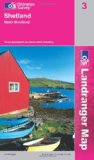
Shetland - Yell, Unst and Fetlar (Landranger Maps) (OS Landranger Map)
This map is part of the Landranger (Pink) series and is designed for people who really want to get to know an area. It includes the following information: tourist information, camping and caravan sites, picnic areas and viewpoints, selected places of interest and rights of way information for England and Wales. Each map in the series covers an area of 40 km by 40 km (25 miles by 25 miles) and like other Ordnance Survey maps, National Grid squares are provided so that any feature can be given a unique reference number. Perfect for planning ahead and local excursions, these maps are full of useful information that will help you really get to know an area.
Price: £6.99
Publication: 8 July 2003
Shetland Islands books: Travel Guides
Shetland - North Mainland (Landranger Maps) (OS Landranger Map)
This map is part of the Landranger (Pink) series and is designed for people who really want to get to know an area. It includes the following information: tourist information, camping and caravan sites, picnic areas and viewpoints, selected places of interest and rights of way information for England and Wales. Each map in the series covers an area of 40 km by 40 km (25 miles by 25 miles) and like other Ordnance Survey maps, National Grid squares are provided so that any feature can be given a unique reference number. Perfect for planning ahead and local excursions, these maps are full of useful information that will help you really get to know an area.
Price: £6.99
Publication: 8 July 2003
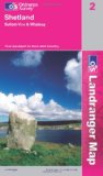
Shetland - Sullom Voe and Whalsay (Landranger Maps) (OS Landranger Map)
This map is part of the Landranger (Pink) series and is designed for people who really want to get to know an area. It includes the following information: tourist information, camping and caravan sites, picnic areas and viewpoints, selected places of interest and rights of way information for England and Wales. Each map in the series covers an area of 40 km by 40 km (25 miles by 25 miles) and like other Ordnance Survey maps, National Grid squares are provided so that any feature can be given a unique reference number. Perfect for planning ahead and local excursions, these maps are full of useful information that will help you really get to know an area.
Price: £6.44
Publication: 8 July 2003
Shetland Islands books: Walking and Tours
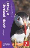
Orkney & Shetland Islands (Footprint Focus) (Footprint Focus Guide)
The third edition of this popular guide to walking on the Scilly Isles at the south-western edge of Britain, including 11 day walks and 4 boat trips, perfect for a fortnight away from it all. With their mild climate and relaxing atmosphere, the Isles make an ideal destination for a retreat, with stunning scenery, rich bird life and myriad wildflowers. Basking in sunshine, rising green and pleasant from the blue Atlantic Ocean, fringed by rugged cliffs and sandy beaches, they reveal their charms to those who walk the headlands, sail from island to island and take time to observe the sights, sounds and scents of the landscape. All routes are illustrated with OS mapping and contain lots of background information on the history, geology and ecology of the islands. There is also practical information on public transport services and accommodation.
Price: £3.50
Publication: 15 July 2011
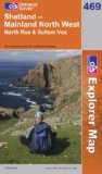
Shetland: Mainland North West (OS Explorer Map Series)
OS Explorer Map is the Ordnance Survey's most detailed map and is recommended for anyone enjoying outdoor activities like walking, horse riding and off-road cycling. Providing complete GB coverage the series details essential information such as youth hostels, pubs and visitor information as well as rights of way, permissive paths and bridleways.
Price: £7.32
Publication: 17 Dec 2007
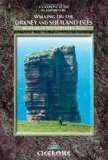
Walking on the Orkney and Shetland Isles: 80 Walks in the Northern Isles (Cicerone Guide)
A guide to day walks on the Isles if Orkney and Shetland - off the northeastern tip of Britain. Packed with archaeological sites, dotted with rare wildflowers and thronged with seabirds, these clusters of islands are a world away from the rest of Scotland. They sit at the turning point of the North Sea and the North Atlantic - Orkney nearest to mainland Scotland and Shetland further out - with the tiny dot of Fair Isle midway between the two. This book is a must for anyone wanting to explore this diverse landscape on foot. Two sections - one for Orkney, the other for Shetland - describe over 80 walks, ranging from short strolls to ancient monuments to more challenging long coastal routes and moorland traverses. ? 80 walks on 25 islands across Orkney and Shetland ? full-colour photographs and OS mapping ? lots of information about the history of each area visited and the wildlife to look out for ? full details of how to get to, and travel around, the islands.
Price: £9.06
Publication: 18 Feb 2009
The Shetland Islands
books listed on this page are for your information and to help you find the books you need quickly. We do not endorse any particular books and are not responsible for the advice and information in the books listed.
The price of books, where indicated, was correct at the time the book was added to this page. Prices may have changed on the booksellers web site.