- UK Information
- UK Guidebooks and Maps
- UK Books for counties
- Hampshire books and maps
Hampshire books and maps
Here is a list of books for Hampshire that you may find useful.- Hampshire books:Maps
- Hampshire books:Travel Guides
- Hampshire books:Walking and Tours
- Hampshire books:Food & Drink
Hampshire books: Maps
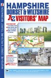
A-Z Hampshire Dorset & Wiltshire Road Map
This full colour foldout visitors' map of Hampshire, Dorset and Wiltshire features road mapping that covers an area extending to:
Chepstow, Stroud, Lechlade on Thames, Oxford, High Wycombe, Maidenhead, Bracknell, Farnham, Midhurst, Chichester, Portsmouth, Isle of Wight, Southampton, Bournemouth, Poole, Swanage, Weymouth, Isle of Portland, Lyme Regis, Ilminster, Bridgwater, Weston-Super-Mare and Newport.
Map information includes:
Motorways open with full junction detail, motorways under construction and proposed, service areas, primary routes and destinations, A and B roads, tolls, mileages, county boundaries, gradients 1:5 and steeper together with spot heights and hill shading.
Fuel station and safety camera locations with their maximum speed limits.
Selected places of interest, tourist information centres, caravan and camping sites and golf courses.
The index panel is adjacent to the map and lists towns, villages, hamlets and locations. Places of interest are listed separately.
Price: £4.40
Publication: 28 Oct 2009 [Folded Map, Illustrated] [Map]
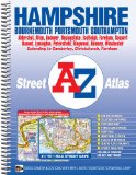
Hampshire County Atlas (A-Z County Atlas)
Price: £9.06
Publication: 27 Jun 2012 [Spiral-Bound]
Price: £9.06
Publication: 27 Jun 2012 [Spiral-Bound]
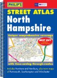
Philip's Street Atlas North Hampshire (Philip's Street Atlases)
A brand new edition of this successful colour atlas of North Hampshire, giving the only comprehensive, detailed coverage of the region. No other atlas shows every street in North Hampshire.The mapping is prepared by the Ordnance Survey and gives the user complete coverage of all urban and rural areas. The mapping is at a standard scale of 3 inches to 1 mile (2 inches to 1 mile in the pocket edition) and is complete with postcode boundaries.The atlas is ideally suited for both business and leisure use. There is a route-planning map at the front of the atlas. The main maps show every named road, street and lane clearly with through-routes highlighted. School locations are marked and emergency services, hospitals, police stations, car parks and rail and bus station locations are all featured. There is a comprehensive index of street names and postcodes including schools, industrial estates, hospitals, sports centres, etc. These are highlighted in red in the hardback and spiral atlases.Main map scale: 3 inches to 1 mile.
Price: £9.99
Publication: 3 Jan 2006
Hampshire books: Travel Guides
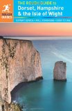
The Rough Guide to Dorset, Hampshire & the Isle of Wight
The Rough Guide to Dorset, Hampshire & the Isle of Wight is the ultimate travel guide to these beautiful and diverse regions of southern England. With detailed coverage of all the top attractions, you'll discover the hidden gems of the New Forest and South Downs National Parks, and find the best beaches on the Isle of Wight and along the stunning south coast, which includes the famous Jurassic Coast. The guide features practical advice on what to see and do, with up-to-date reviews of the best hotels, bars, clubs, shops and restaurants for all budgets.
The Rough Guide to Dorset, Hampshire & the Isle of Wight also includes detailed walks and cycling routes, historical information and the lowdown on the best places to sample local food and drink. Explore every corner of the regions with easy-to-use colour maps to help make sure you don't miss the unmissable.
Price: £9.09
Publication: 17 Jan 2013
Hampshire books: Walking and Tours
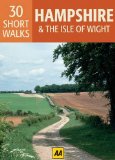
30 Short Walks in Hampshire (Aa 30 Short Walks Boxed Cards)
Handy pocket-sized box of 30 short walking routes in Hampshire & the Isle of Wight. Contained within the box are 30 cards each with a short walking route, so you can easily take it with you on the walk for reference. All of the walks featured are between 1 and 4 miles long meaning they can be tackled in a morning or afternoon. Key panels give details on distance, gradient, difficulty, surface and other practical advice.
Price: £5.24
Publication: 1 Aug 2011 [Cards]
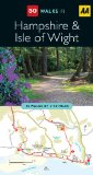
Hampshire & The Isle of Wight (AA 50 Walks Series)
Walking is one of Britain's favourite leisure activities, and this guide features a variety of mapped walks to suit all abilities. The book features all the practical detail you need, accompanied by fascinating background reading on the history and wildlife of Hampshire and the Isle of Wight, as well as other local points of interest. All walks are annotated with places to visit along the way, including tea rooms and pubs, with extra details on their character and the food on offer. Every walk is given a summary of distance, time, gradient, level of difficulty, type of surface and access, landscape, dog friendliness, parking and public toilets.
Price: £6.99
Publication: 28 Feb 2009 [Paperback]
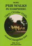
More Pub Walks in Hampshire
Price: £4.95
Publication: 1 Oct 2009 [Paperback]
Price: £4.95
Publication: 1 Oct 2009 [Paperback]
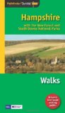
Pathfinder Hampshire: with the New Forest and South Downs National Parks (Pathfinder Guides)
This selection offers interest, regional variety and balance of routes in Hampshire providing the best walks in the area. From an easy stroll through Bishop's Dyke to the much more challenging walks in the East Meion and the Downs this volume contains something for everyone. Covering walks through the whole of Hampshire both popular and little known scenic routes including Highland Water, Standing Hat and Brockenhurst.
Price: £8.39
Publication: 31 Jan 2011 [Paperback]
Pocket Pub Walks Hampshire
This is a collection of fifteen circular walks around Hampshire each based on a local pub serving good food. It includes routes at Wherwell, Silchester, Meonstoke, Keyhaven and Frogham. It is illustrated with maps and photographs.
Price: £4.99
Publication: 6 April 2006 [Paperback]
This is a collection of fifteen circular walks around Hampshire each based on a local pub serving good food. It includes routes at Wherwell, Silchester, Meonstoke, Keyhaven and Frogham. It is illustrated with maps and photographs.
Price: £4.99
Publication: 6 April 2006 [Paperback]
Pub Walks in Hampshire and the I.O.W.
Price: £4.95
Publication: June 1999 [Paperback]
Price: £4.95
Publication: June 1999 [Paperback]
Hampshire books: Food & Drink
Ambling Through Hampshire, Basingstoke and Beyond: 30 Circular Walks Around Hampshire Inns and Teashops
By Malcolm Parker. 104 pages.
Price: £6.95
Publication: Paperback - 1 Mar 2005
By Malcolm Parker. 104 pages.
Price: £6.95
Publication: Paperback - 1 Mar 2005
The Hampshire
books listed on this page are for your information and to help you find the books you need quickly. We do not endorse any particular books and are not responsible for the advice and information in the books listed.
The price of books, where indicated, was correct at the time the book was added to this page. Prices may have changed on the booksellers web site.