- UK Information
- UK Guidebooks and Maps
- UK Books for counties
- East Sussex books and maps
East Sussex books and maps
Here is a list of books for East Sussex that you may find useful.East Sussex books: Maps
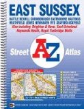
East Sussex Street Atlas (A-Z Street Atlas)
This A-Z map of East Sussex is a full colour, spiral bound street atlas featuring complete countywide coverage in one volume. There are 159 pages of continuous street mapping which includes coverage of:
Battle
Bexhill
Crowborough
Eastbourne
Hastings
Heathfield
Lewes
Newhaven
Rye
Seaford
Uckfield
Brighton & Hove
East Grinstead
Haywards Heath
Royal Tunbridge Wells
In addition, there are large scale city/town centre maps of Brighton, Eastbourne and Rye and a postcode map of the atlas area.
Postcode districts, one-way streets, safety camera locations with their maximum speed and the South Downs National Park boundary are featured on the mapping.
The index section lists streets, selected flats, walkways and places of interest, place, area and station names. There is a separate list of hospitals and hospices covered by this atlas.
Price: £7.66
Publication: 13 July 2011
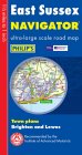
Philip's Navigator Road Map East Sussex
A brand new sheet map featuring Philip's exceptionally large-scale and detailed Navigator(R) mapping and covering the whole of East Sussex. The map is part of Philip's new series of Navigator sheet maps, each covering a county, unitary authority, or group of authorities.The map contains highly detailed coverage at 1 1/2 miles to 1 inch of the region's road network, including minor country lanes and rural tracks - and even major footpaths - and every junction, roundabout and slip-road is shown in detail.There is much other detail, including thousands of individually named farms, houses and hamlets. Also shown are airports, airfields, stations, ferries, canals, marinas and an abundance of places of interest.The map has a comprehensive index and includes indexed town plans of Brighton and Lewes.The maps are designed for both professional and leisure users. For professionals, the wealth of detail makes activities such as regional planning and delivery driving far easier. Also, the map is printed on one side only (including the index) so that it can be used as a wall map. For leisure, the wealth of detail greatly eases the navigation of both main roads and byways, and increases the pleasure of touring by opening up new possibilities.Main map scale: 1.5 miles to 1 inch.
Price: £3.99
Publication: August 26, 2003
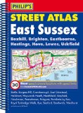
Philip's Street Atlas East Sussex
Philip's Street Atlas East Sussex gives comprehensive and detailed coverage of the county. The route planner shows all the A and B roads, and can be used when driving to get close to the destination before turning to the relevant large-scale street map. The street maps show every named road, street and lane very clearly, with major roads picked out in colour. The maps are at a standard scale of 3.5 inches to 1 mile, and show postcode boundaries. Other information on the maps includes car parks, railway and bus stations, post offices, schools, colleges, hospitals, police and fire stations, places of worship, leisure centres, footpaths and bridleways, camping and caravan sites, golf courses, and many other places of interest. Also included in this edition are fixed single and multiple speed-camera locations, with corresponding speed limits. The comprehensive index lists street names and postcodes, plus schools, hospitals, railway stations, shopping centres and other such features picked out in red, with other places of interest shown in blue.
Price: £8.99
Publication: 1 Aug 2012 [Spiral-Bound]
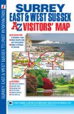
Surrey, East & West Sussex Visitors Map (A-Z Visitors Map)
This full colour foldout visitors' map of Surrey, East Sussex & West Sussex features road mapping that covers an area extending to:
The south coast from Portsmouth to Hastings
Ashford (Kent) and Faversham to the east
Reading, central London, Gravesend and Sheerness to the north
Fareham and Basingstoke to the west.
Map detail is shown at a clear 2.5 miles to 1 inch scale (1.6 kms to 1 cm) and includes the following features:
Motorways, service areas, primary routes and destinations, A & B roads, tolls, mileages, gradients 1:5 and steeper and county boundaries.
Full major road junction detail.
Selected safety camera locations with their maximum speed limits and fuel stations.
Selected places of interest, tourist information centres, caravan and camping sites and golf courses.
Areas of Outstanding Natural Beauty and the boundary to the UK's newest National Park, the South Downs National Park, are also shown.
There are 2 separate index panels adjacent to the mapping:
An index to cities, towns, villages, hamlets and locations
A comprehensive places of interest index with the corresponding map symbol shown alongside each entry for easy identification.
Price: £4.13
Publication: 4 May 2011 [Folded Map, Illustrated] [Map]
East Sussex books: Walking and Tours
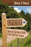
Finding My Place: Seven Long Distance Walks in Kent and East
Finding My Place is more than just a guide book to Kent and parts of East Sussex; it is also a companion guide to the places visited on seven marathon walks. It is a celebration of the geography, geology and landscape, the flora and fauna, the history, people and places of this part of southern England.
A 'Kentish Man', the author writes passionately about the area, including his own experiences from childhood, rediscovering the land as he walks, with references to poetry, music, art and literature. This book relates the author's experiences of walking throughout Kent and parts of East Sussex, from the London suburbs to the North Kent and Channel coasts, accompanied by painful feet and many a pint in local pubs on the way.
Spread throughout the book are 85 illustrative plates to supplement the narrative: including route maps, in-depth historical information, points of interest and notable landmarks, countryside regulations and descriptive wildlife profiles, and a selection of the author's own 'place' poems. The text is also accompanied by a generous sprinkling of illustrations depicting some of the author's encounters.
This is a special, different kind of walking book, not only in terms of its scope and detail, but also because of the hundreds of miles walked by the author in 'finding his place'.
Price: £12.99
Publication: 27 Jan 2012
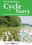
Kent & East Sussex Cycle Tours: On and Off-road Routes Taking Less Than a Day
"Kent and East Sussex" is one of 10 titles in the updated "Cycle Tours" series. The series has now been in continuous print for more than 15 years and with regular route revisions and updating the successful formula has gathered a large following. Each book in the series contains 20 routes all of which are either totally new or have been re-ridden and updated. There are 15 lane rides of between 26 and 36 miles taking you along low-traffic or traffic free roads, tracks and paths. These visit the towns and villages of Kent's Garden of England, the Sussex Weald and Romney Marsh with suggested short cuts for shorter rides, and suggested links to other nearby rides for a full day out. The 5 off-road rides of between 11 and 17 miles explore the North and South Downs. A unique feature of the "Cycle Tours" series is the superb Ordnance Survey 1:50,000 Landranger mapping showing the routes of the rides. The mapping not only gives the detail and clarity you need to follow the route with ease and safety, but allows you to plan short-cuts and detours, to look out for new places of interest, and to become truly involved in the landscape you are cycling through. Clear directions are given alongside the mapping and elevation profiles make planning the pacing of each ride an easy task. Extra information includes an introduction to the area of the route, nearest railway stations, places of interest with descriptions, guides to refreshment stops, and clear indications of distance, grade and terrain. The books are practically designed with a spiral-binding to make route-following as simple as possible.
Price: £9.09
Publication: 1 Jun 2010
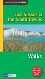
Pathfinder East Sussex & the South Downs Walks
The Pathfinder Guide to East Sussex & the South Downs Walks contains 28 fantastic circular walks across the county, much of which lies inside the new South Downs National Park. Each walk in Pathfinder Guide to East Sussex & the South Downs Walks is accompanied by clear, large-scale Ordnance Survey route maps and GPS waypoints to help you navigate your hike with ease.
Price: £8.39
Publication: 29 Nov 2010
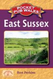
Pocket Pub Walks East Sussex (Pocket Pub Walks)
This is a pocket-size collection of fifteen circular walks each based on a local pub serving good food. It includes routes at Rodmell, Coleman's Hatch, Old Heathfield, Cowbeech and Seddlescombe, with maps and photographs.
Price: £5.39
Publication: 12 April 2007
This is a pocket-size collection of fifteen circular walks each based on a local pub serving good food. It includes routes at Rodmell, Coleman's Hatch, Old Heathfield, Cowbeech and Seddlescombe, with maps and photographs.
Price: £5.39
Publication: 12 April 2007
The East Sussex
books listed on this page are for your information and to help you find the books you need quickly. We do not endorse any particular books and are not responsible for the advice and information in the books listed.
The price of books, where indicated, was correct at the time the book was added to this page. Prices may have changed on the booksellers web site.