- UK Information
- UK Guidebooks and Maps
- Wigan books and maps
Wigan books and maps
Here is a list of books for Wigan that you may find useful.If you plan to travel to Wigan you may be interested in some guide books and travel books that will help you plan your stay in Wigan and to find your way around. Click on any book for more information or to buy.
Wigan books: Maps
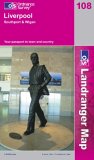
Liverpool, Southport and Wigan (Landranger Maps)
This map is part of the Landranger (Pink) series and is designed for people who really want to get to know an area. It includes the following information: tourist information, camping and caravan sites, picnic areas and viewpoints, selected places of interest and rights of way information for England and Wales. Each map in the series covers an area of 40 km by 40 km (25 miles by 25 miles) and like other Ordnance Survey maps, National Grid squares are provided so that any feature can be given a unique reference number. Perfect for planning ahead and local excursions, these maps are full of useful information that will help you really get to know an area.
Price: £5.24
Publication: October 22, 2003
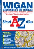
Wigan Street Atlas (A-Z Street Atlas)
This map of Wigan, Ashton-in-Makerfield, Leigh and Skelmersdale features 61 pages of coloured street mapping in an Atlas which extends to include:
Standish
Aspull
Westhoughton
Atherton
Little Hulton
Boothstown
Golborne
Newton-Le-Willows (part)
Blackbrook
Chadwick Green
Rainford (inset)
Also included is a large scale town centre map of Wigan.
Postcode districts, one-way streets and safety camera locations with their maximum speed limit are featured on the mapping.
The index section lists streets, selected flats, walkways and places of interest, place, area and station names, hospitals and hospices covered by this atlas.
Price: £5.16
Publication: 24 Aug 2011 [Illustrated] [Paperback]
Wigan books: History & Heritage

The Making of Wigan
The Making of Wigan summarises the evolution, and highlights the significant changes, in one of Lancashire's most important town's, from Roman origins through to modern times. Tribute is paid to the resilience and determination of Wiganer's in time of adversity, particularly during the English Civil War and when dealing with the Trauma of two World Wars.The town's prosperity and economy expanded during much of the nineteenth century, helped by coal and cotton, but also saw mixed fortunes, as Wigan experienced poverty and unemployment alongside the decline of its traditional industries. In more recent years Wigan has been transformed into a modern urban centre, but remains proud of its history.The book details the developments of the towns transport systems, local collieries with working conditions, strikes, accidents and mining developments all included. Also covered is the history of Wigan's cotton history and the many changes to the town centre buildings and the leisure and recreation activities available to locals. Wigan's involvement in the English Civil War and in both World Wars is covered along with Jacobite Rebellions.
Price: £10.99
Publication: April 30, 2005 [Paperback]
Wigan: History & Guide (Archive Photographs: Images of England S.)
Wigan is one of the oldest chartered boroughs in the north of England, and has a rich and proud heritage. The Town played a significant role in the Civil War, and over the years has been a place known for its highly skilled watchmakers and clockmakers. Despite a history which dates back to pre-Roman times, very little evidence of the early town survived the wholesale reconstruction and expansion which came with the Industrial Revolution and turnded wigan into the centre of both the Lancashire coalfield and the Lancashire cotton industry. Today, the town is a lively mixture of old and new, with Wigan Pier becoming one of the country's most successful tourist attractions, as well as one of the most inspired examples of the industrial restoration. The book includes two walking tours of the town which can be used independently of the main text and enable readers to explore the history of Wigan through the streets, buildings and monuments that can still be found there today.
Price: £13.37
Publication: 15 Aug 2008 [Illustrated] [Paperback]
Wigan books: Walking and Tours
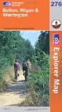
Bolton, Wigan and Warrington (Explorer Maps) (OS Explorer Map)
OS Explorer Map is the Ordnance Survey's most detailed map and is recommended for anyone enjoying outdoor activities like walking, horse riding and off-road cycling. Providing complete GB coverage the series details essential information such as youth hostels, pubs and visitor information as well as rights of way, permissive paths and bridleways.
Price: £5.75
Publication: 30 April 2007
The Wigan books listed on this page are for your information and to help you find the books you need quickly. We do not endorse any particular books and are not responsible for the advice and information in the books listed.
The price of books, where indicated, was correct at the time the book was added to this page. Prices may have changed on the booksellers web site.