- UK Information
- UK Guidebooks and Maps
- Swindon books and maps
Swindon books and maps
Here is a list of books for Swindon that you may find useful.If you plan to travel to Swindon you may be interested in some guide books and travel books that will help you plan your stay in Swindon and to find your way around. Click on any book for more information or to buy.
Swindon books: Maps
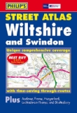
Philip's Street Atlas Wiltshire and Swindon: Pocket Edition
This pocket-sized street atlas of Wiltshire and Swindon gives comprehensive and detailed coverage of the area. The route planner shows all the A and B roads, and can be used when driving to get close to the destination before turning to the relevant large-scale street map.The street maps show every named road, street and lane very clearly, with major roads picked out in colour. The maps are at a scale of 2 2/3 inches to 1 mile, with less densely populated areas at a scale of 1 1/3 inches to 1 mile. Town maps of Andover and Frome are also included. Other information on the maps includes postcode boundaries, car parks, railway and bus stations, post offices, schools, colleges, hospitals, police and fire stations, places of worship, leisure centres, footpaths and bridleways, camping and caravan sites, golf courses, and many other places of interest.The comprehensive index lists street names and postcodes, plus schools, hospitals, railway stations, shopping centres and other such features picked out in red, with other places of interest shown in blue.
Price: £5.99
Publication: 16 May 2011 [Paperback]

Philip's Street Atlas Wiltshire and Swindon: Spiral Edition
This full-colour street atlas of Wiltshire and Swindon gives comprehensive and detailed coverage of the area. The route planner shows all the A and B roads, and can be used when driving to get close to the destination before turning to the relevant large-scale street map.The street maps show every named road, street and lane very clearly, with major roads picked out in colour. The maps are at a scale of 3.5 inches to 1 mile, with less densely populated areas at a scale of 1.75 inches to 1 mile. Town maps of Andover and Frome are also included. Other information on the maps includes postcode boundaries, car parks, railway and bus stations, post offices, schools, colleges, hospitals, police and fire stations, places of worship, leisure centres, footpaths and bridleways, camping and caravan sites, golf courses, and many other places of interest.The comprehensive index lists street names and postcodes, plus schools, hospitals, railway stations, shopping centres and other such features picked out in red, with other places of interest shown in blue.
Price: £9.99
Publication: 13 Jun 2011 [Spiral-Bound]
Swindon books: Travel Guides
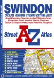
Swindon Street Atlas (A-Z Street Maps & Atlases)
This atlas of Swindon contains 34 pages of coloured street mapping that extends to:
Cricklade, Broad Blunston, Stanton Fitzwarren, Highworth, Watchfield, Shrivenham, South Marston, Wanborough, Liddington, Chiseldon, Wroughton, Blagrove, Wooton Bassett, Lydiard Millicent and Purton (inset).
There is separate coverage of Lyneham
Also included is a large scale town centre map of Swindon.
Postcode districts, one-way streets and safety camera locations with their maximum speed limit are featured on the street mapping.
The index section lists streets, selected flats, walkways and places of interest, place, area and station names, hospitals and hospices covered by this atlas.
Price: £3.38
Publication: 5 Aug 2009 [Illustrated] [Paperback]
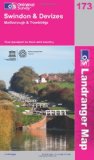
Swindon, Devizes, Malborough and Trowbridge (OS Landranger Map)
Perfect for day trips and short breaks, the OS Landranger Map series covers Great Britain with 204 detailed maps. Each map provides all the information you need to get to know your local area and includes places of interest, tourist information, picnic areas and camp sites, plus Rights of Way information for England and Wales.
Price: £5.24
Publication: 4 Nov 2009
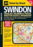
Swindon: Midi (AA Street by Street)
"Street by Street Swindon Midi" has been fully updated with a stylish new cover design, in a handy glovebox size. Quick to navigate and easy-to-use, the maps clearly show AA recommended restaurants, pubs, hotels, one-way streets and car parks. Featuring a clever use of colour to ensure they can be read under street lighting, and National Grid referencing, the "Street by Street Swindon Midi" map is all you need to keep you on the move.
Price: £3.87
Publication: 31 Mar 2008
The Swindon books listed on this page are for your information and to help you find the books you need quickly. We do not endorse any particular books and are not responsible for the advice and information in the books listed.
The price of books, where indicated, was correct at the time the book was added to this page. Prices may have changed on the booksellers web site.