- UK Information
- UK Guidebooks and Maps
- Rugeley books and maps
Rugeley books and maps
Here is a list of books for Rugeley that you may find useful.If you plan to travel to Rugeley you may be interested in some guide books and travel books that will help you plan your stay in Rugeley and to find your way around. Click on any book for more information or to buy.
Rugeley books: Travel Guides
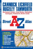
Cannock Street Atlas (A-Z Street Atlas)
This A-Z street map of Cannock, Lichfield, Rugeley and Tamworth features 29 pages of coloured street mapping in an Atlas to include:
Huntington
Hednesford
Burntwood
Chasetown
Norton Canes
Great Wyrley
Amington
Polesworth (part)
Stoneydelph
Belgrave
Wilnecote
Fazeley
Postcode districts, one-way streets and safety camera locations with their maximum speed are featured on the mapping.
The index section lists streets, selected flats, walkways and places of interest, place, area and station names, hospitals and hospices covered by this atlas.
Price: £4.36
Publication: 15 April 2011
The Rugeley books listed on this page are for your information and to help you find the books you need quickly. We do not endorse any particular books and are not responsible for the advice and information in the books listed.
The price of books, where indicated, was correct at the time the book was added to this page. Prices may have changed on the booksellers web site.