- UK Information
- UK Guidebooks and Maps
- Poole books and maps
Poole books and maps
Here is a list of books for Poole that you may find useful.If you plan to travel to Poole you may be interested in some guide books and travel books that will help you plan your stay in Poole and to find your way around. Click on any book for more information or to buy.
Poole books: Maps
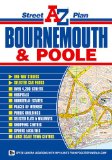
Bournemouth & Poole Street Plan (Street Atlas)
This full colour fold-out street plan of Bournemouth and Poole has a coverage that extends to:
Merley
Bournemouth Airport
Fairmile
Christchurch
Southbourne
Sandbanks
Brownsea Island
Hamworthy
Turlin Moor and Rockley Sands (inset map)
Corfe Mullen (part)
Also there are large scale town centre maps of Bournemouth and Poole.
Postcode districts, one-way streets and safety camera locations with their maximum speed limit are featured on the mapping.
The index is printed on the reverse side of the map and lists streets, selected flats, walkways and places of interest, place, area and station names, hospitals and hospices featured on the mapping.
Price: £3.75
Publication: 6 Feb 2010


Purbeck and South Dorset, Poole, Dorchester, Weymouth & Swanage: Showing part of the South West Coast Path (OS Explorer Map)
OS Explorer Map is the Ordnance Survey's most detailed map and is recommended for anyone enjoying outdoor activities like walking, horse riding and off-road cycling. Providing complete GB coverage the series details essential information such as youth hostels, pubs and visitor information as well as rights of way, permissive paths and bridleways.
Price: £5.99
Publication: 11 Jun 2012


Poole books: General Interest
South West Coast Path: Exmouth to Poole: National Trail Guide
The South West Coast Path is the spectacular 630-mile (1008-km) National Trail around the tip of Britain. This volume features the section of the Path from Exmouth to Poole, a distance of 116 miles (186 km) along the Jurassic Coast, a designated World Heritage Site.
Following Natural England's acorn waymarks, the route wends its way along the cliffs, past The Cobb at Lyme Regis and the impressive sweep of the Chesil Beach to Lulworth Cove and Studland Bay.
This complete, official guide for the long-distance walker or the weekend stroller has been fully revised and updated for 2013. It has also been completely re-designed, and features many more colour photographs and much more backgrpound information on local history and wildlife. It is less a guidebook than a complete companion for anyone visiting this part of the landscape.
National Trail Guides are the official guidebooks to the fifteen National Trails in England and Wales and are published in association with Natural England, the official body charged with developing and maintaining the Trails.
Price: £8.96
Publication: 2 May 2013


The Poole books listed on this page are for your information and to help you find the books you need quickly. We do not endorse any particular books and are not responsible for the advice and information in the books listed.
The price of books, where indicated, was correct at the time the book was added to this page. Prices may have changed on the booksellers web site.


