- UK Information
- UK Guidebooks and Maps
- Middlesbrough books and maps
Middlesbrough books and maps
Here is a list of books for Middlesbrough that you may find useful.If you plan to travel to Middlesbrough you may be interested in some guide books and travel books that will help you plan your stay in Middlesbrough and to find your way around. Click on any book for more information or to buy.
Middlesbrough books: Maps
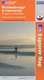
Middlesbrough and Hartlepool, Stockton-on-Tees and Redcar (Explorer Maps) (OS Explorer Map)
OS Explorer Map is the Ordnance Survey's most detailed map and is recommended for anyone enjoying outdoor activities like walking, horse riding and off-road cycling. Providing complete GB coverage the series details essential information such as youth hostels, pubs and visitor information as well as rights of way, permissive paths and bridleways.
Price: £5.75
Publication: (11 Jun 2007)
![Middlesbrough Street Atlas (paperback) (A-Z Street Atlas) [Illustrated]](/images/books/1843487624.jpg)
Middlesbrough Street Atlas (paperback) (A-Z Street Atlas) [Illustrated]
This atlas of Middlesbrough, Stockton-on-Tees, Billingham, Hartlepool, Guisborough and Redcar features 166 pages of coloured street mapping that extends to:
Hart Station
Seaton Carew
Marske-by-the-Sea
Saltburn-by-the-Sea
Brotton
Skinningrove
Staithes
Moorsholm
Great Ayton
Stokesley
Kirklevington
Durham Tees Valley Airport
Long Newton
Stillington (inset)
Wynyard Village
Elwick
There is also separate coverage of Sedgefield.
Postcode districts, one-way streets, safety camera locations with their maximum speed and the North York Moors National Park boundary are featured on the mapping.
Also included is a double-page postcode map of the atlas area.
The index section lists streets, selected flats, walkways and places of interest, place, area and station names. There is a separate list of hospitals and hospices covered by this atlas.
Price: £4.40
Publication: 29 Mar 2011

Middlesbrough, Darlington and Hartlepool (Landranger Maps) (OS Landranger Map)
Perfect for day trips and short breaks, the OS Landranger Map series covers Great Britain with 204 detailed maps. Each map provides all the information you need to get to know your local area and includes places of interest, tourist information, picnic areas and camp sites, plus Rights of Way information for England and Wales.
Price: £6.40
Publication: November 4, 2004
The Middlesbrough books listed on this page are for your information and to help you find the books you need quickly. We do not endorse any particular books and are not responsible for the advice and information in the books listed.
The price of books, where indicated, was correct at the time the book was added to this page. Prices may have changed on the booksellers web site.