- UK Information
- UK Guidebooks and Maps
- Maidenhead books and maps
Maidenhead books and maps
Here is a list of books for Maidenhead that you may find useful.If you plan to travel to Maidenhead you may be interested in some guide books and travel books that will help you plan your stay in Maidenhead and to find your way around. Click on any book for more information or to buy.
Maidenhead books: Maps
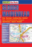
Philip's Red Books Slough and Maidenhead (Local Street Atlases)
This local street atlas of Slough and Maidenhead, and their surrounding towns and villages, gives detailed coverage of the area at a scale of 4.5 inches to 1 mile.The maps show hospitals, car parks, post offices, leisure facilities, schools, industrial areas and retail areas, while the index lists street names and postcodes. An area road map enables the user to identify through-routes more easily.Pocket sized, and wire stitched so that it opens out flat, the atlas is ideally suited for both business and leisure use, whether by locals or visitors.
Price: £3.99
Publication: 1 Sep 2008
Maidenhead books: Travel Guides
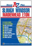
Slough, Windsor & Maidenhead Street Plan (A-Z Street Plan)
This A-Z map of Slough, Windsor, Maidenhead and Eton is a full colour, single sided, foldout street plan covering an area extending to:
Furze Platt
Maidenhead Court
Burnham
Stoke Poges (part)
Iver Heath
Iver (part)
Poyle
Old Windsor
Dedworth
Holyport
Cox Green
Highway
This map is shown at a clear 3⅓ inches to 1 mile (5.26 cm to 1 km) and features postcode districts, one-way streets and safety camera locations with their maximum speed.
Also included, in a panel below the map, is the index to streets, selected flats, walkways and places of interest, junction, area, place and station names, hospitals and hospices covered by this map.
Price: £3.50
Publication: 15 July 2011
Maidenhead books: History & Heritage

Maidenhead Voices
This volume is a collection of reminiscences by local people accompanied by 100 archive photographs.
Price: £11.21
Publication: July 2004
This volume is a collection of reminiscences by local people accompanied by 100 archive photographs.
Price: £11.21
Publication: July 2004
The Maidenhead books listed on this page are for your information and to help you find the books you need quickly. We do not endorse any particular books and are not responsible for the advice and information in the books listed.
The price of books, where indicated, was correct at the time the book was added to this page. Prices may have changed on the booksellers web site.