- UK Information
- UK Guidebooks and Maps
- Loughborough books and maps
Loughborough books and maps
Here is a list of books for Loughborough that you may find useful.If you plan to travel to Loughborough you may be interested in some guide books and travel books that will help you plan your stay in Loughborough and to find your way around. Click on any book for more information or to buy.
Loughborough books: Maps
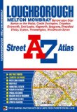
Loughborough Street Atlas (A-Z Street Atlas)
This atlas of Loughborough contains 38 pages of coloured street mapping.
The Loughborough coverage extends to include:
Castle Donington, East Midlands Airport, Kegworth, Hathern, Barrow upon Soar, Quorndon, Seagrave, Sileby, Rearsby, East Goscote, Queniborough, Syston, Cropston, Woodhouse Eaves, Shepshed, Long Whatton and Diseworth (inset).
There is separate coverage of Melton Mowbray, East Leake and Bourton on the Wolds.
Postcode districts, one-way streets and safety camera locations with their maximum speed limit are featured on the mapping.
The index section of the atlas lists streets, selected flats, walkways and places of interest, railway stations, hospitals and hospices covered by this atlas.
Price: £4.36
Publication: 9 Feb 2010

Loughborough, Melton Mowbray and Syston (Explorer Maps)
OS Explorer Map is the Ordnance Survey's most detailed map and is recommended for anyone enjoying outdoor activities like walking, horse riding and off-road cycling. Providing complete GB coverage the series details essential information such as youth hostels, pubs and visitor information as well as rights of way, permissive paths and bridleways.
Price: £5.99
Publication: October 17, 2005
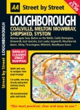
Loughborough: Midi (AA Street by Street): Midi (AA Street by Street)
"Street by Street Loughborough Midi" has been fully updated, in a handy glovebox size. Quick to navigate and easy-to-use, the maps clearly show AA recommended restaurants, pubs, hotels, one-way streets and car parks. Featuring a clever use of colour to ensure it can be read under street lighting, and National Grid referencing, "Street by Street Loughborough Midi" is all you need to keep you on the move.
Price: £3.43
Publication: 31 Aug 2008
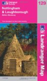
Nottingham and Loughborough, Melton Mowbray (OS Landranger Map)
Perfect for day trips and short breaks, the OS Landranger Map series covers Great Britain with 204 detailed maps. Each map provides all the information you need to get to know your local area and includes places of interest, tourist information, picnic areas and camp sites, plus Rights of Way information for England and Wales.
Price: £5.24
Publication: 25 May 2009
The Loughborough books listed on this page are for your information and to help you find the books you need quickly. We do not endorse any particular books and are not responsible for the advice and information in the books listed.
The price of books, where indicated, was correct at the time the book was added to this page. Prices may have changed on the booksellers web site.