- UK Information
- UK Guidebooks and Maps
- Lancaster books and maps
Lancaster books and maps
Here is a list of books for Lancaster that you may find useful.If you plan to travel to Lancaster you may be interested in some guide books and travel books that will help you plan your stay in Lancaster and to find your way around. Click on any book for more information or to buy.
Lancaster books: Maps
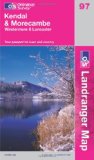
Kendal, Morecambe, Windermere & Lancaster (OS Landranger Map)
Perfect for day trips and short breaks, the OS Landranger Map series covers Great Britain with 204 detailed maps. Each map provides all the information you need to get to know your local area and includes places of interest, tourist information, picnic areas and camp sites, plus Rights of Way information for England and Wales.
Price: £5.24
Publication: 28 Nov 2011
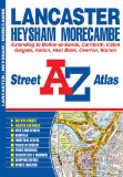
Lancaster Street Atlas (London Street Atlases)
44 pages
20.8 x 14.4 x 1 cm
Price: £3.99
Publication: 22 Jan 2012
44 pages
20.8 x 14.4 x 1 cm
Price: £3.99
Publication: 22 Jan 2012

Lancaster, Morecambe and Fleetwood (Explorer Maps) (OS Explorer Map)
OS Explorer Map is the Ordnance Survey's most detailed map and is recommended for anyone enjoying outdoor activities like walking, horse riding and off-road cycling. Providing complete GB coverage the series details essential information such as youth hostels, pubs and visitor information as well as rights of way, permissive paths and bridleways.
Price: £5.99
Publication: September 8, 2004
Lancaster books: Travel Guides
Lancaster Canal
Tourist map of the Lancaster Canal including the River Ribble, Ribble Link and connection into the Leeds and Liverpool Canal via the River Douglas. Featuring the canal corridor at 1:60,000 showing boat user facilities with details of boatyards, boat hire and boat trip operators. Illustrated guide to the canal features of interest.
Side One
Canal coverage from Lancaster to the present day terminus at Tewitfield and the 15 mile unrestored section to the original terminus in Kendal. Detailed plans of Carnforth and Kendal at 1:15,000. Introduction to the history of the canal.
Side Two
Coverage from the junction of the River Douglas with the Rufford Branch of the Leeds and Liverpool Canal at Tarleton to Lancaster and including the Glasson Branch. Detailed plans of Garstang, Glasson and Lancaster at 1:15,000 showing streets, shopping areas and waterway facilities and places of interest. Diagrammatic section from Tarleton to Kendal.
Price: £4.90
Publication: March 1, 2005
Lancaster books: History & Heritage
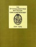
1/4th (Hallamshire) Battalion, York and Lancaster Regiment 1914 - 1919
The history of a TF battalion in the 49th (West Riding) Division which arrived in France in April 1915 and fought with that division on the Western Front to the end of the war.
Price: £23.63
Publication: May 2005
The history of a TF battalion in the 49th (West Riding) Division which arrived in France in April 1915 and fought with that division on the Western Front to the end of the war.
Price: £23.63
Publication: May 2005
Lancaster and the Lune Valley (Archive Photographs: Images of England S.)
This book is part of the Images of England series, which uses old photographs and archived images to show the history of various local areas in England, through their streets, shops, pubs, and people.
Publication: May 30, 2003
This book is part of the Images of England series, which uses old photographs and archived images to show the history of various local areas in England, through their streets, shops, pubs, and people.
Publication: May 30, 2003
Portrait of Lancaster
Lancaster, the ancient county town of Lancashire, is often known as the City of Spires. Founded by the Romans who built their fort on the River Lune, it developed during the Middle Ages around the Norman castle and later as a port which was closely involved with the slave trade. The Castle, later a crown court and prison where the infamous Pendle witches were tried and executed, is still the centre piece of the town which has a wealth of churches, giving it its common sobriquet. The Georgian custom house on St George's Quay is now the fascinating Maritime Museum, which tells the shameful story of the town's slave trading, while the Ashton Memorial, a landmark from the M6 motorway, stands at the green heart of Williamson Park. Award-winning photographer and writer Jon Sparks was born in Cheshire but has lived in Lancaster since the age of 11 and knows the town well. His is an intimate and affectionate portrait of his home town, through over 140 superb colour images. Jon Sparks has published Lancaster and Lake District calendars, greeting cards and postcards for ten years and supplied the words and pictures for Lake District Moods, published by Halsgrove in 2003 and the winner of the photographic book award in the Outdoor Writers' Guild Awards for Excellence in 2004.
Price: £12.99
Publication: May 31, 2005
The Lancaster books listed on this page are for your information and to help you find the books you need quickly. We do not endorse any particular books and are not responsible for the advice and information in the books listed.
The price of books, where indicated, was correct at the time the book was added to this page. Prices may have changed on the booksellers web site.