- UK Information
- UK Guidebooks and Maps
- Inverness books and maps
Inverness books and maps
Here is a list of books for Inverness that you may find useful.If you plan to travel to Inverness you may be interested in some guide books and travel books that will help you plan your stay in Inverness and to find your way around. Click on any book for more information or to buy.
Inverness books: Maps
Inverness and Loch Ness, Strathglass (OS Landranger Map)
Perfect for day trips and short breaks, the OS Landranger Map series covers Great Britain with 204 detailed maps. Each map provides all the information you need to get to know your local area and includes places of interest, tourist information, picnic areas and camp sites, plus Rights of Way information for England and Wales.
Price: £5.24
Publication: 24 Mar 2008


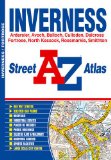
Inverness Street Atlas (A-Z Street Atlas)
This atlas contains 17 pages of coloured street mapping that extends from central Inverness to include coverage of:
North Kessock
South Kessock
Smithton
Culloden
Ballock
Milton of Leys
Lochardil
There is separate coverage of:
Ardersier
Dalcross (Inverness Airport)
Rosemarkie with Fortrose and Avoch
A large scale city centre map of Inverness is also included.
Postcode districts and one-way streets are featured on the mapping.
The index section lists streets, selected flats, walkways and places of interest, place and area names, hospitals and hospices covered by this atlas.
Price: £3.95
Publication: 10 Jan 2010


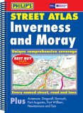
Philip's Street Atlas Inverness and Moray
New, and the only detailed colour atlas of Inverness and Moray that gives comprehensive coverage of the region. No other atlas shows every street in Inverness and Moray. The mapping is based on Ordnance Survey data and gives the user complete coverage of all urban and rural areas. The mapping is at a scale of 1 3/4 inches to 1 mile (1 1/3 inches to 1 mile in the pocket edition) with larger scale mapping of 3 1/2 inches to 1 mile (2 2/3 inches to 1 mile in the pocket edition) for the following towns Alness, Aviemore, Buckie, Charlestown of Aberlour, Dingwall, Dufftown, Elgin, Fochabers, Forres, Fort Augustus, Grantown on Spey, Invergordon, Inverness, Keith, Kingussie, Lossiemouth, Muir of Ord, Nairn, Newtonmore, Tain. The atlas is ideally suited for both business and leisure use. There is a route-planning map at the front of the atlas. The main maps show every named road, street and lane clearly with through-routes highlighted in urban areas. School locations are marked and emergency services, hospitals, police stations, car parks and rail and bus station locations are all featured. There is a comprehensive index of street names and postcodes including schools, industrial estates, hospitals, sports centres, etc. These are highlighted in red.
Price: £6.89
Publication: October 18, 2004


Inverness books: Walking and Tours
Pathfinder Inverness, Loch Ness & the North East Highlands (Pathfinder Guide) [Paperback]
The area covered by this guide centres on the Highland 'capital' of Inverness, and extends north and east along the shores of the Moray Firth, and south and west to Fort Augustus and Glen Affric, encompassing Caithness, eastern Sutherland, Easter Ross, the Black Isle, Moray and the banks of Loch Ness. With coastal walks including a route through classic Caithness scenery at Noss Head. Inland, ascents to Ben Rinnes and Ben Wyvis provide panoramic views of the surrounding area and opportunities to see rare alpine flora, and a route via Loch Affric reveals some of Scotland's most magnificent scenery.
Price: £8.27
Publication: 1 Oct 2008
![Pathfinder Inverness, Loch Ness & the North East Highlands (Pathfinder Guide) [Paperback]](/images/books/buy.gif)
![Pathfinder Inverness, Loch Ness & the North East Highlands (Pathfinder Guide) [Paperback]](/images/books/buy-us.gif)
Inverness books: General Interest
The Inverness books listed on this page are for your information and to help you find the books you need quickly. We do not endorse any particular books and are not responsible for the advice and information in the books listed.
The price of books, where indicated, was correct at the time the book was added to this page. Prices may have changed on the booksellers web site.


![Pathfinder Inverness, Loch Ness & the North East Highlands (Pathfinder Guide) [Paperback]](/images/books/0711750025.jpg)
