- UK Information
- UK Guidebooks and Maps
- Dronfield books and maps
Dronfield books and maps
Here is a list of books for Dronfield that you may find useful.If you plan to travel to Dronfield you may be interested in some guide books and travel books that will help you plan your stay in Dronfield and to find your way around. Click on any book for more information or to buy.
Dronfield books: Maps
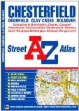
A-Z Chesterfield Atlas (Street Atlas)
This atlas of Chesterfield, Dronfield, Clay Cross and Bolsover contains 38 pages of coloured street mapping that extends to:
Dronfield Woodhouse
Holmesdale
New Whittington
Staveley
Renishaw (inset)
Barlborough
Clowne
Whitwell
Creswell
Holmewood
North Wingfield
Holymoorside
Common Side
Postcode districts, one-way streets and safety camera locations with their maximum speed are featured on the mapping.
The index section lists streets, selected flats, walkways and places of interest, place, area and station names, hospitals and hospices covered by this atlas.
Price: £4.89
Publication: 3 Jan 2011
The Dronfield books listed on this page are for your information and to help you find the books you need quickly. We do not endorse any particular books and are not responsible for the advice and information in the books listed.
The price of books, where indicated, was correct at the time the book was added to this page. Prices may have changed on the booksellers web site.