- UK Information
- UK Guidebooks and Maps
- Birmingham books and maps
Birmingham books and maps
Here is a list of books for Birmingham that you may find useful.If you plan to travel to Birmingham you may be interested in some guide books and travel books that will help you plan your stay in Birmingham and to find your way around. Click on any book for more information or to buy.
Birmingham books: Maps
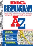
Big Birmingham Street Atlas (A-Z Street Atlas)
Price: £7.66
Publication: 9 July 2012 [Spiral-Bound]


Price: £7.66
Publication: 9 July 2012 [Spiral-Bound]
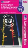
Birmingham & Wolverhampton (OS Landranger Map Active)
Tough, durable and weatherproof, this title features maps that are covered in a lightweight protective plastic coating that can be written on, so that your favourite routes can be easily highlighted.
Price: £8.70
Publication: 16 April 2012
Tough, durable and weatherproof, this title features maps that are covered in a lightweight protective plastic coating that can be written on, so that your favourite routes can be easily highlighted.
Price: £8.70
Publication: 16 April 2012
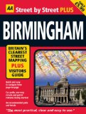
Birmingham (AA Street by Street Plus) (AA Street by Street Plus)
The brand new "Street by Street Plus Birmingham" features all the advantages of the renowned "AA Street by Street" titles, with the added benefit of a comprehensive listings section to help you decide what to do and where to be entertained. The series covers some of our most popular cities, and includes themes as diverse as bars, clubs, comedy, music, dance, art, film, theatre, galleries and museums. Quick to navigate and conveniently sized to carry with you around the city, the easy-to-read large scale map includes car parks and one-way streets, public toilets, pubs, hotels, petrol stations and public buildings, as well as an index of all streets and places of interest. Fully revised and updated, "Street by Street Plus Birmingham" is all you need to keep you on the move in Birmingham.
Price: £4.79
Publication: 1 July 2008

Birmingham and Wolverhampton (OS Landranger Map)
Perfect for day trips and short breaks, the OS Landranger Map series covers Great Britain with 204 detailed maps. Each map provides all the information you need to get to know your local area and includes places of interest, tourist information, picnic areas and camp sites, plus Rights of Way information for England and Wales.
Price: £5.24
Publication: 9 Sep 2009

Birmingham Premier Map
This single-sided, foldout, coloured street map extends from central Birmingham to:
Wednesbury (part), Great Barr, Walmley, Coleshill (part), The National Exhibition Centre, Birmingham International Airport, Solihull (part), Yardley Wood (part), Quinton (part), Smethwick and West Bromwich.
Also included is a large scale city centre map of Birmingham.
Postcode districts, one-way streets and safety camera locations with their maximum speed limit are featured on the mapping.
Attached to the cover is a booklet that contains the index to streets, selected flats, walkways and places of interest, junction, place and area names, National Rail and Midland Metro stations. Also included is a separate listing of hospitals and hospices covered by this map.
A postcode map of Birmingham is also available directly from Geoplan. Their Postcode Sector City maps show postcode sectors (for example HG3 1) on top of our detailed A-Z base mapping.
Price: £4.99
Publication: 10 Jan 2009

Birmingham, Walsall, Solihull and Redditch (OS Explorer Map)
OS Explorer Map is the Ordnance Survey's most detailed map and is recommended for anyone enjoying outdoor activities like walking, horse riding and off-road cycling. Providing complete GB coverage the series details essential information such as youth hostels, pubs and visitor information as well as rights of way, permissive paths and bridleways.
Price: £5.99
Publication: 4 Aug 2008

Birmingham: Mini (AA Street by Street)
"Street by Street Birmingham Mini" has been fully updated with a stylish new cover design, in a handy pocket size. Quick to navigate and easy-to-use, the maps clearly show AA recommended restaurants, pubs, hotels, one-way streets and car parks. Featuring a clever use of colour to ensure they can be read under street lighting, the "Street by Street Birmingham Mini" map is all you need to keep you on the move.
Price: £3.43
Publication: [Paperback] 31 Jan 2008

Central Birmingham Map (AA Street by Street)
Central Birmingham's clearest mapping in a handy, easy-to-use street map. Quick to navigate and conveniently sized to carry with you around the city, this easy-to-read large scale map includes NCP car parks and one-way streets, public toilets, pubs, hotels, petrol stations and public buildings, as well as an index of all streets and places of interest. Fully revised and updated, the "Central Birmingham Map" is all you need to keep you on the move in central Birmingham.
Price: £2.91
Publication: 31 Jan 2008
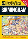
Pocket Map Birmingham (AA Street by Street)
Birmingham's clearest mapping in a handy, pocket-sized format. Quick to navigate and conveniently sized to carry with you around the city, the easy-to-read large scale map includes NCP car parks and one-way streets, public toilets, pubs, hotels, petrol stations and public buildings, as well as an index of all streets and places of interest. Fully revised and updated, "Pocket Map Birmingham" is all you need to keep you on the move in Birmingham.
Price: £1.50
Publication: 31 Jan 2008

Worcester and Birmingham Canal with the Droitwich Canals (Inland Waterways of Britain) [
Tourist map at 1:60,000 of the Worcester and Birmingham Canal connecting the centre of Birmingham to the River Severn at Worcester. Includes the Droitwich Barge and Droitwich Junction Canals, currently under restoration. Shows facilities available to the boat user with details of boatyards, boat hire and boat trip operators.
Detailed plans of Birmingham, Alvechurch, Worcester and Droitwich Spa at 1:15,000 showing streets, shopping areas, waterway facilities and places of interest. Introduction to the history and a diagrammatic section along the waterway.
Price: £4.50
Publication: 1 July 2009
Birmingham books: Travel Guides
![Birmingham & the Heart of England (Collins/Nicholson Waterways Guides, Book 3) [Spiral-Bound]](/images/books/0007452586.jpg)
Birmingham & the Heart of England (Collins/Nicholson Waterways Guides, Book 3) [Spiral-Bound]
Popular guide covering the canals and waterways around Birmingham and central England. Colour Ordnance Survey� maps clearly show locks, towpaths and boating facilities. There are also comprehensive navigational notes as well as descriptions of the towns and villages, pubs and restaurants alongside the waterways.
In print for over 30 years, the Collins/Nicholson guides to the waterways have always been a vital part of journeys along Britain's canals and rivers. They are designed for anyone and everyone with an interest in Britain's inland waterways - from experienced boaters to those planning their first boat trip, as well as walkers, cyclists and visitors.
The Ordnance Survey � Maps have added information showing:
� Locks, bridges, tunnels, aqueducts, winding holes and towpaths.
� Waterpoints, sanitary stations, pump out facilities and refuse disposal.
� Boatyards, pubs, restaurants and local shops.
� Mile markers and milestones (distance in miles and number of locks to strategic points along the waterways).
Price: £9.59
Publication: 1 Mar 2012
Birmingham books: History & Heritage
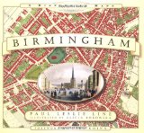
Birmingham: A History in Maps
From the exceptional town plans and maps contained within this unique volume emerges a social picture of Birmingham; a town quickly developing in size and population in the eighteenth century; along with the changes brought about by urbanisation. Land was bought up for development; hundreds of 'courts' were built to home the industrial workers pouring in from the many outlying villages. The many gardens, orchards and wide expanses of open space detailed on Wesley's 1731 plan of Birmingham were soon to be transformed into a sprawling mass of habitation. By 1765 Matthew Boulton, a leading entrepreneur and pioneer of the Industrial Revolution, had built his famous Soho Manufactory on Handsworth Heath. Shortly afterwards, the town plans of Birmingham in the first quarter of the 1800s chart the arrival of the railway; a plan from 1832 is the last glimpse of the city before the arrival of the Grand Junction Railway and other main line stations. Accompanied with informative text and pictures of the cityscape, the many detailed plans contained in this historic atlas of Birmingham are a gateway to its past, allowing the reader and researcher to visually observe the journey of this historic town to city status in 1889 and beyond.
Price: £10.87
Publication: 1 Nov 2011

Birmingham: Pevsner Architectural Guides (Pevsner City Guide S.)
A detailed, authoritative and easy-to-use guide to the architectural wealth of England's second city, the 'workshop of the world'. Its major buildings include the splendid English Baroque cathedral, the pioneering Neo-Roman town hall, and the mighty and still controversial Central Library of the 1970s. Streets of rich and varied Victorian and Edwardian architecture bear witness to the era when Birmingham's civic initiatives were the admiration of the country. Birmingham and Leeds are the latest volumes in the acclaimed Pevsner City Guide series. Illustrated in colour throughout, including many specially-taken photographs, historical images, and numerous maps, they are both essential works of reference and indispensable visitors' companions.
Price: £11.25
Publication: May 2005
The Birmingham books listed on this page are for your information and to help you find the books you need quickly. We do not endorse any particular books and are not responsible for the advice and information in the books listed.
The price of books, where indicated, was correct at the time the book was added to this page. Prices may have changed on the booksellers web site.