- UK Information
- UK Guidebooks and Maps
- Bedford books and maps
Bedford books and maps
Here is a list of books for Bedford that you may find useful.If you plan to travel to Bedford you may be interested in some guide books and travel books that will help you plan your stay in Bedford and to find your way around. Click on any book for more information or to buy.
Bedford books: Maps
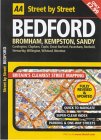
AA Street by Street Bedford MIDI Local (AA Street by Street S.)
This series of street maps aim to provide clear, legible mapping with easily identifiable landmarks and a large index. They incorporate current digital data from Ordnance Survey. Each atlas in the range contains: a clear road hierarchy with a clever use of colour for easy navigation; prominent landmarks and detail for motorists; clearly marked one-way streets; easily identifiable symbols; a distance measure on each page; easy-to-read street names in clear type; clear district names and area postcodes; and an index with coloured letter headers for quick reference.
Price: £3.50
Publication: November 1, 2003
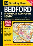
AA Street by Street Bedford: Midi local
This new edition in the AA's groundbreaking series of "Street by Street" titles, covering Aberdeen, is fully revised and updated for 2007. Presented in a handy glovebox size, the maps clearly show recommended restaurants, pubs, hotels, one-way streets and car parks. Featuring a clever use of colour to ensure it can be read under street lighting, this essential street atlas is all you need to keep you on the move.
Price: £3.99
Publication: 31 Jan 2007

Bedford and St.Neots, Sandy and Biggleswade (OS Explorer Map)
OS Explorer Map is the Ordnance Survey's most detailed map and is recommended for anyone enjoying outdoor activities like walking, horse riding and off-road cycling. Providing complete GB coverage the series details essential information such as youth hostels, pubs and visitor information as well as rights of way, permissive paths and bridleways.
Price: £5.99
Publication: 2 Mar 2009
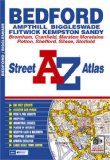
Bedford Street Atlas (A-Z Street Atlas)
This atlas of Bedford, Ampthill, Biggleswade, Flitwick, Kempston and Sandy contains 49 pages of coloured street mapping.
Price: £3.71
Publication: 26 Aug 2008
This atlas of Bedford, Ampthill, Biggleswade, Flitwick, Kempston and Sandy contains 49 pages of coloured street mapping.
Price: £3.71
Publication: 26 Aug 2008
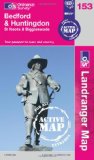
Bedford, Huntingdon, St. Neots & Biggleswade (OS Landranger Map Active)
Tough, durable and weatherproof, this title features maps that are covered in a lightweight protective plastic coating that can be written on, so that your favourite routes can be easily highlighted.
Price: £11.59
Publication: 16 April 2012
Tough, durable and weatherproof, this title features maps that are covered in a lightweight protective plastic coating that can be written on, so that your favourite routes can be easily highlighted.
Price: £11.59
Publication: 16 April 2012
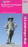
Bedford, Huntingdon, St. Neots and Biggleswade (OS Landranger Map)
Perfect for day trips and short breaks, the OS Landranger Map series covers Great Britain with 204 detailed maps. Each map provides all the information you need to get to know your local area and includes places of interest, tourist information, picnic areas and camp sites, plus Rights of Way information for England and Wales.
Price: £5.24
Publication: 16 Nov 2009
Bedford books: Travel Guides

Bedford Street Plan and Guide
Price: £2.20
Publication: February 2005
Price: £2.20
Publication: February 2005
Bedford to Wellingborough: Including Hitchin, Northampton & Higham Ferrers
The Hitchin-Bedford route formed part of the Midland Railway's first line for London trains. Its subsequent secondary nature is fully illustrated, along with the lesser lines to Northampton Castle and Higham Ferrers.
Price: £16.76
Publication: June 2004
The Hitchin-Bedford route formed part of the Midland Railway's first line for London trains. Its subsequent secondary nature is fully illustrated, along with the lesser lines to Northampton Castle and Higham Ferrers.
Price: £16.76
Publication: June 2004
Bedford: Bromham / Ampthill / Flitwick
Map: 1 pages
Product Dimensions: 21 x 12.6 x 0.4 cm
Price: £2.75
Publication: May 1, 2003
Map: 1 pages
Product Dimensions: 21 x 12.6 x 0.4 cm
Price: £2.75
Publication: May 1, 2003
The Bedford books listed on this page are for your information and to help you find the books you need quickly. We do not endorse any particular books and are not responsible for the advice and information in the books listed.
The price of books, where indicated, was correct at the time the book was added to this page. Prices may have changed on the booksellers web site.