- UK Information
- UK Guidebooks and Maps
- UK Books for counties
- Tyne and Wear books and maps
Tyne and Wear books and maps
Here is a list of books for Tyne and Wear that you may find useful.Tyne and Wear books: Maps
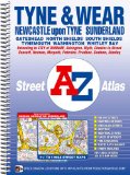
A-Z Tyne & Wear Street Atlas
This spiral bound street atlas of Tyne and Wear features 180 pages of continuous street mapping covering:
Newcastle-upon-Tyne, Sunderland, Durham, Gateshead, North Shields, South Shields and Tynemouth.
The coverage extends to:
Mitford, Morpeth, Ashington, Newbiggin-by-the-Sea, Blyth, Seaton Sluice, Whitley Bay, Tynemouth, South Shields, Whitburn, Roker, Sunderland, Ryhope, Seaham, Peterlee, Hesleden, Wingate, Bowburn, Brandon, Esh Winning, Lanchester, Castleside, Consett, Ebchester, Riding Mill, Hexham, Acomb, Corbridge, Heddon-on-the-Wall, Darras Hall, Ponteland, Dinnington, Brunswick Village, Hartford Bridge, Hepscott and Tranwell.
Also included are large scale city centre maps of Newcastle-upon-Tyne, Sunderland and Durham.
Postcode districts, one-way streets and safety camera locations with their maximum speed limit are featured on the street mapping.
The index section of the atlas lists streets, selected flats, walkways and places of interest, place and area names, National Rail and Tyne & Wear Metro Stations. There is a separate list of hospitals and hospices covered by the atlas.
A Tyne & Wear Metro and Rail Connections map is featured on the inside back cover.
Price: £11.95
Publication: 27 Sep 2010
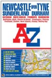
Newcastle Upon Tyne Street Atlas (A-Z Street Atlas)
This A-Z map of Newcastle upon Tyne is a full colour, paperback street atlas featuring 154 pages of continuous street mapping that covers:
Bedlington
Blyth
Darras Hall
Whitley Bay
Tynemouth
South Shields
Ryton
Gateshead
Washington
Sunderland
Stanley
Chester-le-Street (part)
Seaham
Durham
In addition, there is separate coverage of Peterlee, Easington and Horden and large scale city centre maps of Newcastle upon Tyne, Sunderland and Durham.
Postcode districts, one-way streets and safety camera locations with their maximum speed limit are featured on the street mapping.
The index section of the atlas lists streets, selected flats, walkways and places of interest, place and area names, National Rail and Tyne & Wear Metro Stations. There is a separate list of hospitals and hospices covered by the atlas.
Featured on the back cover is a Tyne & Wear Metro and Rail Connections map.
Price: £4.99
Publication: 20 Sep 2011
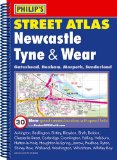
Philip's Street Atlas Newcastle Tyne and Wear
This fully revised street atlas of Newcastle and Tyne & Wear gives comprehensive and detailed coverage of the area. The route planner shows all the A and B roads, and can be used when driving to get close to the destination before turning to the relevant large-scale street map.The street maps show every named road, street and lane very clearly, with major roads picked out in colour. The maps are at a standard scale of 3 1/2 inches to 1 mile, with Newcastle and Sunderland shown at 7 inches to 1 mile.Other information on the maps includes postcode boundaries, car parks, railway and bus stations, post offices, schools, colleges, hospitals, police and fire stations, places of worship, leisure centres, footpaths and bridleways, camping and caravan sites, golf courses, and many other places of interest. New to this edition are fixed single and multiple speed-camera locations, with corresponding speed limits.The comprehensive index lists street names and postcodes, plus schools, hospitals, railway stations, shopping centres and other such features picked out in red, with other places of interest shown in blue.
Price: £10.48
Publication: 3 Aug 2009
Tyne and Wear books: Walking and Tours
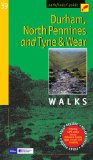
Pathfinder Durham, North Pennines, Tyne & Wear: Walks (Pathfinder Guide)
This walking guide covers both the Cumbrian and Durham sides of the North Pennines, a designated Area of Outstanding Beauty, and also extends eastwards across Durham to the North Sea Coast. The area contains some of the finest moorland in the country, explored here in walks across Bowes Moor and the grouse moors near Holwick, but there are also plenty of relaxing, low-level walks beside rivers, through woodlands and forests, by the coast, and along former railway tracks. Durham Castle and Cathedral, Brough Castle, High Force the mightiest of England's waterfalls, and Causey Arch, the world's earliest railway bridge, are featured.
Price: £9.59
Publication: 1 May 2008 [Paperback]
The Tyne and Wear
books listed on this page are for your information and to help you find the books you need quickly. We do not endorse any particular books and are not responsible for the advice and information in the books listed.
The price of books, where indicated, was correct at the time the book was added to this page. Prices may have changed on the booksellers web site.