- UK Information
- UK Guidebooks and Maps
- UK Books for counties
- North Yorkshire books and maps
North Yorkshire books and maps
Here is a list of books for North Yorkshire that you may find useful.- North Yorkshire books:Maps
- North Yorkshire books:Travel Guides
- North Yorkshire books:Walking and Tours
North Yorkshire books: Maps
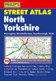
Philip's Street Atlas North Yorkshire
This fully revised pocket-sized street atlas of North Yorkshire gives comprehensive and detailed coverage of the area. The route planner shows all the A and B roads, and can be used when driving to get close to the destination before turning to the relevant large-scale street map.The street maps show every named road, street and lane very clearly, with major roads picked out in colour. The maps are at a scale of 1 1/3 inches to 1 mile, with larger scale maps at a scale of 2 2/3 inches to 1 mile for the following towns: Harrogate, Ilkley, Knaresborough, Malton, Richmond, Ripon, Scarborough, Selby, Skipton, Spofforth, Thirsk, Whitby and York. York city centre is also shown at 5 1/3 inches to 1 mile.Other information on the maps includes postcode boundaries, car parks, railway and bus stations, post offices, schools, colleges, hospitals, police and fire stations, places of worship, leisure centres, footpaths and bridleways, camping and caravan sites, golf courses, and many other places of interest. New to this edition are fixed single and multiple speed-camera locations, with corresponding speed limits.The comprehensive index lists street names and postcodes, plus schools, hospitals, railway stations, shopping centres and other such features picked out in red, with other places of interest shown in blue.
Price: £5.24
Publication: 6 July 2009
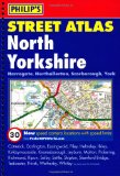
Philip's Street Atlas North Yorkshire: Spiral Edition
This fully revised street atlas of North Yorkshire gives comprehensive and detailed coverage of the area. The route planner shows all the A and B roads, and can be used when driving to get close to the destination before turning to the relevant large-scale street map.The street maps show every named road, street and lane very clearly, with major roads picked out in colour. The maps are at a scale of 1 3/4 inches to 1 mile, with larger scale maps at a scale of 3 1/2 inches to 1 mile for the following towns: Harrogate, Ilkley, Knaresborough, Malton, Richmond, Ripon, Scarborough, Selby, Skipton, Spofforth, Thirsk, Whitby and York. York city centre is also shown at 7 inches to 1 mile.Other information on the maps includes postcode boundaries, car parks, railway and bus stations, post offices, schools, colleges, hospitals, police and fire stations, places of worship, leisure centres, footpaths and bridleways, camping and caravan sites, golf courses, and many other places of interest. New to this edition are fixed single and multiple speed-camera locations, with corresponding speed limits.The comprehensive index lists street names and postcodes, plus schools, hospitals, railway stations, shopping centres and other such features picked out in red, with other places of interest shown in blue.
Price: £8.39
Publication: 6 July 2009 [Spiral-Bound]
North Yorkshire books: Travel Guides
The North Yorkshire Moors (Salmon Guide)
Price: £2.75
Publication: July 16, 2003 [Paperback]
Price: £2.75
Publication: July 16, 2003 [Paperback]
North Yorkshire books: Walking and Tours
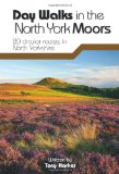
Day Walks in the North York Moors: 20 Circular Routes in North Yorkshire
"Day Walks in the North York Moors" is the sixth title in Vertebrate Publishing's series of compact and portable hill walking guidebooks. This book showcases 20 circular routes, between 6 and 14 miles (9km and 22km) in length, suitable for hill walkers of all abilities. The routes are split into three areas - The Cleveland Hills, Central Moors and Coastal Walks - and include walks to the most historic and beautiful areas of the Moors, including Lord Stones, Wainstones and Clay Bank, Rievaulx Abbey, Blakey Ridge and Farndale, the Hole of Horcum, and the stunning coastline at Robin Hood's Bay and Ravenscar. The author of this guidebook, Tony Harker, is a Moors local and keen hill walker. This is Tony's second book with Vertebrate Publishing, following the successful and popular "North York Moors Mountain Biking". Each route in this guide is described with easy-to-follow directions and details of distance, navigation information, refreshment stops and is plotted on clear and easy to use Ordnance Survey 1:25,000 mapping. Also included is a detailed Appendix. Vertebrate Publishing is dedicated to producing the very best outdoor leisure titles. We have award-winning and bestselling titles covering a range of activities, including; mountain biking, cycling, rock climbing, hill walking and others. We are best known for our own titles such as "Lake District Mountain Biking", "Dark Peak Mountain Biking" and "Revelations", the award-winning autobiography of rock climber Jerry Moffatt.
Price: £9.07
Publication: 12 Sep 2011

Historic Walks in North Yorkshire: A Collection of 20 Scenic Walks (Cicerone British Walking)
A guide to historic walks in North Yorkshire in 20, mostly circular, routes, Historic Walks in North Yorkshire attempts to reveal some of the splendours of this land of the ?broad acres'. Accompanied by OS mapping and illustrated with colour photographs, the series of walks combine landscape with architecture, natural beauty with history, and our heritage with our diverse and complex culture. When we approach these historic sites on foot, a greater appreciation of their being, purpose and geographical setting is gained, along with the satisfaction of reaching a place under our own steam, watching its contours and outline unfold, as well as sharing an experience common to the ancient and ancestral people who once developed, built and inhabited them. The routes have both a scenic and historical appeal, taking you from open moorland and exposed sections of hillside and cliff to the more sheltered dales and the streets of York.
Price: £12.95
Publication: 1 July 2003 [Paperback]
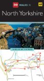
North Yorkshire (AA 50 Walks Series)
Walking is one of Britain's favourite leisure activities, and this great pocket-sized walking guide to North Yorkshire features a variety of mapped walks to suit all abilities. Contained within the guide are 50 walks of 2-10 miles and all the practical detail you need, accompanied by fascinating background reading on the history and wildlife of the area, and an introduction to each walk. All walks are annotated with local points of interest and places to stop for refreshments. And every walk is given a summary of distance, time, gradient, level of difficulty, type of surface and access, landscape, dog friendliness, parking and public toilets.
Price: £6.99
Publication: 1 Aug 2009
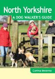
North Yorkshire a Dog Walker's Guide
North Yorkshire is an ideal place to walk with a dog. On offer are ancient paths, heather-clad moors,picturesque dales, woodland, beaches and pretty villages. There are also plenty of opportunities for off-the-lead romps, paddles and swims. In addition there is the chance to visit the gounds of Castle Howard, the North York Moors preserved railway, the White Horse at Sutton Royal Park and the beach at Whitby. The 20 dog-friendly circular walks in this book vary in length from 2 to 7 and three quarter miles. All the walk descriptions include details of how to get to the start, the type of terrain to be encountered, numbered route directions, points of interest along the way, recommended dog-friendly refreshment stops, dog factors such as live-stock and stiles, and the telephone number of the nearest vet.
Price: £7.95
Publication: 8 April 2013
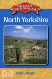
Pocket Pub Walks North Yorkshire
A collection of fifteen circular walks each based on a local pub serving good food, this title includes routes at Ravenscar, Pately Bridge, Giggleswick, Reeth, and Harrogate, with maps, and photographs.
Price: £4.99
Publication: 22 Jun 2006
A collection of fifteen circular walks each based on a local pub serving good food, this title includes routes at Ravenscar, Pately Bridge, Giggleswick, Reeth, and Harrogate, with maps, and photographs.
Price: £4.99
Publication: 22 Jun 2006
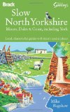
Slow North Yorkshire: Moors, Dales & Coast, including York (Bradt Travel Guides (Slow Guides))
Travel and nature writer Mike Bagshaw has lived in Yorkshire for over 25 years and in this, his unique guide to the area, he brings to life the landscapes and wildlife of the region and indulges his interests in crafts, architecture, local history, folklore and pubs. This personal guide - a book to be read as well as used - explores the nooks and crannies of this dramatic and diverse county and takes in all the well known sights as well as regional secrets, including fossil hunting, wild food foraging and the game of quoits. Hand-picked accommodation from Alastair Sawday ensures a comfortable stay, helping to get the most out of a 'slow' visit to one of Britain's most beautiful areas.
Price: £10.34
Publication: 15 May 2010
The North Yorkshire
books listed on this page are for your information and to help you find the books you need quickly. We do not endorse any particular books and are not responsible for the advice and information in the books listed.
The price of books, where indicated, was correct at the time the book was added to this page. Prices may have changed on the booksellers web site.