- UK Information
- UK Guidebooks and Maps
- UK Books for counties
- Lincolnshire books and maps
Lincolnshire books and maps
Here is a list of books for Lincolnshire that you may find useful.Lincolnshire books: Maps
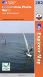
Lincolnshire Wolds North (Explorer Maps) (OS Explorer Map)
OS Explorer Map is the Ordnance Survey's most detailed map and is recommended for anyone enjoying outdoor activities like walking, horse riding and off-road cycling. Providing complete GB coverage the series details essential information such as youth hostels, pubs and visitor information as well as rights of way, permissive paths and bridleways.
Price: £5.75
Publication: 3 April 2006
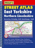
Philip's Street Atlas East Yorkshire and Northern Lincolnshire
This fully revised street atlas of East Yorkshire and Northern Lincolnshire gives comprehensive and detailed coverage of the area. The route planner shows all the A and B roads, and can be used when driving to get close to the destination before turning to the relevant large-scale street map.The street maps show every named road, street and lane very clearly, with major roads picked out in colour. The maps are at a scale of 1.75 inches to 1 mile, with larger scale maps at a scale of 3.5 inches to 1 mile for the following towns: Beverley, Bridlington, Cleethorpes, Cottingham, Driffield, Goole, Grimsby, Hornsea, Kingston upon Hull, Market Weighton, Scunthorpe, Selby and York. Beverley, Kingston upon Hull and York city centres are also shown at 7 inches to 1 mile.Other information on the maps includes postcode boundaries, car parks, railway and bus stations, post offices, schools, colleges, hospitals, police and fire stations, places of worship, leisure centres, footpaths and bridleways, camping and caravan sites, golf courses, and many other places of interest. New to this edition are fixed single and multiple speed-camera locations, with corresponding speed limits.The comprehensive index lists street names and postcodes, plus schools, hospitals, railway stations, shopping centres and other such features picked out in red, with other places of interest shown in blue.
Price: £8.39
Publication: 1 Jun 2009
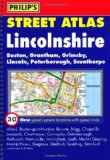
Philip's Street Atlas Lincolnshire
This full colour street atlas of Lincolnshire gives comprehensive and detailed coverage of the county. The route planner shows all the A and B roads, and can be used when driving to get close to the destination before turning to the relevant large-scale street map.The street maps show every named road, street and lane very clearly, with major roads picked out in colour. The maps are at a scale of 1.75 inches to 1 mile, with larger-scale maps at 3.5 inches to 1 mile for urban areas. Lincoln city centre is shown at 7 inches to 1 mile.Other information on the maps includes car parks, railway and bus stations, post offices, schools, colleges, hospitals, police and fire stations, places of worship, leisure centres, footpaths and bridleways, camping and caravan sites, golf courses, and many other places of interest. New to this edition are fixed single and multiple speed-camera locations, with corresponding speed limits.The comprehensive index lists street names and postcodes, plus schools, hospitals, railway stations, shopping centres and other such features picked out in red, with other places of interest shown in blue.
Price: £8.39
Publication: 1 Dec 2008
Lincolnshire books: History & Heritage
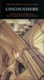
Lincolnshire (Pevsner Architectural Guides: Buildings of England)
Lincolnshire is incredibly rich in medieval churches from Saxon times onwards, many of them still little known. Lincoln Cathedral is justly famous, and second only to Durham in the grandeur of its setting. The prosperous years from the Middle Ages though to the eighteenth century have left a splendid legacy in the great town churches of Boston and Louth, in the innumerable village churches of the south of the county, the delightful manor houses (such as Tennyson's Somersby) and the Georgian town houses and coaching inns of Boston and Grantham, of Lincoln and Louth, and above all of Stamford. Monuments to industry include the vast maltings at Sleaford, the soaring dock tower of Grimsby, and an abundance of windmills.
Price: £26.25
Publication: 1 Jan 1989
Lincolnshire books: Walking and Tours
A Boot Up the Lincolnshire Wolds: 10 Leisure Walks of Discovery
The LincolnshireWolds comprise an area of approximately
216 square miles / 558 square kilometres.
In recent years the delights of its quiet, unspoilt
countryside which offer great walking opportunities
have become better known and appreciated.
TheWolds were designated as an Area of
Outstanding Natural beauty (AONB) in 1973.They
are made up of Cretaceous rocks, primarily chalk
but with some limestone in the south.These dip
towards the east, where many glacial valleys divide
the gentler slopes, but conversely create a steep
scarp slope to the west.TheWolds therefore
present an extremely attractive walking environment
that is rarely very demanding given that the highest
point is 551 feet (168 metres).The hills do however
appear higher in places for theWolds are
surrounded by the low-lying land of the coastal
marshes to the east and the "fen-like" valleys of
the RiversWitham and Ancholme to the west.
All the walks have been carefully selected to give
as wide as possible an overview of this lovely part of
Lincolnshire balanced with an attempt to explore
some of its lesser-known areas.They range in
distance from 4 to 10 miles and are ideal for
families and groups of friends.
Price: £3.74
Publication: 28 Jun 2011
![Lincolnshire Wolds South (Explorer Maps) (OS Explorer Map) [Folded Map]](/images/books/0319238210.jpg)
Lincolnshire Wolds South (Explorer Maps) (OS Explorer Map) [Folded Map]
OS Explorer Map is the Ordnance Survey's most detailed map and is recommended for anyone enjoying outdoor activities like walking, horse riding and off-road cycling. Providing complete GB coverage the series details essential information such as youth hostels, pubs and visitor information as well as rights of way, permissive paths and bridleways.
Price: £5.75
Publication: 3 April 2006
Pathfinder Lincolnshire & the Wolds: Walks (Pathfinder Guide)
The second largest county in England, Lincolnshire offers a surprising diversity of landscape - rolling wolds, coastal reaches, marshlands with endless skies and wide and impressive vistas, interspersed with historic market towns, magnificent churches and, of course, the ancient cathedral city of Lincoln. The county is largely unspoilt and offers a great opportunity for new and unique walking experiences. Outstanding features of the 28 walks in this guide include the Lincoln Edge, Boston and the River Witham, Somersby in the heart of Tennyson Country, and the River Humber. Now fully revised to include GPS data and new Ordnance Survey open access land mapping.
Price: £8.39
Publication: 1 Dec 2008
Pocket Pub Walks in Lincolnshire (Pocket Pub Walks)
A pocket size collection of fifteen circular walks each based on a local pub serving good food. With maps and photographs.
Price: £5.99
Publication: 10 April 2008
A pocket size collection of fifteen circular walks each based on a local pub serving good food. With maps and photographs.
Price: £5.99
Publication: 10 April 2008
Ramblers Short Walks in Lincolnshire and the Wolds (Collins Ramblers Short Walks)
A practical little walk guide to Lincolnshire and the Wolds endorsed by the Ramblers. All the walks are 5 miles or under in length and can easily be completed in less that 3 hours. 20 walks are included and use clear Ordnance Survey maps to show the route plus easy to follow walk descriptions.
The walks are located in the Lincolnshire Wolds, a scenic range of hills in eastern England. They are a designated Area of Outstanding Natural Beauty and the highest area of land in eastern England between Yorkshire and Kent. The hills run roughly parallel with the North Sea coast, from the Humber in the northwest to the town of Spilsby in the southeast.
This guide, produced in co-operation with the Ramblers and featuring Ordnance Survey mapping, is the perfect way to get out and enjoy the stunning scenery.
This compact little guide contains walks, all of which are 5 miles or under, which are ideal for an afternoon stroll.
INCLUDES:
• 20 easy to follow walks which can be completed in 3 hours and under.
• Each walk has a detailed Ordnance Survey map with the route clearly marked plus a detailed description of the route.
• The walks have been chosen with issues like parking and refreshments in mind to make life easy for families.
• There are interesting facts about the things you'll see along the route.
• All the books include general information on walking and also the general area covered by the guide.
• Packed with colour photographs of scenes you will see along the walk.
Price: £4.49
Publication: 3 Mar 2011
The Lincolnshire
books listed on this page are for your information and to help you find the books you need quickly. We do not endorse any particular books and are not responsible for the advice and information in the books listed.
The price of books, where indicated, was correct at the time the book was added to this page. Prices may have changed on the booksellers web site.