- UK Information
- UK Guidebooks and Maps
- UK Books for counties
- Cumbria books and maps
Cumbria books and maps
Here is a list of books for Cumbria that you may find useful.- Cumbria books:Maps
- Cumbria books:Travel Guides
- Cumbria books:History & Heritage
- Cumbria books:Walking and Tours
Cumbria books: Maps
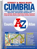
Cumbria County Atlas (A-Z County Atlas)
This County Atlas of Cumbria contains 117 pages of coloured street mapping featuring all the principal towns and villages, and 16 pages of road mapping covering the whole county.
The principal towns featured on the street mapping include:
Carlisle, Cockermouth, Barrow-in-Furness, Kendal, Keswick, Penrith, Maryport, Whitehaven and Workington.
Carlisle coverage also includes a large scale city centre map.
Other main centres of population include:
Alston, Ambleside. Appleby-in-Westmorland, Brampton, Cleator Moor, Dalton-in-Furness, Egremont, Grange-over-Sands, Kirkby Lonsdale, Millom, Ulverston, Windermere, Walney Island and many other towns and villages within the county.
Postcode districts, one-way streets and safety camera locations with their maximum speed limit are featured on the street mapping. Safety Camera locations with their maximum speed limit are also shown on the road mapping.
The index section lists streets, selected flats, walkways and places of interest, place, area and station names. Hospitals and hospices covered by this atlas are listed separately.
Price: £7.16
Publication: 20 Oct 2010
Cumbria books: Travel Guides
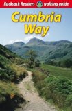
Cumbria Way (Rucksack Readers)
The Cumbria Way begins at Ulverston and heads north for 73 miles (123 km) through the unspoiled dales with stone-built farms of the Lake District, running around charming lakes and passing beneath rugged fells. Busy tourist towns and villages contrast with woodland, wild fellside, high passes and remote moorlands. The Way passes over the summit of High Pike (658 m) with panoramic views, and descends to the historic border city of Carlisle.
Price: £8.99
Publication: 21 Mar 2013
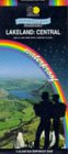
Lakeland: Central (Superwalker)
Detailed map of the Central Lake District for walking, cycling, scrambling and climbing. Ambleside to Keswick, Derwentwater on the west to Ullswater on the east. This map for hillwalkers covers Helvellyn, Striding Edge, the Fairfield Horseshoe and the Langdale Fells. As used by the Langdale/Ambleside Mountain Rescue Team.
Price: £7.95
Publication: 1 Jan 2010
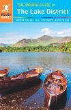
The Rough Guide to the Lake District
The Rough Guide to the Lake District, features comprehensive reviews of the finest places to stay and eat for every budget, based on personal inspection by a long-time Lakes expert. Whether you're looking for a walker's hostel or boutique hotel, café or gastro-pub, farmhouse B&B or country-house hotel, this guide has the lowdown on all the best deals. There's detailed information on the best way to get around by public transport, while special features on the great outdoors focus on local walks, classic hikes, mountain climbs, lake cruises and family adventures. Whether you're on a walking holiday or family break you can discover all the facts you need - from current opening times to festival dates. There's also background information on the history, culture, nature and wildlife of the English Lakes, and plenty of special features - from the history of rock-climbing or a rundown of music festivals to the fascinating lives of the locals.
Price: £9.09
Publication: 17 Jan 2013
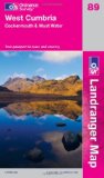
West Cumbria, Cockermouth & Wast Water (OS Landranger Map)
Perfect for day trips and short breaks, the OS Landranger Map series covers Great Britain with 204 detailed maps. Each map provides all the information you need to get to know your local area and includes places of interest, tourist information, picnic areas and camp sites, plus Rights of Way information for England and Wales.
Price: £5.24
Publication: 28 Nov 2011
Cumbria books: History & Heritage
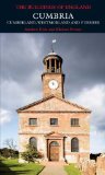
Cumbria: The Buildings of England (Pevsner Architectural Guides) (Pevsner Architectural Guides: Buildings of England)
This fully revised volume brings together the historic counties of Cumberland and Westmorland with the old Furness division of Lancashire, in a comprehensive architectural guide to one of Englands most varied and rewarding regions. At its heart is the Lake District, where the well-loved vernacular architecture is overlaid by centuries of buildings, Georgian to modern, that respond in diverse ways to the magnificent landscape. The less familiar areas outside the National Park have an equal fascination, with numerous historic towns, spectacular industrial monuments, and distinctive traditions of church-building and fortified great houses. Fine Victorian and Arts-and-Crafts architecture can be found throughout, much of it published here for the first time.
Price: £24.50
Publication: 8 Oct 2010
Cumbria books: Walking and Tours
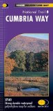
Cumbria Way XT40 (Route Map)
The HARVEY series of maps of National Trails has long been a success. Now we have applied the advanced technology used in the creation of last year s best-selling British Mountain Maps of Dark Peak, Snowdonia and Lake District to provide the XT40 version of the route maps. These maps are a leap forward in technical excellence. They are tough, durable, light, and 100% waterproof virtually indestructible in normal use. They are light to carry, and compact not the great bulky package you get with a laminated map As before, just one HARVEY map covers the whole route. The map is detailed, with the route of the National Trail clearly marked. It also contains general information and useful telephone numbers to assist with planning, and a full key. Tough and durable XT40 virtually indestructible Light, compact Entire route on one sheet Clear and easy to read Accommodation and services Great value at £11.95.
Price: £11.66
Publication: 21 Dec 2011
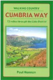
Cumbria Way: 72 Miles Through the Lake District (Walking Country)
Price: £6.99
Publication: 28 Feb 2005
Price: £6.99
Publication: 28 Feb 2005
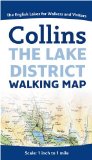
Lake District Map
Always popular with walkers and visitors to the Lake District. Features detailed layer-coloured mapping on one easy-to-use sheet. Scale 1 inch to 1 mile (1:63 360).
� Layer tints, contour lines and spot heights to give an accurate indication of the rise and fall of the ground.
� Roads, tracks, paths, youth hostels.
� Lake District National Park Visitor and Information Centres.
� Advice for walkers.
� Internet links and other sources for further information.
Price: £4.99
Publication: 2 April 2009
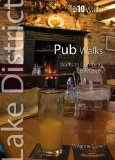
Pub Walks: Walks to Cumbria's Best Pubs (Lake District Top 10 Walks)
This attractive and cleverly structured guide gives walkers ten of the finest walks to Lakeland pubs in a popular pocketable format. With clear information, an overview and introduction for each walk, expertly written numbered directions, large scale Ordnance Survey maps, superb, eye-grabbing panoramic photographs, and interpretation of points of interest along the way, these guides set a new standard in clarity and ease-of-use.
Price: £4.99
Publication: 10 Oct 2012
The Cumbria Way: An Illustrated Walking Guide
mywalkingguide.com guidebooks are indispensable companions for all walkers, hikers and trekkers - guide to the 73 miles of the popular Cumbria Way from Ulverston to Carlisle contains 120 colour photographs and details of 136 GPS Waypoints / OS grid references. You also get access to our website to download at no additional cost A list detailing all known accommodation providers on or near the route; A booklet packed with the information you need to enable you to plan and organise your very own perfect walking holiday; An electronic waypoint file for direct upload into your GPS receiver; Updates as and when we know about changes to the route, accommodation providers etc.
Price: £12.00
Publication: 30 April 2012
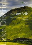
The Low Fells: Walks on Cumbria's Lower Fells (Lake District Top 10 Walks)
This is one of six books in the new "Top 10 Walks: Lake District" series. These are handy, pocket-sized, full colour walking guides written by experts, for under a fiver. It is the perfect impulse buy. Other titles in the series include: "Lakeside walks", "High Fells", "Woodland & Waterfall walks", "Pub walks", and "walks to Tarns". This attractive and cleverly structured guide gives walkers the ten finest, classic routes on the Lake District's lower fells in a popular pocketable format. With clear information, an overview and introduction for each walk, expertly written numbered directions, large scale Ordnance Survey maps, superb, eye-grabbing panoramic photographs, and interpretation of points of interest along the way, these guides set a new standard in clarity and ease-of-use. Featured low fells include: Lord's Seat, Dodd, Catbells, Castle Crag, High Rigg, Haystacks, Helm Crag, Loughrigg Fell, Wansfell and Holme Fell.
Price: £3.74
Publication: 1 April 2012
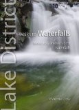
Walks to Waterfalls: Walks to Cumbria's Best Waterfalls (Lake District Top 10 Walks)
This attractive and cleverly structured guide gives walkers ten of the finest walks to Lakeland waterfalls in a popular pocketable format. With clear information, an overview and introduction for each walk, expertly written numbered directions, large scale Ordnance Survey maps, superb, eye-grabbing panoramic photographs, and interpretation of points of interest along the way, these guides set a new standard in clarity and ease-of-use. Featured waterfalls include: Lodore Falls, Aira Force, Scale Force, Stock Ghyll, Skelwith Force, Colwith Force, Stanley Ghyll Force, Tom Gill, The Howk and Holme Force.
Price: £3.74
Publication: 15 Jun 2012
The Cumbria
books listed on this page are for your information and to help you find the books you need quickly. We do not endorse any particular books and are not responsible for the advice and information in the books listed.
The price of books, where indicated, was correct at the time the book was added to this page. Prices may have changed on the booksellers web site.