- UK Information
- UK Guidebooks and Maps
- UK Books for counties
- Scottish Borders books and maps
Scottish Borders books and maps
Here is a list of books for Scottish Borders that you may find useful.Scottish Borders books: Maps
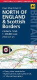
8. Northern England & Scottish Borders: AA Road Map Britain
Fully updated, this map combines clear design and an easy-to-read scale with more road detail to ensure that you never lose your way. Each map includes information on toll points, service areas, road numbers, motorways, dual carriageways and wide and narrow local roads. National Parks and places of interest are also highlighted.
Price: £3.74
Publication: 1 July 2013
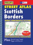
Philip's Street Atlas Scottish Borders
This street atlas of the Scottish Borders gives comprehensive and detailed coverage of the region. The route planner shows all the A and B roads, and can be used when driving to get close to the destination before turning to the relevant large-scale street map.The street maps show every named road, street and lane very clearly, with major roads picked out in colour. The maps are at a scale of 1.75 inches to 1 mile, with the more densely populated urban areas at 3.5 inches to 1 mile.Other information on the maps includes postcode boundaries, car parks, railway and bus stations, post offices, schools, colleges, hospitals, police and fire stations, places of worship, leisure centres, footpaths and bridleways, camping and caravan sites, golf courses, and many other places of interest.The comprehensive index lists street names and postcodes, plus schools, hospitals, railway stations, shopping centres and other such features picked out in red, with other places of interest shown in blue.
Price: £11.99
Publication: 18 Jan 2010
Scottish Borders books: Travel Guides
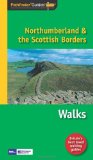
Pathfinder Northumberland & the Scottish Borders (Pathfinder Guides)
This selection offers interest, regional variety and balance of routes in Northumberland the the Scottish Borders providing the best walks in the area. From an easy stroll through Doddington Moor to the much more challenging walks in Windy Gyle this volume contains something for everyone. Covering walks through the whole of Northumberland both popular and little know scenic routes including Hadrian's Wall, Thirlwall Castle and Longhoughton.
-See walk locations by Looking Inside
Inside:
-28 great walks in Northumberland from 2 to 10 miles
-Clear, large scale Ordnance Survey route maps
-GPS reference for all Northumberland waypoints
-Where to park, good pubs and places of interest en route
-All routes have been fully researched and written by expert outdoor writers
-Beautiful photography of scenes from the walks
Pathfinder® Guides are Britain's best loved walking guides. Made with durable covers, they are the perfect companion for countryside walks throughout Britain. Each title features circular walks with easy-to-follow route descriptions, large-scale Ordnance Survey route maps and GPS waypoints. With over 70 titles in the series, they offer essential information for walkers throughout the country.
Price: £8.39
Publication: 29 Nov 2010
Scottish Borders (Foxglove Visitor Guides)
Price: £9.99
Publication: 1 July 2013
Price: £9.99
Publication: 1 July 2013
The Scottish Borders
books listed on this page are for your information and to help you find the books you need quickly. We do not endorse any particular books and are not responsible for the advice and information in the books listed.
The price of books, where indicated, was correct at the time the book was added to this page. Prices may have changed on the booksellers web site.