- UK Information
- UK Guidebooks and Maps
- Wrexham books and maps
Wrexham books and maps
Here is a list of books for Wrexham that you may find useful.If you plan to travel to Wrexham you may be interested in some guide books and travel books that will help you plan your stay in Wrexham and to find your way around. Click on any book for more information or to buy.
Wrexham books: Maps
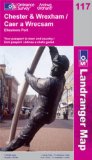
Chester and Wrexham, Ellesmere Port (OS Landranger Map)
Perfect for day trips and short breaks, the OS Landranger Map series covers Great Britain with 204 detailed maps. Each map provides all the information you need to get to know your local area and includes places of interest, tourist information, picnic areas and camp sites, plus Rights of Way information for England and Wales.
Price: £5.24
Publication: 25 May 2009
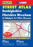
Philip's Street Atlas Denbighshire, Flintshire and Wrexham (Philip's Street Atlases)
New, and the only detailed colour atlas of Denbighshire, Flintshire and Wrexham that gives comprehensive coverage of the region.The mapping is based on Ordnance Survey data and gives the user complete coverage of all urban and rural areas. The mapping is at a scale of 1 3/4 inches to 1 mile (1 1/3 inches to 1 mile in the pocket edition) with larger scale mapping of 3 1/2 inches to 1 mile (2 2/3 inches to 1 mile in the pocket edition). Chester and Wrexham are also shown at the extra-large scale of 7 inches to 1 mile (5 1/3 inches to 1 mile in the pocket edition). The mapping is also complete with postcode boundaries.The atlas is ideally suited for both business and leisure use. There is a route-planning map at the front of the atlas. The main maps show every named road, street and lane clearly with through-routes highlighted. School locations are marked and emergency services, hospitals, police stations, car parks and rail and bus station locations are all featured. There is a comprehensive index of street names and postcodes including schools, industrial estates, hospitals, sports centres, etc. These are highlighted in red.Main map scale: 1 1/3 inches to 1 mile and 2 2/3 inches to 1 mile
Price: £6.34
Publication: March 29, 2004 [Paperback]
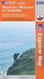
Wrexham (Explorer Maps): Showing part of Offa's Dyke Path (OS Explorer Map)
OS Explorer Map is the Ordnance Survey's most detailed map and is recommended for anyone enjoying outdoor activities like walking, horse riding and off-road cycling. Providing complete GB coverage the series details essential information such as youth hostels, pubs and visitor information as well as rights of way, permissive paths and bridleways.
Price: £5.99
Publication: 17 Oct 2005
Wrexham Street Atlas (A-Z Street Atlas)
Price: £3.71
Publication: 16 Jun 2013 [Paperback]
Price: £3.71
Publication: 16 Jun 2013 [Paperback]
Wrexham books: Travel Guides
Philip's Red Books Chester and Wrexham (Philip's Local Street Atlases)
This local street atlas of Chester and Wrexham, and their surrounding towns and villages, gives detailed coverage of the area at a scale of 4 inches to 1 mile. It also includes enlarged centre maps for Chester (at 6 inches to 1 mile) and Wrexham (at 7 inches to 1 mile).The maps show hospitals, car parks, post offices, one-way streets, leisure facilities, industrial areas and retail areas, while the index lists street names and postcodes. An area road map enables the user to identify through-routes more easily.Pocket sized, and wire stitched so that it opens out flat, the atlas is ideally suited for both business and leisure use, whether by locals or visitors.
Price: £4.25
Publication: 18 April 2008
Wrexham books: History & Heritage
The Wrexham and Ellesmere Railway
Railway History The Wrexham & Ellesmere line was opened in 1895 and was worked by the Cambrian Railways and, for a few years at least, this single track branch formed part of a tenuous cross country link between Manchester and Liverpool and the districts served by the Cambrian system. The 1922-1923 Grouping ensured that the line passed into Great Western hands and it treated the route as an ordinary country branch line, and in the 1920s and 1930s this 12 mile single track route would have been very similar to scores of other rural lines. In World War II the route carried extra traffic to and from a large ordnance factory that had been established at Marchwiel, and in post-war years the site of this factory became an industrial estate that continued to provide freight traffic for the railway. Sadly, the Wrexham & Ellesmere line did not survive the anti-railway purges of the 1960s, and its passenger services were withdrawn in 1962. Freight traffic continued to operate over the northern end of the line until the 1980s. There has not, hitherto, been a history of the line, and very few articles have been written; neither has the route received much attention from casual photographers. This present volume therefore fills a small but significant gap in the railway history of the Welsh border region.
Price: £10.95
Publication: July 19, 2004 [Illustrated] [Paperback]
The Wrexham books listed on this page are for your information and to help you find the books you need quickly. We do not endorse any particular books and are not responsible for the advice and information in the books listed.
The price of books, where indicated, was correct at the time the book was added to this page. Prices may have changed on the booksellers web site.