- UK Information
- UK Guidebooks and Maps
- Preston books and maps
Preston books and maps
Here is a list of books for Preston that you may find useful.If you plan to travel to Preston you may be interested in some guide books and travel books that will help you plan your stay in Preston and to find your way around. Click on any book for more information or to buy.
Preston books: Maps
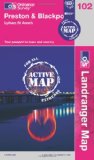
Preston & Blackpool, Lytham (OS Landranger Map Active)
Tough, durable and weatherproof, this title features maps that are covered in a lightweight protective plastic coating that can be written on, so that your favourite routes can be easily highlighted.
Price: £11.60
Publication: 16 April 2012


Tough, durable and weatherproof, this title features maps that are covered in a lightweight protective plastic coating that can be written on, so that your favourite routes can be easily highlighted.
Price: £11.60
Publication: 16 April 2012
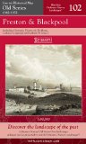
Preston and Blackpool (Cassini Old Series Historical Map)
Map: 1 pages
Product Dimensions: 21.2 x 12.8 x 1.4 cm
Price: £9.47
Publication: 6 Nov 2006
Map: 1 pages
Product Dimensions: 21.2 x 12.8 x 1.4 cm
Price: £9.47
Publication: 6 Nov 2006
![Preston Street Atlas (A-Z Street Atlas) [Illustrated]](/images/books/184348563X.jpg)
Preston Street Atlas (A-Z Street Atlas) [Illustrated]
This atlas of Preston, Chorley and Leyland contains 39 pages of coloured street mapping and covers an area extending to include:
Longridge, Grimsargh, Longton, Walmer Bridge, Hutton, Bamber Bridge, Gregson Lane, Much Hoole, Wheelton, Croston, Eccleston, Euxton, Charnock Richard, Coppull and Heath Charnock.
There is a large scale town centre map of Preston.
Postcode districts and one-way streets are featured on the mapping.
The index section list streets, selected flats, walkways and places of interest, place, area and station names, hospitals and hospices covered by this atlas.
Price: £4.95
Publication: 30 April 2008
![Preston,Blackpool, Lytham St. Anne's (Landranger Maps) (OS Landranger Map) [Folded Map]](/images/books/nopic.gif)
Preston,Blackpool, Lytham St. Anne's (Landranger Maps) (OS Landranger Map) [Folded Map]
Perfect for day trips and short breaks, the OS Landranger Map series covers Great Britain with 204 detailed maps. Each map provides all the information you need to get to know your local area and includes places of interest, tourist information, picnic areas and camp sites, plus Rights of Way information for England and Wales.
Price: £5.24
Publication: February 12, 2004
Preston books: General Interest
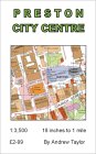
Preston City Centre Map
Price: £2.99
Publication: March 1, 2004
Price: £2.99
Publication: March 1, 2004
The Preston books listed on this page are for your information and to help you find the books you need quickly. We do not endorse any particular books and are not responsible for the advice and information in the books listed.
The price of books, where indicated, was correct at the time the book was added to this page. Prices may have changed on the booksellers web site.