- UK Information
- UK Guidebooks and Maps
- Great Yarmouth books and maps
Great Yarmouth books and maps
Here is a list of books for Great Yarmouth that you may find useful.If you plan to travel to Great Yarmouth you may be interested in some guide books and travel books that will help you plan your stay in Great Yarmouth and to find your way around. Click on any book for more information or to buy.
Great Yarmouth books: Maps
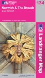
Norwich and the Broads, Great Yarmouth (OS Landranger Map)
Perfect for day trips and short breaks, the OS Landranger Map series covers Great Britain with 204 detailed maps. Each map provides all the information you need to get to know your local area and includes places of interest, tourist information, picnic areas and camp sites, plus Rights of Way information for England and Wales.
Price: £5.24
Publication: 14 Dec 2009
Great Yarmouth books: Travel Guides

Great Yarmouth and Gorleston Pubs (Images of England S)
This title provides a COLLECTION OF ARCHIVE IMAGES ACCOMPANIED BY CAPTIONS.
Price: £8.96
Publication: July 2004
This title provides a COLLECTION OF ARCHIVE IMAGES ACCOMPANIED BY CAPTIONS.
Price: £8.96
Publication: July 2004

Gt. Yarmouth / Lowestoft: Bradwell / Caister
Price: £2.75
Publication: May 1, 2003
Price: £2.75
Publication: May 1, 2003
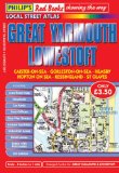
Philip's Red Books Great Yarmouth and Lowestoft (Philip's Local Street Atlases)
This local street atlas of Great Yarmouth and Lowestoft, and their surrounding towns and villages, gives detailed coverage of the area at a scale of 4 inches to 1 mile. It also includes enlarged centre maps for Great Yarmouth (at 6 inches to 1 mile) and Lowestoft (at 7 inches to 1 mile).The maps show hospitals, car parks, post offices, one-way streets, leisure facilities, industrial areas and retail areas, while the index lists street names and postcodes. An area road map enables the user to identify through-routes more easily.Pocket sized, and wire stitched so that it opens out flat, the atlas is ideally suited for both business and leisure use, whether by locals or visitors.
Price: £3.50
Publication: 13 Mar 2008
Great Yarmouth books: History & Heritage

Great Yarmouth Then & Now
Great Yarmouth Then & Now
Price: £8.96
Publication: 1 Nov 2012
Great Yarmouth Then & Now
Price: £8.96
Publication: 1 Nov 2012
The Great Yarmouth books listed on this page are for your information and to help you find the books you need quickly. We do not endorse any particular books and are not responsible for the advice and information in the books listed.
The price of books, where indicated, was correct at the time the book was added to this page. Prices may have changed on the booksellers web site.