- UK Information
- UK Guidebooks and Maps
- Dundee books and maps
Dundee books and maps
Here is a list of books for Dundee that you may find useful.If you plan to travel to Dundee you may be interested in some guide books and travel books that will help you plan your stay in Dundee and to find your way around. Click on any book for more information or to buy.
Dundee books: Maps
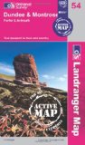
Dundee & Montrose, Forfar & Arbroath (OS Landranger Map Active)
Tough, durable and weatherproof, this title features maps that are covered in a lightweight protective plastic coating that can be written on, so that your favourite routes can be easily highlighted.
Price: £12.03
Publication: 16 April 2012


Tough, durable and weatherproof, this title features maps that are covered in a lightweight protective plastic coating that can be written on, so that your favourite routes can be easily highlighted.
Price: £12.03
Publication: 16 April 2012
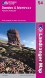
Dundee and Montrose, Forfar and Arbroath (Landranger Maps) (OS Landranger Map)
Perfect for day trips and short breaks, the OS Landranger Map series covers Great Britain with 204 detailed maps. Each map provides all the information you need to get to know your local area and includes places of interest, tourist information, picnic areas and camp sites, plus Rights of Way information for England and Wales.
Price: £6.85
Publication: 3 Sep 2007
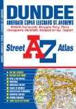
Dundee Street Atlas (A-Z Street Atlas)
Paperback: 56 pages
Product Dimensions: 21 x 14.4 x 0.6 cm
Price: £3.71
Publication: 6 Sep 2012
Paperback: 56 pages
Product Dimensions: 21 x 14.4 x 0.6 cm
Price: £3.71
Publication: 6 Sep 2012
Dundee books: Travel Guides
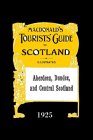
Aberdeen, Dundee and Central Scotland: Macdonald's Tourists' Guide 1925
Originally published in 1925, this guide uses the routes of the Caledonian and North British Railway companies between Glasgow, Aberdeen, and the territory of the Great North of Scotland and Highland Railways. The style is entirely practical, and remarkably informative. A particular feature is the habit of quoting the cost of buildings and structures, where known; for example, the Convict Prison in Perth, for French prisoners, cost GBP130,000 in 1812, while Dundee's Prison cost GBP26,000 in 1836. Both were soon enlarged. By the time of publication, the British railways had been brought into four groups, after the ravages of the Great War. However, what was to prove a more substantial threat to their dominance of the travel and tourist market had already arrived - chars-a-banc and motor 'buses provided the "favourite excursions".
Price: £9.65
Publication: May 5, 2004

Dundee and Sidlaw Hills (Lamfold Explorer Map)
OS Explorer Map is the Ordnance Survey's most detailed map and is recommended for anyone enjoying outdoor activities like walking, horse riding and off-road cycling. Providing complete GB coverage the series details essential information such as youth hostels, pubs and visitor information as well as rights of way, permissive paths and bridleways.
Price: £7.99
Publication: 25 May 2007

Philip's Red Books Dundee and St Andrews (Philip's Local Street Atlases)
This local street atlas of Dundee and St Andrews, and their surrounding towns and villages, gives detailed coverage of the area at a scale of 4 inches to 1 mile. It also includes an enlarged centre map for Dundee at 8 inches to 1 mile.The maps show hospitals, car parks, post offices, one-way streets, leisure facilities, industrial areas and retail areas, while the index lists street names and postcodes. An area road map enables the user to identify through-routes more easily.Pocket sized, and wire stitched so that it opens out flat, the atlas is ideally suited for both business and leisure use, whether by locals or visitors.
Price: £3.75
Publication: 28 Mar 2008
Dundee books: Walking and Tours
Angus and Dundee: 40 Coast and Country Walks
Angus is the historical heartland of Scotland, a county where the past has left an indelible mark on the present. Prehistoric forts, ancient castles and Pictish standing stones dot a rich and varied landscape where bracing coastal hikes, tranquil riverside rambles, sheltered woodland wanders and more challenging hill ascents await the walker. This book features 40 walks, combining exploration of the county's stunning coastline where rocky cliffs and coves reveal swathes of golden sand, with gentle inland trails and more adventurous forays into the celebrated Angus Glens where the terrain is altogether wilder and more dramatic.
Price: £5.59
Publication: 4 Jun 2011
The Dundee books listed on this page are for your information and to help you find the books you need quickly. We do not endorse any particular books and are not responsible for the advice and information in the books listed.
The price of books, where indicated, was correct at the time the book was added to this page. Prices may have changed on the booksellers web site.