- UK Information
- UK Guidebooks and Maps
- Burnley books and maps
Burnley books and maps
Here is a list of books for Burnley that you may find useful.If you plan to travel to Burnley you may be interested in some guide books and travel books that will help you plan your stay in Burnley and to find your way around. Click on any book for more information or to buy.
Burnley books: Maps
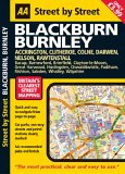
AA Street by Street Blackburn, Burnley: Midi (AA Street by Street S.)
A new edition in the AA's ground breaking series of "Street Atlases", covering Blackburn and Burnley in a handy glovebox size. With an enlarged scale for city / town centres, this really is Britain's clearest street mapping. The atlas uses the latest digital data for Britain from Ordnance Survey and the AA and also includes National Grid Referencing as used by the emergency services. All of the maps clearly show recommended restaurants, hotels, one-way streets and car parks with 24-hour petrol stations now highlighted. Featuring a clever use of colour to ensure they can be read under street lighting, these maps are all you need to keep you on the move.
Price: £3.99
Publication: December 31, 2005
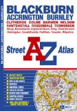
Blackburn & Burnley Street Atlas
This atlas of Blackburn, Burnley and Accrington contains 50 pages of coloured street mapping. The continuous coverage around Blackburn, Burnley and Accrington extends to include:
Barrowford, Colne, Trawden, Nelson, Whalley, Higham, Brierfield, Harle Syke, Langho, Wilpshire, Great Harwood, Clayton-le-Moors, Padiham, Rose Grove, Worsthorne, Mellor, Rishton, Oswaldtwistle, Pleasington, Baxenden, Goodshaw, Darwen, Rossendale, Rawtenshaw and Bacup.
Also included are large scale town centre maps of Blackburn and Burnley.
There is separate coverage of Todmorden, Clitheroe, Barnoldswick and Earby.
Postcode districts and one-way streets are featured on the mapping.
The index section of the atlas lists streets, selected flats, walkways and places of interest, place, area and station names, hospitals and hospices covered by the atlas.
Price: £5.33
Publication: 5 Jun 2008
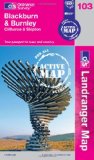
Blackburn & Burnley, Clitheroe & Skipton (OS Landranger Map Active)
Tough, durable and weatherproof, this title features maps that are covered in a lightweight protective plastic coating that can be written on, so that your favourite routes can be easily highlighted.
Price: £12.00
Publication: 16 April 2012
Tough, durable and weatherproof, this title features maps that are covered in a lightweight protective plastic coating that can be written on, so that your favourite routes can be easily highlighted.
Price: £12.00
Publication: 16 April 2012
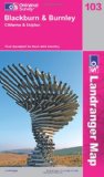
Blackburn and Burnley, Clitheroe and Skipton (OS Landranger Map)
Perfect for day trips and short breaks, the OS Landranger Map series covers Great Britain with 204 detailed maps. Each map provides all the information you need to get to know your local area and includes places of interest, tourist information, picnic areas and camp sites, plus Rights of Way information for England and Wales.
Price: £5.24
Publication: 6 April 2009
South Pennines (OS Explorer Map): Burnley, Hebden Bridge, Keighley & Todmorden. Showing the Pennine Way and the area between Yorkshire Dales and Peak District national Parks
OS Explorer Map is the Ordnance Survey's most detailed map and is recommended for anyone enjoying outdoor activities like walking, horse riding and off-road cycling. Providing complete GB coverage the series details essential information such as youth hostels, pubs and visitor information as well as rights of way, permissive paths and bridleways.
Price: £5.91
Publication: 12 May 2008
Burnley books: History & Heritage
Burnley Then & Now (Then & Now (History Press))
A history of Burnley.
Price: £8.96
Publication: 1 May 2012
A history of Burnley.
Price: £8.96
Publication: 1 May 2012
The Burnley books listed on this page are for your information and to help you find the books you need quickly. We do not endorse any particular books and are not responsible for the advice and information in the books listed.
The price of books, where indicated, was correct at the time the book was added to this page. Prices may have changed on the booksellers web site.