- UK Information
- UK Guidebooks and Maps
- UK books and maps - Maps
UK books and maps - Maps
Here is a list of books for UK that you may find useful.UK books
- UK books:Maps
- UK books:Travel Guides
- UK books:History & Heritage
- UK books:Art & Culture
- UK books:Walking and Tours
- UK books:Accommodation Guides
- UK books:Entertainment & Leisure
- UK books:Food & Drink
- UK books:General Interest
UK books: Maps

A-Z Great Britain: Handy Road Atlas
Price: £4.00
Publication: Spiral-bound (December 7, 2002)


Price: £4.00
Publication: Spiral-bound (December 7, 2002)
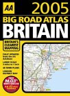
AA Big Road Atlas Britain 2005 (AA Atlases S.)
The AA's popular, large-format road atlas fully revised and updated for 2005. Each map has been created by experts at the AA to help readers navigate Britain's roads safely and easily.
Price: £7.69
Publication: Spiral-bound July 2004
The AA's popular, large-format road atlas fully revised and updated for 2005. Each map has been created by experts at the AA to help readers navigate Britain's roads safely and easily.
Price: £7.69
Publication: Spiral-bound July 2004
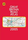
AA Great Britain Road Atlas 2005 (AA Atlases S.)
The 19th edition of this hardback road atlas with large-scale mapping has been created by experts at the AA to help readers navigate Britain's roads safely and easily.
Price: £14.00
Publication: Hardcover August 2004
The 19th edition of this hardback road atlas with large-scale mapping has been created by experts at the AA to help readers navigate Britain's roads safely and easily.
Price: £14.00
Publication: Hardcover August 2004
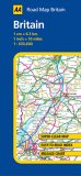
AA Road Map Britain
From the experts at the AA this series of fully updated road maps are all you need for motoring around Britain. The maps combine clear design and more road detail with an easy to read scale to ensure that you never lose your way. New to these editions is a large sheet map covering the whole of the West Country and South Wales, stretching from Bristol, Bath, Swansea and Pool to Land's End and Lizard Point. There are also fifteen town plans on the reverse of each map plus an easy to read place-name index. The maps are folded to a handy slim line format and are contained in a durable encapsulated card cover, offering great value for this price.
Price: £4.99
Publication: February 28, 2005
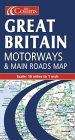
Great Britain Motorways and Main Roads Map
This revised edition features an up-to-date route planning map; large scale maps of major urban areas; UK traffic signs; and a distance chart.
Price: £3.50
Publication: October 5, 1998
This revised edition features an up-to-date route planning map; large scale maps of major urban areas; UK traffic signs; and a distance chart.
Price: £3.50
Publication: October 5, 1998
Great Britain Road Map (A-Z Road Maps & Atlases S.)
Price: £3.75
Publication: February 10, 2003
Price: £3.75
Publication: February 10, 2003
Map of Britain
9 miles to 1 inch 1:550,000 approx. Full colour map of Great Britain with road network, counties and unitary authorities clearly shown. MAIN FEATURES * Counties and unitary authorities shown in colour * Covers the whole of Britain * Fully updated for 2005 * 16 city/town centre plans * Mapping at 9 miles to 1 inch INCLUDES * Index to place names * Mileage chart * Key in English, French and German AREA OF COVERAGE Double sided map covering the whole of Britain. Northern England and Scotland on one side with Southern England and Wales on the other. WHO THE PRODUCT IS OF INTEREST TO This is a general purpose map but with a particular emphasis on political features. It can be used as a reference map and a route planning map.
Price: £4.99
Publication: September 6, 2004
Map of Britain
This is a full colour, double-sided map of the whole of Great Britain with the road network, counties and unitary authorities clearly shown. It has been fully updated for 2004. The counties and unitary authorities are shown in colour along with 16 city/town centre plans. It incorporates an index to place names, mileage chart, and a key in English, French and German. This is a general purpose map but with a particular emphasis on political features. It can be used as a reference map and a route planning map.
Price: £1.14
Publication: September 1, 2003
Nicholson Inland Waterways Map of Great Britain
Synopsis
This is the map companion to the "Nicholson Waterways Guides", covering the entire network of canal and river navigations in England, Scotland and Wales. It identifies narrow and broad canals, navigable rivers, tidal river navigations and waterways under construction. An inset map of the Scottish navigations has been enlarged and clearly shows the restored Forth and Clyde and Union Canals. The map also features: contact telephone numbers and dimensions for each waterway; insets of the Birmingham Canal Navigations, Scottish navigations, the Norfolk Broads and the London area; and a guide to the position of locks, tunnels, access roads and boat hire bases.
Price: £4.79
Publication: March 3, 2003
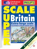
Philips OS Superscale Atlas of Britain
Packed with motoring detail and tourist information, the digital mapping in this edition is at an extra-large scale of 2.25 miles to 1 inch. Other key features include route planning maps and 53 extra-detailed town plans.
Price: £9.79
Publication: October 6, 2003
Packed with motoring detail and tourist information, the digital mapping in this edition is at an extra-large scale of 2.25 miles to 1 inch. Other key features include route planning maps and 53 extra-detailed town plans.
Price: £9.79
Publication: October 6, 2003
The UK books listed on this page are for your information and to help you find the books you need quickly. We do not endorse any particular books and are not responsible for the advice and information in the books listed.
The price of books, where indicated, was correct at the time the book was added to this page. Prices may have changed on the booksellers web site.